

Medium Range Air Quality Outlook
Mid-Atlantic Region
Issued: Tuesday, May 30, 2018
Valid: May 30-June 3 (Wednesday-Sunday)
![]()

Summary
The medium range period looks very quiet, with only a Slight chance for an ozone exceedance each day. A persistently humid air mass, with lingering weak frontal boundaries, and a developing upper-level trough for the weekend will keep the weather unsettled, with a chance for showers every day across most of the region. Onshore flow and mostly cloudy skies on Wednesday and Thursday will keep ozone in check, while Saturday will be rainy, with stronger onshore flow returning on Sunday. The only real question is Friday’s forecast when there is a chance for enough clearing along the I-95 Corridor to promote ozone formation. At this time, afternoon thunderstorms seem probable, keeping the risk for an ozone exceedance Slight.
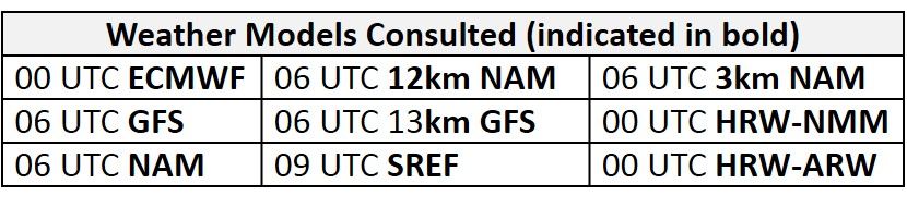
NWP Model Discussion
Unsettled conditions appear likely for most of the Mid-Atlantic throughout the medium range period. The weather models are generally in agreement with placement of synoptic scale features into the weekend, where the GFS and ECMWF solutions begin to diverge slightly, but the overall pattern is not conducive for ozone. The remnants of Subtropical Depression Alberto will move over the intersection between the Mississippi and Ohio River Valleys by 12Z Wednesday, forming the base of a negatively tilted upper-level longwave trough, with the top centered over the Northern Plains. As this trough lifts northward on Wednesday, the upper-level ridge currently over the Great Lakes will move eastward, with its axis reaching over Atlantic coast. This ridge will keep progressing eastward and move over New England on Thursday. By this time, the remnants of Alberto will be fully absorbed into the upper-level trough as it contracts northward, loses its tilt, and moves over the Great Lakes region. On Friday, the trough will dip southeastward over the NMA. On Saturday, another shortwave, moving in the northern stream flow along the Canadian Prairies, will eject energy southward into the Northern Plains. Both the GFS and EC phase this shortwave with the NMA longwave trough on Sunday, but the GFS has a stronger northern stream shortwave, resulting in a stronger mid-level and surface low over the NMA.
The Dailies
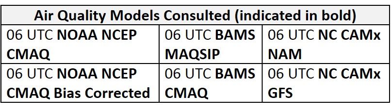
Day 1 (Wednesday): Unsettled conditions will impact most of the Mid-Atlantic on Wednesday. A weak “back door” cold front, moving into the NMA today, will continue to slowly progress southward and stall across the CMA by 00Z Thursday. This frontal boundary, in conjunction with tropical-like moisture, will be the primary drivers for precipitation and widespread cloud cover across most of the region. Partly sunny skies in the morning will give way to mostly cloudy skies in the afternoon, with scattered showers and thunderstorms possible in the NMA and CMA. The chance for thunderstorms will increase in the late afternoon to evening hours as convection allowing models develop two areas of thunderstorms along the western half of the Mid-Atlantic. One area is in the western NMA and CMA, along the OH/WV/PA border, and the second is in the CMA and SMA along I-77 through VA and NC. The convection-allowing and deterministic models all keep locations along and east of I-95 at least partially dry through 00Z Thursday, making this area the most likely for any ozone development. Nevertheless, ozone exceedances are not a concern on Wednesday because mid-level riding over the Northeast US will promote strong onshore (south/southeasterly) flow for most of the Mid-Atlantic, which should be sufficient to limit ozone production during periods of sunshine. This is apparent in the air quality models as they all show widespread Good ozone across most of the region. The BAMS and NC models, however, both develop a region of Moderate ozone in northern/northwestern PA, possibly due to the proximity of mid-level ridging and associated slower transport aloft. The risk of an exceedance will be Slight for the Mid-Atlantic on Wednesday.
Day 2 (Thursday): Unsettled conditions will continue across the Mid-Atlantic as the stalled frontal boundary very slowly lifts northward as a warm front. The remaining shortwave energy from Alberto will lift the front northward as a surface low pressure system develops in the Great Lakes. Continued southerly onshore flow will lift a very moist air mass over this boundary, promoting widespread showers across the region. The air quality models appear to be responding to the southerly, onshore flow and unsettled conditions as most of the Mid-Atlantic remains under Good ozone. Looking at slightly upstream, the air quality models also appear to respond to the wave of low pressure over southern ON flattening the mid-level ridge, resulting in a more southwesterly flow for locations in the Ohio River Valley, as they develop scattered upper Good/low Moderate ozone in western PA and OH. Mostly cloudy skies, strong clean southerly flow, and widespread precipitation will keep the risk of an ozone exceedance Slight on Thursday.
Day 3 (Friday): Friday will be the warmest day of the period, with above average temperatures and dew points near 70 °F. There is some uncertainty regarding the clouds and precipitation forecast. The NAM keeps the region along the I-95 Corridor partly to mostly sunny and thunderstorm free through the early evening, while the GFS and EC have more clouds and scattered thunderstorms. The flow aloft will shift westerly/southwesterly, which will bring warm and humid air into the forecast area; the GFS has many places reaching into the 90s °F. The air quality models are responding to the potential for ozone friendly conditions as the BAMS and NC-GFS models develop Moderate ozone along I-95 in the NMA and CMA as well as an area of Moderate ozone in central NC. At this time, given the very humid air mass in place, afternoon thunderstorms seem likely, limiting the chances for an ozone exceedance. Uncertainty in precipitation and temperatures in addition to more westerly flow will result in a Slight risk for an ozone exceedance.
Day 4-5 (Saturday-Sunday): There is uncertainty in the weather forecast for the weekend, related to the strength and location of the mid-level and surface lows moving into the NMA on Saturday and lingering nearby on Sunday. Regardless of the exact solution for this low, Saturday looks cloudy and wet, while on Sunday, the position of the low will promote relatively strong onshore flow. For now, the risk of an ozone exceedance will remain Slight due to uncertainty in the forecast.
-Enlow/Huff