

Medium Range Air Quality Outlook
Mid-Atlantic Region
Issued: Tuesday, May 22, 2018
Valid: May 23-27 (Wednesday-Sunday)
![]()

Summary
Friday and Saturday are still the days of interest in the medium range period. On Wednesday, a weak cold front will progress through the region, triggering clouds and thunderstorms across the SMA, and ushering in a noticeably drier and presumably clean air mass into the NMA and CMA. Thursday will be sunny and seasonably warm. Ozone will be on the rise, with the highest mixing ratios expected at locations impacted by bay and sea breezes, but strong northerly transport and ample vertical mixing should keep daily ozone in check. Surface high pressure will move offshore on Friday, and the upper level ridge axis will be located in an ozone-favorable position just to the west of the Mid-Atlantic. Above average temperatures, light/calm southwesterly surface winds, sunny skies, and more localized transport aloft will be favorable for ozone formation. The main forecast question will be how fast the air mass in the NMA and CMA modifies on Thursday. For now, we will increase the risk of an ozone exceedance but only to Marginal. There will still be ample vertical mixing, breezy surface winds in the afternoon, and rising dew points, all of which should take the edge off of rising ozone. Unsettled conditions will return to the Mid-Atlantic over the weekend as the region is squeezed between a tropical disturbance to the south and a wave of low pressure to the northwest. There is uncertainty in the extent of showers and thunderstorms on Saturday. The NMA may remain clear and dry, especially along and east of the I-95 Corridor, so the risk of an exceedance remains Marginal on Saturday. By Sunday, widespread regional precipitation drops the chance for an exceedance back to Slight.
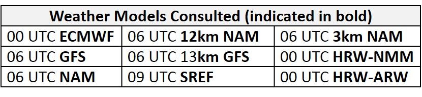
NWP Model Discussion

There continues to be a general consensus between the weather models in regards to the synoptic scale features for entire medium range period. At the start of the period, the northeastern CONUS remains under the influence of a strong and persistent upper level trough located over the Eastern Canada/ Canadian Maritimes. Shortwave energy embedded in this trough will sweep across Hudson Bay today, invigorating a trough axis over the eastern St. Lawrence River Valley by 18Z Wednesday. This shortwave energy will pull the low pressure system that is passing over the eastern Great Lakes today northeastward, bringing a weak cold front through most of the Mid-Atlantic on Wednesday. As this occurs, an upper level low currently located over the Great Basin will eject shortwave energy northeastward, reaching MT by 00Z Thursday. The eastward propagation of this energy, combined with the presence of the strong upper level eastern Canadian trough, will amplify an upper level ridge located just west of the Mississippi River Valley on Wednesday. This ridge will begin to impact the Mid-Atlantic on Wednesday following the passage of a surface cold front. High pressure building behind the front will usher a considerably drier air mass into much of the NMA and CMA by 12Z Thursday. Throughout the day Thursday, the upper level ridge will continue to move eastward, with the axis moving over the western Great Lakes by 00Z Friday. Surface high pressure will pass through the Mid-Atlantic on Thursday, moving off shore by 12Z Friday, as the Mid-Atlantic is slowly surrounded by a number of large scale features. The upper level ridge will gradually flatten by 12Z Saturday. At the same time, the semi-persistent southeastern Canadian trough pulls away, allowing the western edge of the Bermuda high to nose into the Mid-Atlantic. In addition, a tropical disturbance in the Gulf of Mexico will be nearing the Mississippi River Delta late Friday. These two features will bring a large plume of tropical moisture into the SMA on Saturday and Sunday due to strong southerly flow. As tropical moisture moves into the Southeast, shortwave energy cresting the ridge over southern MB/ON/MN will develop a low pressure system in the Upper Midwest. The warm front associated with this system will linger along the eastern Great Lakes on Saturday and Sunday, resulting in possible widespread unsettled conditions in the NMA.
The Dailies
Day 1 (Wednesday): The cold front that will enter northwestern PA today will push southeastward overnight, clearing the NMA and most of the CMA by 21Z Wednesday. The noticeably drier air mass behind the front will be slow to filter into the NMA and CMA, resulting in mostly cloudy skies in the morning hours that will slowly give way to mostly sunny skies in the afternoon. In addition to cloud cover, the lingering moisture combined with cooler 850mb temperatures and ample (1.5-1.75 km) vertical mixing will keep daytime temperatures across the NMA and CMA near average. In the SMA, the cold front will be at the NC/VA border around 21Z Wednesday. The front will slowly push southeastward throughout the rest of day, promoting areas of mostly cloudy skies. Despite cloud cover, slightly above average temperatures in addition to dew points in the low 70s °F will be favorable for the development of thunderstorms across southern and eastern NC in the late afternoon hours. Convection allowing models are developing a line of thunderstorms along I-40 around 21Z. The air quality models appear to be responding the chance for sea and bay breezes, with scattered Moderate ozone along the western Chesapeake Bay, coastal DE, and southern NJ. Most versions of the NC model develop scattered Moderate ozone across WV with a swath of Moderate just to the northwest of I-40. The BAMS models also have a similar feature, however, they keep ozone in the upper Good range. The Moderate ozone across the SMA seems overdone, given the expected clouds and thunderstorms. In the NMA and CMA, a fresh air mass, northerly synoptic winds and near average temperatures will also keep the risk of an ozone exceedance Slight, with the fastest rising ozone likely at the bay/sea breeze impacted locations.
Day 2 (Thursday): Thursday will be considerably less humid for most of the Mid-Atlantic as a dry air mass filters into the region from the north. This air mass change will also be accompanied by increased influence from upper and mid-level ridging building over the Ohio River Valley. In the SMA, Wednesday’s cold front will linger just to the south of NC, promoting a few areas of cloudy skies with the chance for scattered showers and thunderstorms in the afternoon. Despite sunny skies, light surface winds and slightly above average temperatures, ozone formation is expected to be limited in the NMA by ample vertical mixing (again, near 1.75km) and strong northerly flow aloft, with back trajectories originating from interior southern ON. This is evident in the air quality models as both the NC and BAMS models keep widespread Good ozone across most of PA. The lone exception is along the I-95 Corridor, where the air quality models develop a strip of Moderate ozone, again at the sea/bay breeze impacted locations. The 3km and 12km weather models show a strong sea/bay breeze signature for Thursday. The air quality models also develop an area of widespread low Moderate ozone across the CMA and SMA. Weaker northerly flow, possibly tapping into the transport of pollutants from the I-95 Corridor, could be responsible. Given plenty of vertical mixing and a presumably clean air mass, the risk of an exceedance remains Slight. The main forecast question is how fast ozone will rise, given the very dry air and strong late-May sunshine.
Day 3 (Friday): Friday remains the primary day of interest. The center of surface high pressure will pass through the CMA and SMA early Friday and then move offshore, promoting sunny skies and above average temperatures across the Mid-Atlantic as the flow shifts southerly. In the SMA, the passing of the surface high pressure will bring a surge of moisture into the southern parts of NC as a return flow sets up. This shift to onshore flow appears to limit any excessive ozone formation across the SMA on Friday. Coming back to the NMA and CMA, above average temperatures, light/calm southwesterly surface winds, clear skies, and more localized transport aloft will be favorable for ozone formation. The main forecast question will be how fast the air mass in the NMA and CMA modifies on Thursday. The air quality models are responding to ozone conducive conditions as the NC-GFS develops areas of USG across central PA and along the I-95 Corridor with widespread Moderate ozone in the CMA. The BAMS models are similar with more emphasis on the I-95 corridor. Both the BAMS and the NC models develop widespread Moderate ozone across the rest of the Mid-Atlantic. We aren’t confident in the magnitude of the air quality models since they began May by under-forecasting substantially, and then last week, they shifted to over-forecasting substantially, predicting Code Orange ozone in PA on a day when Code Green was observed. So for now, we will increase the risk of an ozone exceedance but only to Marginal. There will still be ample vertical mixing, breezy surface winds in the afternoon, and rising dew points, all of which should take the edge off of rising ozone.
Day 4-5 (Saturday-Sunday): Unsettled conditions will return to the Mid-Atlantic over the weekend as the region is squeezed between a tropical disturbance to the south and a wave of low pressure to the northwest. Southerly/southwesterly flow at mid-levels will continue to bring a plume of moisture northward into the CMA and NMA on Saturday. Increased moisture, slightly above average temperature and mostly sunny skies in the morning and afternoon hours will provide the opportunity for scattered thunderstorms across the entire Mid-Atlantic in the afternoon and evening. Onshore flow in the SMA and southwesterly flow in the NMA combined with unsettled conditions across most of the area should limit ozone formation. The main forecast question for Saturday will be the timing of any precipitation and clouds that move into the I-95 Corridor. The EC, with its tropical disturbance farther west, keeps the NMA clear through Saturday evening. The GFS, in contrast, has widespread afternoon precipitation, associated with the tropical disturbance being a bit farther east along the Gulf Coast. Given the uncertainty regarding the eastern extent of clouds and precipitation on Saturday, the risk of an exceedance will remain Marginal, with a focus on the northern part of the I-95 Corridor. The air quality models appear to pick up on this possibility as the BAMS and NC develop an area of USG/upper Moderate ozone along the I-95 corridor and eastern CMA.
Widespread unsettled conditions will cover the Mid-Atlantic on Sunday as the tropical disturbance to the south and a cold front associated with the low pressure system to the north pinch the Mid-Atlantic throughout the day. There is still uncertainty between the weather models concerning the track of the tropical disturbance, however, the WPC seem to favor the ECMWF’s farther west solution. There is also disagreement between the weather models with how far south the cold front approaching from the north will push. Despite uncertainty with the specifics of these features, unsettles conditions seem likely for the entire Mid-Atlantic and will lower the chance for an ozone exceedance back to Slight.
-Enlow/Huff