

Medium Range Air Quality Outlook
Mid-Atlantic Region
Issued: Monday, July 30, 2018
Valid: July 31-August 4 (Tuesday-Saturday)
![]()

Summary
The upper level synoptic pattern throughout most of the medium range period will be reminiscent of that from early last week, resulting in another multi-day stretch of strong moist southerly flow and relentless precipitation across the Mid-Atlantic, keeping a Slight risk of an ozone exceedance each day. Similar to last week, the location of the Mid-Atlantic between the Bermuda ridge of high pressure to the east and a stalling trough to the west will allow a tropical air mass to surge northward into the region promoting widespread heavy precipitation through Friday. Tuesday and Wednesday will be cloudy and soggy as a stalling trough over the Mississippi River Valley pulls a warm front northward across the NMA, and southerly flow feeds an atmospheric river of moisture flowing into the region. On Thursday, a weak cold front will push into the western Mid-Atlantic from the west before it seemingly stalls across the NMA and CMA due to weakening upper level support. The possibility for a few breaks in the clouds and light surface winds throughout the morning could be favorable for some ozone formation but continued southerly flow and widespread precipitation returning for the afternoon and evening should be enough to keep ozone in check. The primary forecast question for Thursday will be the timing and coverage of precipitation across the NMA and air mass characteristics behind the front given a shift to westerly flow. Although there is some uncertainty in the air quality forecast, the risk of an ozone exceedance will remain Slight. Friday will likely be the last day of widespread unsettled conditions as the stalled front across the NMA and CMA dissipates throughout the day. Another day of strong southerly flow will continue to feed the atmospheric river of moisture, promoting widespread precipitation across the region, with the heaviest likely occurring throughout the NMA and CMA. A pattern change looks like it will begin on Saturday. as the Bermuda High will build westward at mid-levels, bringing some relief from the relentless stretch of unsettled conditions. All-day precipitation along a surface trough draped along the I-95 Corridor will keep locations east of I-81 throughout the NMA and CMA clean. Mostly sunny skies, seasonable temperatures, and a shift to westerly flow will be favorable for ozone formation west of I-81. The primary forecast question for these locations will be how quickly the air mass is able to modify given the anticipated stretch of unsettled conditions through Friday. Given the likely clean air mass in place, the risk of an ozone exceedance will remain Slight on Saturday.
NWP Model Discussion
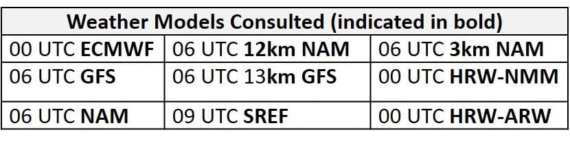
The weather models are generally in close agreement with the evolution of synoptic scale features until late in the medium range period. Similar to last week’s pattern, the Mid-Atlantic’s location between a stalled trough to the west and a strong Bermuda High to the east through Friday will promote strong southerly flow, bringing another stretch of unsettled conditions to the region. The NAM solution is the most aggressive of the three models through Wednesday, as it develops stronger shortwaves embedded in a longwave trough over the eastern U.S., resulting in a deeper trough than the ECMWF and GFS. Shortwave energy dropping southeastward across the Great Plains today will develop into a positively tilted longwave trough stretching across the Great Lakes, Mississippi River Valley, and into OK/AR by 12Z Tuesday. Similar to last week’s pattern, this trough will seemingly stall throughout Tuesday as it encounters a strong Bermuda High ridge in place over the Atlantic Ocean. As the upper level trough stalls over the Mississippi River Valley, embedded shortwave energy will round the base of the trough on Tuesday, lifting northeastward through the Ohio River Valley and into the Great Lakes on Wednesday, weakening the trough. The northward lifting of this shortwave energy will pick up the frontal boundary currently hung up across the southeastern U.S., developing a low pressure system that will pass through the Ohio River Valley on Wednesday. By 12Z Thursday, the shortwave energy that lifted northeastward will be absorbed into the northern stream flow as the weakening Mississippi River Valley through remains in place. On Friday, the axis of an upper level ridge over the Southwest U.S. will gradually tilt eastward, stretching northeastward into the Upper Midwest by 00Z Friday. At the same time, the Bermuda High ridge in the Atlantic will begin to build westward. The Mississippi River Valley through will begin to fall apart on Friday, in between the two ridges of high pressure. By about 18Z Saturday, broad ridging will set up across the most of the CONUS, including the Mid-Atlantic.
The Dailies
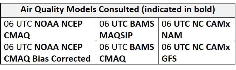
Day 1 (Tuesday): Tuesday will be soggy across the Mid-Atlantic as a warm front lifts northward across the NMA and southerly flow across the SMA feeds an atmospheric river of moisture into the Mid-Atlantic. Similar to last week, the location of the Mid-Atlantic sandwiched between a Bermuda ridge of high pressure to the east and a stalling trough to the west will allow a tropical air mass to surge northward into the region, promoting widespread and locally heavy precipitation. The WPC has the entire region under a Marginal risk of excessive rainfall with a Slight risk of excessive rainfall in the NMA and western SMA. Widespread precipitation, cloudy skies, sustained southerly surface winds, and strong southerly flow aloft will prevent any significant ozone formation from occurring on Tuesday. Despite the widespread coverage of clouds and precipitation, the air quality models keep the region under upper Good ozone with a few pockets of Moderate ozone throughout the eastern NMA/CMA, specifically along the I-95 corridor. The patches of Moderate ozone is likely in response to the warm front lifting northward in the NMA and associated converging surface winds, but they seem unlikely to verify. As a result of these conditions, the risk of an ozone exceedance will be Slight on Tuesday.
Day 2 (Wednesday): Widespread unsettled conditions will persist on Wednesday as southerly flow continues across the region ahead of a cold front slowly approaching the western Mid-Atlantic from the west. Another day of widespread showers and thunderstorms, cloudy skies, sustained southerly/southwesterly surface winds, and strong southerly flow aloft across the region will ensure Good air quality on Wednesday. The air quality models are in agreement on Wednesday but again appear to be too aggressive with ozone along frontal boundaries throughout the region. The air quality models develop Moderate ozone (upper Moderate range in BAMS-MAQSIP) across the western Mid-Atlantic where the cold front is forecast to be slowly pushing eastward. Given the flow pattern and widespread nature of unsettled conditions, ozone levels reaching the Moderate range seems unlikely in the Mid-Atlantic. This risk of an ozone exceedance will remain Slight on Wednesday.
Day 3 (Thursday): The cold front will finally push into the Mid-Atlantic on Thursday as it seemingly stalls across the NMA and CMA, given weak upper level support. Despite the arrival of the cold front, model guidance suggests that the majority of precipitation could hold off until the afternoon and evening hours. The possibility for a few breaks in the clouds and light surface winds throughout the morning could be favorable for some ozone formation but continued southerly flow and widespread precipitation throughout the afternoon and evening should be enough to keep ozone in check. The air quality models keep ozone levels elevated along and behind the cold front; specifically, the BAMS models develop Moderate/isolated USG ozone across the NMA with Good ozone throughout the rest of the region. Elevated ozone across the NMA is likely in response to less widespread precipitation, light surface winds, and a shift to westerly flow following the front, but USG ozone seems very unlikely. The primary forecast question for Thursday will be the timing and coverage of precipitation across the NMA and air mass characteristics behind the front given a shift to westerly flow. Although there is some uncertainty in the air quality forecast, the risk of an ozone exceedance will remain Slight.
Day 4-5 (Friday-Saturday): Friday will likely be the last day of widespread unsettled conditions as the stalled front across the NMA and CMA dissipates throughout the day. Another day of strong southerly flow will continue to feed an atmospheric river of moisture, promoting widespread precipitation across the region, with the heaviest likely occurring throughout the NMA and CMA. Unsettled conditions combined with strong southerly flow will keep ozone formation minimal on Friday. The BAMS air quality models are more reasonable on Friday as they keep just about the entire Mid-Atlantic under Good ozone with Moderate ozone creeping into northwestern PA. Given these conditions, the risk of an ozone exceedance will again remain Slight.
A pattern change looks like it will begin on Saturday. The Bermuda High building westward at mid-levels will bring some relief from the relentless stretch of unsettled conditions. Although scattered showers will remain along the east coast (along and east of I-81 through the NMA and CMA) and throughout the SMA, precipitation will not be as heavy, allowing most of the NMA and CMA to begin to dry out. Mostly sunny skies, seasonable temperatures, and a shift to westerly flow will be favorable for ozone formation west of I-81 throughout the NMA and CMA. The primary forecast question for these locations will be how quickly the air mass is able to modify given the anticipated stretch of unsettled conditions and upwind air mass characteristics. Throughout the rest of the region, southerly flow, scattered precipitation, and mostly cloudy skies will keep ozone formation in check. The risk of an ozone exceedance will remain Slight.
-Enlow/Huff