Monthly Archives: June 2018

Mid-Atlantic Medium Range Air Quality Discussion, Issued Friday, June 29, 2018

Medium Range Air Quality Outlook
Mid-Atlantic Region

Issued: Friday, June 29, 2018
Valid: June 30- July 4 (Saturday-Wednesday)

Summary

A strong upper-level ridge will settle over the Mid-Atlantic on Saturday and persist, with some oscillation, through the end of the medium range period. The weather models are still in relatively close consensus on the main synoptic features, but there is inconsistency in recent days as to the exact position of the center of high pressure aloft. These variations have introduced much more uncertainty in the air quality forecasts for the period, compared to yesterday. The exact placement of the center of high pressure could have a large impact on the air quality forecast across the eastern NMA/CMA beginning Monday, as flow aloft and at the surface have to potential to shift southerly across the Delmarva and entire I-95 Corridor. As a result, we still have confidence in the arrival and persistence of the mid/upper level ridges; these features will set the stage for a multi-day poor air quality event that has the potential to last through the medium range period. We have less confidence today, however, in the magnitude and geographic distribution of the exceedances – Monday, in particular, does not look as dirty as it did yesterday, and southern/western parts of the region may clean out on Tuesday and Wednesday. The best chances for ozone exceedances throughout the period will be the historically high ozone locations along the I-95 Corridor from BAL to NYC.

The main forecast question for Saturday is the potential for transport of dilute smoke from the northern Great Lakes into the I-95 Corridor. Large wildfires burning across eastern SK and western ON are producing a large plume of medium density smoke that is stretching across southern ON and into the source region of back trajectories (36 hr, ending at KPHL at 12 UTC) for the I-95 Corridor on Saturday. Given the many risk factors in place, the chance of an ozone exceedance will remain High on Saturday, with the highest ozone most likely along I-95 from RIC to NYC, as well as in western PA (PIT). On Sunday, temperatures will rise into the upper 90s°F across the NMA, with locations along the I-95 heat island possibly exceeding 100°F. Although light (< 10 mph) southerly surface winds are possible for coastal regions, the inward push of precursors/pollutants will probably promote rapid ozone formation along the entire I-95 Corridor. The risk of an ozone exceedance will remain High with a focus along I-95 again from RIC to NYC and locations in western PA (PIT). Uncertainty is much greater than it was yesterday for Monday’s forecast due to a variety of factors: the approach of a very weak cool front from the northwest, slightly stronger southerly (onshore) flow, and the amount of local NOx emissions (which may make Monday more like a typical Sunday). At this time, we think any southerly flow will be weak enough to keep chances for an exceedance High for the I-95 Corridor from BAL to NYC. Given questions about the weak front advancing from the northwest, the influence of onshore flow across the southern and eastern parts of the region, and mobile emissions, the risk of an exceedance will drop to Appreciable for Tuesday and Wednesday, with the best chances for an exceedance along the I-95 Corridor from BAL to NYC.

NWP Model Discussion

Aside from a few minor details, there is continued agreement between the weather models in regard to the synoptic pattern throughout the medium range period, which gives us confidence in the overall synoptic weather features, but we have much higher uncertainty today in the mesoscale details. A strong upper level ridge will build into the Mid-Atlantic on Saturday, with its axis moving over the region by 18Z, and the center of the ridge settling over the region as well. This ridge will encompass and influence most of the eastern CONUS throughout the medium range period. The arrival and persistence of this feature will set the stage for a multi-day poor air quality event that will probably last through the medium range period; however, we have less confidence today in the magnitude and geographic distribution of the exceedances. The center of high pressure aloft will remain over the NMA, unchallenged until Sunday, when a shallow longwave trough moves across the upper Great Plains and into the upper Midwest by 12Z. This trough will attempt to continue eastward, but the strength of the ridge will weaken and deflect it to the north, over ON/QC by 00Z Monday. The arrival of the trough will briefly dampen the upper-level ridge over the Great Lakes and send a weak shortwave trough southeastward towards the Mid-Atlantic. This trough will also quickly weaken as it pushes into the northwestern Mid-Atlantic by 00Z Tuesday, due to the lingering center of high pressure over the northeast U.S. In a change from yesterday’s guidance, the mid-level ridge will briefly weaken on Monday as it is temporarily dampened by the mid-level low as it moves across southern Canada. In the wake of the shallow longwave upper-level trough, the upper level ridge will back-build across the NMA and into the Midwest by 06Z Wednesday, placing the entire eastern two-thirds of the CONUS under a broad 594dm ridge through 00Z Thursday. In a change from yesterday’s forecast, the mentioned possible tropical disturbance has weakened in the weather models and its impacts on the Mid-Atlantic air quality forecast appear less clear.

The Dailies

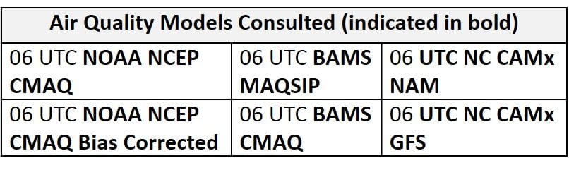
Day 1 (Saturday): Multiple ozone exceedances are possible in the Mid-Atlantic on Saturday. Surface high pressure centered in the CMA will promote sunny skies and light surface winds across the region. Strong subsidence will inhibit clouds and convection. Temperatures will continue to rise, with most of the region reaching into the 90s °F. Light and variable winds and localized transport across most of the Mid-Atlantic are combining with temperatures well above average and pushing regional ozone higher in the air quality models. Similar to yesterday’s model runs, the air quality models develop widespread Moderate ozone and scattered USG across the region. The pockets of USG ozone are focused along the western bank of the Chesapeake Bay, the I-95 Corridor from RIC to NYC, and across western PA. In the SMA, it seems like the air quality models are picking up on the possibility of weak onshore component to the mid/upper level flow, as NC is under a mix of Good and Moderate ozone. This onshore component in the SMA flow appears to be the only limiting factor across the region on Saturday. Large wildfires burning across eastern SK and western ON are producing a large plume of medium density smoke that is stretching across southern ON and into the source region of back trajectories (36 hr, ending at KPHL at 12 UTC) for the I-95 Corridor on Saturday. The potential for transport of dilute smoke into the I-95 Corridor is a wildcard for Saturday’s ozone forecast. Given the many risk factors in place, the chance of an ozone exceedance will remain High on Saturday, with the highest ozone most likely along I-95 from RIC to NYC, as well as western PA (PIT).

Day 2 (Sunday): Conditions favorable for high ozone will continue into the Sunday for most of the Mid-Atlantic. Aloft, the center of high pressure will move over the eastern NMA/CMA. The exact placement of the center of surface/mid-level high pressure could have a large impact on the air quality forecast across the eastern NMA/CMA as surface winds have to potential to shift southerly across the Delmarva and entire I-95 Corridor. This is a major source of uncertainty for the ozone forecast beginning on Sunday, due to day-to-day inconsistency in the model runs. For example, in yesterday’s guidance, the threat of southerly flow was much reduced from Wednesday’s guidance. At this time, the close proximity of the center of high pressure aloft suggests that any southerly flow across the NMA and CMA, both aloft and at the surface, will be extremely light, which would not have much – if any – limiting effect on ozone. But it is something that we will have to monitor as the weekend progresses since southerly flow has the potential to quickly clean out affected areas. Once again in the SMA, the gradual eastward push of the center of high pressure and the possible development of an upper level shortwave trough over the Gulf will increase southerly/onshore transport. This will have a domino effect across the SMA and into the CMA on Sunday as flow across the region slowly shifts easterly. This is evident in the air quality models as both the BAMS models and several of the NC models keep NC and VA under Good and Moderate ozone. Throughout the NMA, temperatures will rise into the upper 90s°F with locations along the I-95 heat island possibly exceeding 100°F. Although light (< 10 mph) southerly surface winds are possible for coastal regions, the inward push of precursors/pollutants will probably promote rapid ozone formation along the entire I-95 Corridor. This can be seen in the air quality models as USG ozone blankets the eastern NMA/CMA, reaching westward into western PA. The risk of an ozone exceedance will remain High with a focus along I-95 again from RIC to NYC and locations in western PA (PIT).

Day 3 (Monday): Uncertainty is much greater than it was yesterday for Monday’s forecast, as a weak cold front could approach the northwestern Mid-Atlantic in the afternoon. The return of a few clouds as well as a few afternoon showers are possible in the western NMA and CMA as the front edges towards the region. The models are not in agreement with the strength of this frontal boundary and associated precipitation, as the GFS and ECMWF show slightly different solutions. The GFS is a little stronger with the boundary, developing scattered showers across western PA throughout the afternoon hours, whereas the ECMWF has a weaker front, keeping conditions dry into the night. This boundary is impossible to see at 850 mb, and looks more like a surface trough in the surface wind guidance. At this time, we do not recommend counting on this front to end the threat of an ozone exceedance on Monday. Despite the uncertainty in this frontal boundary, transport aloft will continue to shift southerly across the region, possibly relieving most of the region from poor air quality. This is the one day that the mid-level ridge seems to weaken, allowing for a better chance of onshore flow, albeit still very light in the NMA. This shift in transport is resulting in Good range ozone across the SMA and western half of the NMA and CMA. Transport aloft will also shift southerly across the eastern NMA and CMA but it remains uncertain if it will be strong enough to diminish the risk of an ozone exceedance. The air quality models seem to buy into this southerly flow as the BAMS models develop Moderate range ozone across the Delmarva and most of the I-95 Corridor. Both BAMS models keep extreme eastern PA and northern NJ under USG ozone as pollutants are pushed northward. Another key forecast question for Monday, and continuing on Tuesday and Wednesday, is the amount of local NOx emissions. With the Independence Day holiday on Wednesday this year, there is not a clear holiday weekend. This means that Monday may be more like a “normal” Monday in terms of mobile emissions, or it may be more like a Sunday. With the near record-breaking temperatures on Sunday and Monday, a/c demand will be very high, and shore traffic is also probably going to be heavy, which may compensate for any potential reductions in work/school commutes. Given the uncertainty in the forecast, we are less confident in the chances for an ozone exceedance on Monday. But at this time, we think any southerly flow will be weak enough to keep chances for an exceedance High for the I-95 Corridor from BAL to NYC.

Day 4-5 (Tuesday-Wednesday):  Monday’s approaching weak cold front will keep uncertainty in the forecast for Tuesday. The GFS and ECMWF continue to disagree with precipitation associated with the frontal boundary as the GFS has a few showers across PA on Tuesday, west of I-81, but the EC keeps the region totally dry. Although showers and associated cloud cover could have an impact on the air quality forecast, the main forecast question will be the eastward push of the front as it is forecast to dissipate in the NMA sometime in the afternoon. If the front is able to push far enough east with limited cloud cover, it could act as a converging factor to combine with strong July Sun and weak surface winds to allow rapid ozone formation to take place along I-81 in PA. Although it will be very humid, the back-building ridge aloft could suppress any developing convection. Across the rest of the region, mostly sunny skies and above average temperatures will be favorable for ozone formation, but continued onshore transport will diminish the risk of an exceedance. The air quality models have most of the Mid-Atlantic under Good/Moderate range ozone, with eastern PA and the I-95 Corridor under USG ozone. Light onshore flow, aloft and at the surface, is possible again on Tuesday, adding to uncertainty regarding the air mass characteristics. Given questions about the weak front advancing from the northwest, the influence of onshore flow across the southern and eastern parts of the region, and mobile emissions, the risk of an exceedance will drop to Appreciable, with the best chances for an exceedance along the I-95 Corridor from BAL to NYC.

The potential lingering frontal boundary across the NMA will keep uncertainty in the forecast. The arrival of a very moist air mass will combine with the lingering boundary and above average temperatures to possibly spark a few afternoon showers and thunderstorms across the northern half of PA. Throughout the rest of the region, skies will remain mostly sunny as the upper level ridge continues to build overhead. Temperatures across most of the Mid-Atlantic will remain in the 90s°F with weak surface winds. The flow aloft still has a southerly component, but become much weaker/shorter, with the center of the upper level ridge overhead. The primary forecast question will be how quickly the air mass is able to modify once the light onshore (southeasterly) flow is cut off across the region, especially given it is a holiday. In the SMA, back trajectories will also weaken but will remain onshore, keeping ozone levels in check. The risk of an ozone exceedance will remain Appreciable, with the highest ozone again most likely along the I-95 Corridor.

-Enlow/Huff

Mid-Atlantic Medium Range Air Quality Discussion, Issued Thursday, June 28, 2018

Medium Range Air Quality Outlook
Mid-Atlantic Region

Issued: Thursday, June 28, 2018
Valid: June 29- July 3 (Friday-Tuesday)

Summary

An extended ozone exceedance event is likely throughout the medium range period as a very strong ridge builds over the entire eastern CONUS, starting on Friday. There is excellent agreement between the weather models regarding the primary features throughout the forecast period, resulting in strong confidence through Monday. The guidance today is trending towards a stronger ridge, lasting longer into next week, which is increasing the chances for extended poor ozone air quality. At this point, Sunday and Monday seem like the worst days, with the focus on the entire I-95 Corridor from RIC to NYC. The only portion of the region that appears like it will be spared is NC, where onshore flow seems as if it will be sufficient to keep ozone from rising above the Moderate range. On Saturday, fast northwesterly flow aloft in the NMA will limit rising ozone along the northern I-95 Corridor, making the chance for an exceedance most likely in western PA (PIT), which will feel the effects of the approaching ridge first, and at locations from DC to BAL along the Chesapeake Bay, which will be affected by a bay breeze. Sunday and Monday, temperatures will approach or exceed 100 °F along I-95, with essentially calm or very light surface winds. Back trajectories are slow westerly (Sun) and localized (Mon). Although Sunday emissions may be lower, the extreme heat and strong subsidence associated with the ridge aloft will likely be sufficient to drive ozone into the USG range at multiple locations. The potentially limiting southerly flow that was in the guidance yesterday is gone today, making Monday possibly the highest ozone day of the period. Uncertainty enters the forecast on Tuesday. The guidance points to a tropical cyclone approaching the Southeastern US coast, which helps to develop a weak onshore flow across the NMA and CMA. This shift in transport could take the edge off ozone for locations along the east coast, but the flow may not be strong enough to impact locations further inland, especially along and west/north of I-95. The trend in the models has also been to slow the progression of a weak cold front that may move into northwestern PA on Tuesday. As a result, the chances for an ozone exceedance extend into Tuesday, with a focus on locations west of I-95 across the NMA and CMA.

NWP Model Discussion

The weather models remain in strong consensus with the synoptic pattern throughout the medium range period. The longwave trough currently passing over the northeast U.S. will continue to push eastward, moving out to sea by 12Z Friday. As this trough departs to the east, the axis of a very strong upper level ridge will move over the Mississippi River Valley, encompassing most of the eastern CONUS by 12Z Friday. The arrival of this ridge will set the stage for a multi-day poor air quality event across the entire Mid-Atlantic region. The trend in the guidance today is for a stronger ridge, lasting longer into next week. The center of this ridge will progress eastward, along the Ohio River Valley, before settling over the NMA on Saturday; although the center of the ridge will tilt slightly, it will remain in place over the Mid-Atlantic through the end of the period (and possibly beyond). Around 12Z Sunday, a shortwave trough moving into the Upper Midwest will attempt to push into the Great Lakes. This feature will begin to dampen the ridge over the Great Lakes region, but it will quickly weaken as it deflects to the northeast over the ridge and into ON by 00Z Monday. This is a change from yesterday’s guidance, helping to keep the ridge in place into next week. The upper level trough will pull a weak shortwave trough and associated cold front southeastward towards the Mid-Atlantic on Monday/Tuesday. The weather models slightly disagree with the strength and southeastward push of this feature as it moves towards the center of upper-level high pressure over the Mid-Atlantic. The GFS keeps this shortwave trough slightly stronger as it lingers along Lake Erie/Ontario through the end of the period, while the ECMWF pushes the shortwave trough into the NMA by 06Z Tuesday and slowly dissipates it by the end of the medium range period. The GFS and ECMWF both have shortwave energy breaking off the downwind side of the ridge that drops down southward and eventually develops into a possible tropical disturbance off of the FL/GA/SC coasts on Monday/Tuesday. Both the GFS and EC bring this tropical cyclone northward, but well off the Atlantic coast, which allows a weak onshore flow to develop in the NMA and CMA on Tuesday. The NHC isn’t mentioning this potential system yet, as it’s too far out, but we will keep a close eye on it as the period progresses. The fact that the GFS and EC both develop the system in almost the same place and at the same time lends confidence.


The Dailies

Day 1 (Friday): Friday will be the first in a string of days where conditions will be favorable for ozone exceedances, as a dome of high pressure begins to move overhead. Sunny skies across most of the region will allow temperatures to surge above average values with many locations reaching into the 90s °F. Surface high pressure in the CMA will promote weak surface winds throughout the region with sea/bay breezes likely along coastal regions, especially the Chesapeake Bay. The ridge axis to the west will promote back trajectories from the northwest across the NMA, which are still quite fast (e.g., from northern WI for 36hr ending at 12Z Friday at KPHL). This transport pattern has the potential to keep ozone below the USG threshold along the northern branch of the I-95 Corridor, since the residual layer will likely be clean. Transport will be localized across the SMA, but today’s (Thursday’s) weak cold, which will stall in the vicinity of the NC/SC border, will promote a few patches of clouds and isolated showers in the afternoon hours along southern NC. As a result, there is uncertainty in how quickly ozone may rise in the CLT metro area due to the potential for afternoon clouds and precipitation. The air quality models are generally in agreement with widespread Moderate ozone and a few scattered areas of USG ozone across the region. The models highlight the BAL-DC coast along the Chesapeake Bay with USG ozone in response to sunny skies and the likely development of a bay breeze. The models also highlight western PA (PIT) with USG ozone likely in response to weaker transport aloft and calm surface winds. Similar to yesterday’s air quality model runs, the models develop Good range ozone across the northeastern portion of the NMA, along and north/west of I-95 from PHL to NYC, likely in response to stronger northwesterly transport aloft. The primary forecast question will be how strong the influence of northwesterly transport across the NMA will impact ozone and precursors in the residual layer. It will be important to closely monitor today’s conditions locally and upwind to get a feel for how quickly the air mass is beginning to modify. The risk of an ozone exceedance will remain High with a focus on western PA and the western bank of the Chesapeake Bay.

Day 2 (Saturday): Conditions will be favorable for multiple ozone exceedances across the Mid-Atlantic on Saturday as the upper level ridge builds directly overhead. The presence of strong high pressure and associated subsidence will prevent the development of optically thick clouds, keeping sunny skies across the region. Temperatures will continue to rise with most of the region reaching into the upper 90s °F. Light variable surface winds, localized transport, and above average temperatures are pushing regional ozone higher in the air quality models as they develop widespread USG ozone across the NMA and eastern CMA. The BAMS and NC models both highlight the Chesapeake Bay region and I-95 Corridor from RIC to NJ with USG ozone. The NC models are the most aggressive across the rest of the NMA with large pockets of USG ozone and isolated Unhealthy ozone across western PA. Similar to yesterday’s air quality model runs, the models are holding off on USG ozone across NC, likely due to weak onshore flow. The risk of an ozone exceedance will remain High with a focus across the entire NMA and CMA, with the highest ozone most like along the entire extent of I-95 from RIC to NYC, as well as western PA. There do not look to be any limiting factors for rising ozone at this point.

Day 3 (Sunday): Summer will be in full swing for the start of July as the center of high pressure passes over the NMA. Oppressive conditions will impact most of the Mid-Atlantic as temperatures rise to upper 90s °F with temperatures possibly surpassing 100 °F in the CMA and along the I-95 heat island. Another day of sunny skies, more localized back trajectories and weak surface winds will result in ozone exceedances across the northern half of the Mid-Atlantic region. In a change from yesterday, flow aloft will be more westerly than weakly southerly in the NMA and CMA, increasing the chances for rising ozone. The gradual eastward push of the ridge/high pressure will continue to slowly place NC under increasing influence of onshore flow through the end of the medium range period, diminishing the risk of an ozone exceedance in NC. Ozone conducive conditions across the northern two-thirds of the Mid-Atlantic are resulting in widespread USG ozone across the NMA in the air quality models with scattered Unhealthy ozone along the I-95 Corridor from RIC to NYC. Although Sunday emissions may be lower, the extreme heat and strong subsidence associated with the ridge aloft will likely be sufficient to drive ozone into the USG range at multiple locations. As a result, the risk of an ozone exceedance will remain High on Sunday.

Day 4-5 (Monday-Tuesday): Again, in a change from yesterday, the stronger ridge will diminish chances for cleaner southerly flow on Monday. Widespread poor air quality will likely pour into the work week as the heat wave continues across the Mid-Atlantic. Yesterday’s forecast mentioned the possible arrival of a shortwave trough and associated weak cold front in the northwestern NMA but the today’s model runs have suggested that this feature will weaken and slow as it pushes southward through the Great Lakes. As a result, persistent high pressure will keep skies clear and temperatures on Monday just as hot as on Sunday, with even higher heat indices due to increasing humidity. The air quality models continue to increase regional ozone with widespread USG ozone across the eastern NMA/CMA and western PA. They also continue to develop a large patch of Unhealthy ozone along the I-95 Corridor from DC reaching northeastward through NJ and into NY. The air quality models place most of the SMA and western CMA under Good ozone possibly in response to increasingly south/southeasterly transport of presumably clean air. Ozone exceedances across the northern half of the Mid-Atlantic remain likely on Monday keeping a High risk.

Uncertainty enters the forecast on Tuesday. A very broad center of upper level high pressure will remain over the NMA but an elongated center and a potential tropical disturbance in the Atlantic, off of the Southeastern US coast, may develop weak onshore flow for most of the Mid-Atlantic on Tuesday. This shift in transport could take the edge off ozone for locations along the east coast but the flow may not be strong enough to impact locations further inland, especially along and west/north of I-95. The trend in the models has been to slow the progression of a weak cold front that may move into northwestern PA on Tuesday. This trend will likely continue, given that there is weak support for the front aloft, and it will be moving into an extremely hot air mass. Despite these uncertainties, mostly sunny skies and another day with temperatures across the region in the mid-to-upper 90s °F will keep conditions generally conducive for another day of high ozone on Tuesday. As a result, a High risk of an ozone exceedance will continue on Tuesday, with a focus on locations west of I-95 across the NMA and CMA.

-Enlow/Huff

Mid-Atlantic Medium Range Air Quality Discussion, Issued Wednesday, June 27, 2018

Medium Range Air Quality Outlook
Mid-Atlantic Region

Issued: Wednesday, June 27, 2018
Valid: June 28- July 2 (Thursday-Monday)

Summary

A mid-summer heat wave will begin on Friday and last into next week, setting the stage for a High risk of an ozone exceedance across the Mid-Atlantic throughout most of the medium range period. Heavy overnight precipitation and limited daytime sunshine across the region will keep the risk of an exceedance Slight on Thursday. The days of interest begin on Friday as a strong upper-levels ridge begins to build over the Mid-Atlantic. It will be sunny and hot, with temperatures reaching into the 90s °F, and weak surface winds, with bay and sea breezes likely. Relatively fast northwesterly flow aloft is a key potentially limiting factor for locations west and north of the I-95 Corridor. Another factor to consider is the fact that the NMA and CMA will be weakly post-frontal, with Thursday’s weak cold front making it to the SMA early Friday, and then moving back northeastward during the day on Friday as the mid-level ridge builds northeastward into the Mid-Atlantic. As a result, there is some uncertainty for Friday’s forecast, but given many ozone-conducive conditions in place, the risk of an ozone exceedance will increase to High ay, with a focus on western PA, which will be the first to feel the effects of the upper level ridge, as well as the BAL-DC corridor along the Bay, which will be susceptible to the impacts of the bay breeze. Multiple ozone exceedances seem likely on Saturday, Sunday, and Monday as the upper-level ridge builds overhead and then just offshore. The best chances for multiple exceedances are over the weekend when it will be very hot, sunny, and stagnant. On Monday, a low pressure system passing through ON will bring some uncertainty into the forecast as a weak cold front will approach the NMA from the northwest. The development of clouds and precipitation will be the primary forecast question on Monday. At this point, they look to stay west of the I-95 Corridor through the late afternoon, keeping the chances for widespread ozone exceedances High.


NWP Model Discussion

There is strong consensus between the weather models with the evolution of the synoptic pattern throughout the medium range period, which gives us confidence in a likely high ozone event starting as early as Friday and continuing through the end of the period. The axis of the upper level trough currently passing over the Great Lakes will reach the Mid-Atlantic by 06Z Thursday, before moving off the east coast by 00Z Friday. The departure of this feature will allow a strong upper-level ridge, currently building over the Great Plains, to push eastward on Friday. The ridge will encompass most of the eastern CONUS as its axis moves over the Mississippi River Valley around 12Z Friday. At upper levels, the center of high pressure will progress northeastward along the Ohio River Valley, moving directly over the NMA/CMA by 12Z Saturday. At mid-levels, the ridge will initially be centered over the Southeastern U.S./Gulf Coast, and the departure of the Great Lakes trough will allow it build north and east on Friday, pushing a weak frontal boundary from the SMA back northeastward across the CMA and NMA. The mid-level ridge will merge with the Bermuda High by roughly 12Z Saturday. This dome of high pressure will remain directly over the NMA through 12Z Sunday. At this time, a broad and shallow longwave trough over the Upper Midwest will push eastward, weakening as it moves through the Great Lakes, before deflecting to the northeast over the ridge by 00Z Monday. This upper level feature will flatten the ridge over the Mid-Atlantic late Sunday before the mid-level ridge strengthens again on Monday. At upper levels, the Mid-Atlantic ridge will merge with a broad ridge centered over the Plains on Monday, forming one large, broad ridge over essentially the entire CONUS. Under this upper level ridge, a shortwave trough will approach the Mid-Atlantic from the northwest on Monday.

The Dailies

Day 1 (Thursday): A low pressure system moving along the St. Lawrence River Valley will pull a weak cold front through the region on Thursday, bringing unsettled conditions to parts of the Mid-Atlantic. Periods of locally heavy rain across the NMA and CMA will gradually clear throughout the morning hours, with the possibility of another round of scattered showers and thunderstorms in the afternoon, due to the slowing of the cold front near the Atlantic coast. Mostly cloudy skies will partially clear by the afternoon, from west to east, as high pressure moves into the Ohio River Valley. In the SMA, periods of sun and clouds will allow temperatures to rise to above average values. The air quality models are responding to overnight precipitation and periodic cloud cover across the Mid-Atlantic as they develop a mix of Good/Moderate range ozone. As a result, the risk of an ozone exceedance will remain Slight.

Day 2 (Friday): An extended poor air quality event will likely start on Friday as the upper-level ridge begins to build over the Mid-Atlantic. Sunny skies across the region will allow temperatures to rise above average values, with many locations reaching into the 90s °F. Surface high pressure centered over WV will promote weak surface winds throughout the region, with bay and sea breezes likely. The center of high pressure aloft will be off to the west, allowing for northwesterly back trajectories for the NMA. This is a key potentially limiting factor for locations west and north of the I-95 Corridor. Another factor to consider is the fact that the NMA and CMA will be weakly post-frontal, with Thursday’s weak cold front making it to the SMA early Friday, and then moving back northeastward during the day on Friday as the mid-level ridge builds northeastward into the Mid-Atlantic. This frontal movement raises questions about the air mass characteristics on Friday. The air quality models are responding to conditions favorable for ozone formation with widespread Moderate ozone with a few pockets of USG ozone across the region. The BAMS and the NC models develop isolated USG ozone in western PA, along the western coast of the Chesapeake Bay, and across the NC Piedmont. Notably, the models keep the area east of I-99 and north of I-76 in the Good to low Moderate range; these are the locations most susceptible to the effects of northwesterly flow aloft. The primary forecast questions for Friday will be how modified the air mass in place is, considering it should be relatively clean after Thursday’s widespread periods of precipitation and weak frontal passage, and the impact of the northwesterly transport. The risk of an ozone exceedance will increase to High on Friday, with a focus on western PA, which will be the first to feel the effects of the upper level ridge, as well as the BAL-DC corridor along the Bay, which will be susceptible to the impacts of the bay breeze.

Day 3 (Saturday): Multiple ozone exceedances seem likely on Saturday, as the upper-level ridge builds overhead. Surface high pressure lingering over the CMA will again promote sunny skies and weak surface winds. The strong ridge aloft will generate strong subsidence, with essentially no chance for optically thick clouds or thunderstorms. Temperatures will remain above average across the entire Mid-Atlantic with many locations reaching well into the 90s °F. Nearby high pressure will result in localized back trajectories (for PIT and RDU) although 36 hr back trajectories ending at 12Z for PHL are quicker than expected, sourcing form northern MI/southern ON. As the mid-level ridge builds in on Saturday, however, upper level transport will recirculate and shift weakly southward by the end of the day. The air quality models continue to increase regional ozone concentrations with USG ozone across much of the NMA and eastern CMA. In the SMA, the air quality models are holding back on USG ozone, possibly associated with a weak southerly component to the flow, due to the position of high pressure to the north. The BAMS models and the NC-GFS2 suggest that ozone will be the highest along the I-95 Corridor in the NMA and CMA, most likely due to sea/bay breeze development and calm surface winds inland. High risk of an ozone exceedance will continue on Saturday with a focus on the NMA and CMA.

Day 4-5 (Sunday-Monday): Persistent high pressure over the Mid-Atlantic will result in a scorching hot start to the month of July. On Sunday, temperatures will reach well into the 90s °F across most of the region as increasing humidity pushes heat indices past the century mark in many locations. Sunday will likely be the hottest day of the period. Sunny skies, localized back trajectories, and weak surface winds in the northern half of the region are promoting even higher ozone in the air quality models, with widespread USG and a few patches of Unhealthy ozone across the eastern NMA/CMA. The development of a sea/bay breeze across the eastern NMA/CMA will probably result in the highest ozone along the I-95 Corridor and surrounding locations. The only potentially limiting factors will be lower Sunday emissions (likely not much of a deterrent for locations directly along I-95), and weak southerly flow aloft and at the surface. Southerly flow has the ability to quickly clean things out, but the flow on Sunday and Monday looks weak and localized enough that it will likely exacerbate rising ozone, not reduce it. Across the southern half of the region, weak onshore flow and periods of sun and clouds are resulting in Good range ozone in the air quality models despite temperatures in the upper 90s °F. Once again, ozone conducive conditions will promote chances for multiple exceedances across the NMA and CMA, keeping the risk of an exceedance High.

Poor air quality will likely spill into the work week as oppressive conditions continue throughout the Mid-Atlantic on Monday. A low pressure system moving through ON will try to pull a weak cold front into the NMA sometime in the first half of the day, possibly resulting in scattered showers and thunderstorms. Increasing cloud cover throughout the day will keep temperatures a few degrees lower across most of the region, but it will probably feel just as hot as Sunday due to rising humidity. The development of clouds and precipitation will be the primary forecast question on Monday. At this point, they look to stay west of the I-95 Corridor through the late afternoon, keeping the chances for widespread ozone exceedances High.

-Enlow/Huff


Mid-Atlantic Medium Range Air Quality Discussion, Issued Tuesday, June 26, 2018

Medium Range Air Quality Outlook
Mid-Atlantic Region

Issued: Tuesday, June 26, 2018
Valid: June 27 – July 1 (Wednesday-Sunday)

Summary

Summary Friday, Saturday, and Sunday are the days of interest in the medium range period, as strong mid- and upper-level ridges set the stage for a probable multi-day high ozone event. The period will begin quietly with only a Slight chance of an ozone exceedance on Wednesday and Thursday. A low skirting the Mid-Atlantic to the northwest on Wednesday will pull a weak cold front through the region on Thursday morning. Rain west of I-81, diminishing afternoon sunshine along I-95, and onshore flow aloft and at the surface will limit ozone production on Wednesday. Rain and thunderstorms will push eastward overnight into Thursday morning. Showers may liger into the early afternoon along I-95 as the weak cold front slows as it reaches the Atlantic coast around lunchtime. Periods of heavy rain overnight and only partly sunny skies in the late afternoon along I-95 will limit ozone formation on Thursday. A mid-summer heat wave will begin on Friday and continue through at least Sunday. Full sun, subsidence, and light northwesterly surface winds, with bay and sea breezes likely, will promote rapid ozone formation on Friday. The main forecast questions for Friday will be the impact of northwesterly flow aloft (fast, from northern WI, presumably clean) on ozone in the residual layer, as well as how quickly ozone can form locally. The chance for an ozone exceedance will jump to Appreciable, with a focus on locations south and east of I-95, along with western PA. The weekend will be extremely hot, with temperatures approaching 100 °F. With strong mid- and upper-level ridges moving overhead on Saturday and then offshore on Sunday, subsidence will keep skies fully sunny and surface winds light. The only factor that may possibly limit ozone formation is lower Sunday emissions, but shore traffic and a/c use will keep NOx emissions high along I-95. Ozone exceedances are likely, with a High risk for both Saturday and Sunday.

NWP Model Discussion

The weather models are in consensus on the main synoptic features of the medium range period, which gives us confidence in the broad features of the air quality forecast. The period begins on Wednesday with an open upper-level longwave trough centered over MI, moving slowly into southeastern ON by 00Z Thursday. At the same time, the upper level ridge currently over the Mid-Atlantic will move eastward to New England and offshore. A small shortwave along the NC coast will slowly drift offshore on Wednesday as the day progresses. The Great Lakes upper-level trough will move over the Mid-Atlantic on Thursday morning, while a large upper level ridge builds over the central Plains. This ridge will build eastward, with its axis over the Mississippi River Valley by 12Z Friday and over the Mid-Atlantic by 12Z Saturday. A broad but shallow upper-level trough developing across the northern U.S. Plains/southern Canadian Prairies over the weekend will push the upper-level ridge further eastward on Sunday, taking its center into the Atlantic and its axis over New England; the Mid-Atlantic will be on the western edge of the upper-level ridge for the second half of the weekend. The corresponding mid-level ridge, centered over the Gulf Coast on Thursday, will push north and east in the wake of the departing Mid-Atlantic trough. The center of the mid-level ridge will be over the Great Lakes/Ohio River Valley on Friday and the NMA on Saturday, before moving offshore on Sunday. The ridging will be strong enough to inhibit precipitation from Friday through Sunday.

The Dailies

Day 1 (Wednesday): Wednesday will be seasonably cool with onshore flow both aloft and at the surface. The Great Lakes low will skirt the region to the northwest, bringing precipitation into the Mid-Atlantic from west to east. Rain will begin in the morning in the western Mid-Atlantic, moving to I-81 by 18Z. There is still discrepancy in the weather models regarding how far east precipitation will push in the afternoon. The 12km NAM brings showers to I-95 by 21Z, for example, while the 13km GFS keeps precipitation west of I-95 until around 06Z Thursday. Regardless of the exact timing and coverage of precipitation, the weather models increase clouds along the I-95 Corridor in the afternoon. Diminishing afternoon sunshine, in conjunction with onshore flow, will limit ozone production. The air quality models are responding to these conditions by keeping essentially the entire region under Good ozone on Wednesday. As a result, the risk for an ozone exceedance is Slight.

Day 2 (Thursday): The upper-level trough moving over the region on Thursday will pull a weak cold front to I-95 in the late morning. The main effect of this front will be to promote showers and thunderstorms overnight and into the morning hours; rain will be heavy at times. The front will slow as it reaches the Atlantic coast around lunchtime, allowing clouds and showers to linger along the I-95 Corridor through the early afternoon. Some clearing is possible in the late afternoon, with partly sunny skies likely. The BAMS and NC air quality models are leaning toward more afternoon clearing, with Moderate ozone along I-95. Given the widespread precipitation overnight, lingering clouds/showers in the early afternoon, and breezy westerly surface winds in the wake of the front, this seems overdone. Therefore, the risk of an ozone exceedance will remain Slight for Thursday.

Day 3 (Friday): A mid-summer heat wave will begin on Friday and continue through at least Sunday. Temperatures will ramp up into the low-to-mid 90s °F on Friday as the mid- and upper-level ridges build toward the Mid-Atlantic. Sunny skies, subsidence, and light northwesterly surface winds, with bay and sea breezes likely, will promote ozone formation. The one limiting factor will be northwesterly transport aloft. Given the position of the mid-level ridge, 36-hr back trajectories ending at KPHL on 12Z Friday originate from northern WI. Although this transport pattern will support plenty of warm air advection aloft, the actual air mass in the residual layer may be relatively clean, which could limit how fast ozone rises along the I-95 Corridor in the NMA. The NC-GFS models are responding to this transport pattern by keeping Good ozone in locations roughly east of I-99 and north of I-76 in the NMA, with isolated USG ozone in PIT. The BAMS models are more aggressive, with USG ozone in PIT and along I-95. The main forecast questions for Friday will be the impact of northwesterly flow aloft on ozone in the residual layer, as well as how quickly ozone can form locally. The chance for an ozone exceedance will jump to Appreciable, with a focus on locations south and east of I-95, along with western PA.

Day 4-5 (Saturday-Sunday): It will be an extremely hot weekend, with temperatures approaching 100 °F. With strong mid- and upper-level ridges moving overhead on Saturday and then offshore on Sunday, subsidence will keep skies fully sunny and surface winds light. 36-hr back trajectories ending at KPHL are slowly westerly (from Lake Erie) on Saturday and recirculating on Sunday. I can’t really see any factors that could limit ozone formation over the weekend except possibly lower Sunday emissions, which would only be a factor for locations not adjacent to I-95. Shore traffic and a/c use will both be high, maximizing NOx emissions. The risk of an ozone exceedance is High for both Saturday and Sunday.

-Huff

Mid-Atlantic Medium Range Air Quality Discussion, Issued Monday, June 25, 2018

Medium Range Air Quality Outlook
Mid-Atlantic Region

Issued: Monday, June 25, 2018
Valid: June 26-30 (Tuesday-Saturday)

Summary

Periods of unsettled conditions will keep a low risk of an ozone exceedance through most of the work week before the arrival of a strong upper level ridge on Friday poses an exceedance threat through the weekend. Surface high pressure currently in ON will migrate southeastward into the NMA by Tuesday morning, promoting dry conditions across the northern half of the Mid-Atlantic, while a shortwave brings unsettled conditions to the southern half of the region. Light surface winds and periods of late June sun will result in a Marginal risk of an ozone exceedance with a focus of the NMA/CMA I-95 Corridor. A low pressure system moving across the Great Lakes will bring unsettled conditions to the northern half of the Mid-Atlantic on Wednesday. Mostly cloudy skies, breezy southerly surface winds, and below average temperatures will keep ozone formation in check. The risk of an ozone exceedance will decrease to Slight on Wednesday. Wednesday’s approaching low pressure system will skirt the region to the northwest on Thursday as it pulls a weak cold front eastward into the NMA during the day, with a pre-frontal trough reaching the vicinity of I-95 in the late morning. Precipitation will taper off from west to east but uncertainty remains for locations east of I-81. If precipitation clears the eastern NMA/CMA early enough, above average temperatures and weakening surface winds from the west could allow ozone concentrations to rise. The primary forecast questions will be the impact of the pre-frontal trough (on surface winds and precipitation) and amount of afternoon sunshine across the eastern NMA/CMA. Given the uncertainty, the risk on an ozone exceedance will remain Marginal with a focus on the I-95 Corridor. Friday will probably be the start of a multi-day ozone event as mid- and upper-level ridges begin to move overhead, promoting hot and sunny conditions. Surface high pressure in the Ohio River Valley will allow temperatures to rise to well above average values across the entire Mid-Atlantic. The risk of an exceedance will increase to Appreciable with a focus on the eastern NMA/CMA and western PA. Ozone conducive conditions will continue on Saturday as a broad upper level ridge moves directly over the Mid-Atlantic. Surface high pressure in the western CMA/SMA will result in another day with mostly sunny skies, above average temperatures and weak surface winds. The risk of an ozone exceedance will increase to High on Saturday with exceedances possible throughout the Mid-Atlantic.


NWP Model Discussion

Aside from a few minor differences, the weather models are in agreement with the synoptic pattern throughout the medium range period. By 12Z Tuesday, an upper level trough departing eastern Canada will allow an upper level ridge to build over the eastern US. This ridge axis will move over the Mid-Atlantic between 18Z Tuesday and 00Z Wednesday. A lingering shortwave perturbation traversing the base of the ridge across the SMA will keep the impact of high pressure to the north. Upstream, a longwave trough currently moving across the central US will move into the Great Lakes by 12Z Wednesday as it begins to flatten the upper level ridge over the Mid-Atlantic and push it eastward. This trough axis will continue to push eastward, moving directly over the Mid-Atlantic by 12Z Thursday and to the eastern coast by 00Z Friday. A broad dome of high pressure building over the south-central US on Thursday will build northward and eastward in the wake of this trough, resulting in an upper level ridge centered over the Mississippi River Valley by 12Z Friday, with its eastern edge moving over the Mid-Atlantic as the day progresses. The center of high pressure aloft will move along the Ohio River Valley throughout the day on Friday before setting up over the Mid-Atlantic on Saturday. At mid-levels, the ridge will be centered over the Gulf of Mexico and Gulf Coast through the period, gradually building northeastward into the Mid-Atlantic beginning on Friday, in the wake of the departing mid- and upper-level trough. The mid- and upper-level ridging will set the stage for a probable poor air quality event across the Mid-Atlantic through the weekend and into the first week of July.


The Dailies

Day 1 (Tuesday): Surface high pressure currently in ON will migrate southeastward into the NMA by Tuesday morning, promoting dry conditions across the northern half of the Mid-Atlantic. A seasonable air mass will continue to filter into the NMA behind today’s cold frontal passage, resulting in another day of near average temperatures under mostly sunny skies. A shortwave will bring unsettled conditions to the southern half of the Mid-Atlantic, forming a surface wave along today’s cold front, which will stall over NC. Widespread heavy precipitation overnight will gradually lighten in the morning hours before more scattered thunderstorms develop in the afternoon. Widespread cloud cover and onshore surface winds will limit temperatures to well below average values across the CMA and SMA. The air quality models are responding to high pressure in the NMA with a mix of Moderate and upper Good range ozone. The BAMS models are not in close agreement as the more conservative MAQSIP develops widespread Good range ozone across the NMA, while the CMAQ highlights the eastern NMA and CMA with widespread Moderate range ozone. Although slightly more aggressive, the NC models are similar to the BAMS-MAQSIP with Moderate ozone across the NMA and eastern CMA, with a few isolated patches of USG ozone along the I-95 Corridor in PA/NJ. The focus on the eastern NMA/CMA in the air quality models is likely due to light surface winds (although onshore) and mostly sunny skies, with strong late June sun. The locations of the highest magnitude ozone in the models seem correct, but ozone maxima seem much too high, given the clean air mass currently in place and upwind. In the SMA, the air quality models still keep ozone concentrations in the upper Good/Moderate range despite heavy precipitation and persistent cloud cover; the magnitude here also seems overdone. Given mostly sunny skies and light surface winds, with surface high pressure moving nearby in the morning, the risk of an ozone exceedance will be Marginal with a focus on the I-95 Corridor in the NMA and CMA.

Day 2 (Wednesday): A low pressure system moving across the Great Lakes will bring unsettled conditions to the northern half of the Mid-Atlantic on Wednesday. A shift to southwesterly flow will lift Monday’s cold front back northward into the NMA as a warm front, allowing a more humid air mass to filter into the region. Scattered showers and thunderstorms are forecast to impact the NMA and CMA, but the models are not in agreement with how far east precipitation will be able to push by 00Z Thursday. The NAM and ECMWF keep precipitation west of I-81 until after 00Z Thursday while the GFS is the lone model pushing showers and thunderstorms to the I-95 corridor in the afternoon. Despite uncertainty in the precipitation forecast, mostly cloudy skies, breezy southerly surface winds and below average temperatures will keep ozone formation in check across the northern half of the region. In the SMA, slightly below average temperatures, periods of sunshine and a humid air mass will provide the opportunity for scattered showers and thunderstorms in the afternoon, with Tuesday’s surface wave lingering nearby. The air quality models are generally in agreement with Good ozone across most of the Mid-Atlantic. They highlight northeastern PA, northern NJ, and west-central NC with areas of low Moderate ozone. The risk of an ozone exceedance will decrease to Slight on Wednesday.

Day 3 (Thursday): Wednesday’s low pressure system will skirt the region to the northwest on Thursday as it pulls a weak cold front eastward into the NMA during the day, with a pre-frontal trough reaching the vicinity of I-95 in the late morning. Scattered showers and thunderstorms will taper off as the front pushes eastward, but it is not clear how long they will linger into the afternoon. Temperatures will remain near/slightly below average in locations west of I-81 as mostly cloudy skies linger into the early afternoon. A shift to southwesterly flow along and east of I-81 will allow temperatures to surge above average. If precipitation clears the eastern NMA/CMA early enough, above average temperatures and weakening surface winds from the west could allow ozone concentrations to rise. In the SMA, mostly sunny skies will promote near average temperatures. The air quality models all have the same idea as they increase regional ozone concentrations. The BAMS models place most of the Mid-Atlantic under upper Good/low Moderate ozone with a patch of Moderate ozone over the eastern NMA/CMA. The NC models are slightly more aggressive with more widespread Moderate range ozone across the entire region. The primary forecast questions will be the impact of the pre-frontal trough (on surface winds and precipitation) and amount of afternoon sunshine across the eastern NMA/CMA. Given the uncertainty, the risk on an ozone exceedance will remain Marginal with a focus on the I-95 Corridor.

Day 4-5 (Friday-Saturday): Friday will probably be the start of a multi-day ozone event as mid- and upper-level ridges begin to move overhead. Surface high pressure in the Ohio River Valley will promote mostly sunny skies allowing temperatures to rise well above average values across the entire Mid-Atlantic. The air quality models are responding to weak surface winds under the strong late June sun as they develop widespread Moderate ozone, with pockets of USG ozone in PIT, CLT, and along the I-95 Corridor. Conditions favorable for ozone formation will bring the risk of an ozone exceedance to Appreciable on Friday, with a focus on the eastern NMA/CMA and western PA. Ozone conducive conditions will continue on Saturday as a broad upper level ridge moves directly over the Mid-Atlantic and the mid-level ridge builds northeastward as well. Surface high pressure in the western CMA/SMA will result in another day with mostly sunny skies, above average temperatures and weak surface winds. Back trajectories both Friday and Saturday for the NMA/CMA are weakly northerly (from southeastern ON), but this is not expected to be a limiting factor for rising ozone. The northerly direction of transport aloft is due to the somewhat unusual position of the mid-level ridge, to the south of the traditional ozone-conducive pattern. But the trajectories are slow and essentially localized, which will favor rising ozone. The risk of an ozone exceedance will increase to High on Saturday with exceedances possible throughout the Mid-Atlantic.

-Enlow/Huff