

Medium Range Air Quality Outlook
Mid-Atlantic Region
Issued: Friday, May 25, 2018
Valid: May 26-30 (Saturday-Wednesday)
![]()

Summary
Saturday, Monday, and Tuesday are the days to watch in the medium range period, with a focus on the I-95 Corridor. The trend for Saturday is toward greater chances for mid-afternoon clouds and thunderstorms reaching I-95, decreasing confidence in an ozone exceedance. But it will be very warm with light southwesterly surface winds, and smoke may linger over the NMA. Any locations that experience sufficient afternoon sunshine, mainly north of I-76 and east of I-95, have a Marginal risk of an exceedance. Sunday will be cloudy with widespread showers and thunderstorms, driven by tropical moisture streaming northward from a disturbance in the Gulf of Mexico. This system is very likely to form a tropical or subtropical low on Saturday. The low will slowly move onshore near the Mississippi River delta on Sunday and Monday before turning northeastward and heading toward the Tennessee River Valley on Tuesday and Wednesday. A weak longwave trough will push a “back door” cold front southward into the NMA on Monday and CMA on Tuesday, cutting off these locations from the stream of tropical moisture. As a result, the weather models are trending toward more sun and less precipitation. Given the persistent high dew points, clouds seem likely in the vicinity of the frontal boundary, but there is uncertainty in the air quality forecast, since weak frontal boundaries can act as lines of convergence, increasing ozone formation. The risk of an ozone exceedace rises to Marginal given the greater chances for clear skies and above average temperatures, along with light and converging winds in the vicinity of the weak front. By Wednesday, the risk of an exceedance drops back to Slight as winds shift onshore in response to surface high pressure moving into NY and New England.
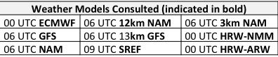
NWP Model Discussion

The weather models continue to be in close agreement on the main features of the medium range period, but uncertainly continues regarding a weak “back door” cold front that will move into the NMA as early as Sunday and persist through Tuesday. The period begins on Saturday, with a complex synoptic set-up. Shortwaves cresting the upper level ridge will continue to progress eastward into southern ON and QC and develop a weak longwave trough that will push the back door cold front into NY. At the same time, a tropical disturbance will move into the Gulf of Mexico from the south. The NHC gives this system a 90% chance of becoming a tropical or subtropical depression on Saturday. In addition, the western edge of the semi-permanent Bermuda High will remain over the CMA and SMA at mid-levels. As the advancing shortwaves flatten the upper level ridge and surface high pressure moves further offshore, the flow aloft will turn southwesterly and start to stream tropical moisture into the Mid-Atlantic. The tropical system will approach the LA/MS/AL coastline on Sunday and then slowly move onshore near the Mississippi River delta on Monday, progressing northward on Monday before gradually turning northeastward and heading toward the Tennessee River Valley (TRV) on Tuesday and Wednesday. The southern edge of the weak longwave trough to the north will reach down to the NMA on Sunday and will be reinforced by another shortwave on Monday, which will help to push the weak cold front a bit farther south. On Tuesday, an upper level ridge will amplify over the Midwest/western Great Lakes but will weaken as it progresses eastward to the Mid-Atlantic on Wednesday and interacts with the tropical vorticity near the TRV.
The Dailies
Day 1 (Saturday): Saturday will be very warm and uncomfortably humid. There is still some uncertainty as to whether afternoon showers and thunderstorms will reach the I-95 Corridor in the afternoon. But all of this morning’s convection-allowing models show a strong signal for thunderstorms reaching I-95 as early as 18Z and definitely by 21Z. This should be sufficient to take the edge off any rising ozone and decrease the risk of an ozone exceedance. In addition, back trajectories shift southerly, which should bring cleaner air into the region. The smoke from the Canadian wildfires is very evident this morning in the visible GOES-16/ABI band and the ABI GeoColor imagery – the thickest smoke is located over eastern NY, New England, and southern ON/QC, with a moderately thick plume stretching down over eastern PA, NJ, and the Delmarva. Presumably with the shift in flow aloft on Saturday, this smoke will be advected out of the Mid-Atlantic, but if any does linger, it will promote ozone formation in locations that see sufficient afternoon sunshine. The air quality models are keeping the I-95 Corridor and along/north of I-76 well into the Moderate range on Saturday. The NC models are once again the most aggressive, with isolated USG ozone in western PA. Given the likelihood of afternoon clouds and precipitation, this seems overdone. But we will keep the risk of an exceedance Marginal to account for the very warm conditions, light southwesterly surface winds, and chances for lingering smoke.
Day 2 (Sunday): Sunday looks like the cleanest day of the period. It will be mostly cloudy with widespread showers and thunderstorms across the region. It won’t be a washout, but showers are likely at anytime, from overnight through the evening. With very high precipitable water and dew points around 70 °F, periods of heavy rain are likely.
Day 3-4 (Monday and Tuesday): The trend for Monday and Tuesday is toward less precipitation and fewer clouds in the NMA and CMA. The tricky aspect of the forecast is the progression of the weak “back door” cold front. The weak longwave trough aloft will push the front southward on Monday, but it’s not clear how far south or how strong the front will be. Given the very humid air mass in place, clouds and showers seem likely to form in the vicinity of the front, but the operational weather models keep the NMA in particular relatively clear, presumably because the advancement of the front cuts off the NMA from the tropical moisture to the southwest. Weak frontal boundaries act as a line of convergence and can promote ozone formation, assuming skies remain clear. Upper level ridging will not be particularly strong, however, so clouds seem more likely at this point. But the BAMS models are super aggressive, predicting upper Moderate ozone on Monday and USG to Unhealthy ozone on Tuesday along the I-95 Corridor. This seems overdone to me, but it suggests at least a chance for Moderate conditions on Monday and Tuesday. The risk of an ozone exceedance rises to Marginal as a result, with a focus on the I-95 Corridor.
Day 5 (Wednesday): Surface high pressure to the north/northeast, building in behind a secondary cold frontal passage late Tuesday, will shift the flow onshore in the NMA for Wednesday. It will be seasonable with breezy east/southeasterly surface winds in the NMA and CMA, while the SMA will remain under the influence of the nearby, slowly moving tropical system. These factors should be sufficient to decrease the risk of an ozone exceedance back to Sight, although the transport of smoke from the Canadian wildfires will have to be monitored once again.
-Huff