

Medium Range Air Quality Outlook
Mid-Atlantic Region
Issued: Friday, August 3, 2018
Valid: August 4-8 (Saturday-Wednesday)
![]()

Summary
Bermuda high pressure at mid-levels will move over the Mid-Atlantic on Sunday and Monday, pulling the risk of an ozone exceedance to Appreciable before an upper level trough drops the risk to Marginal with unsettled conditions possible Tuesday and Wednesday, with Saturday the transition day to the new pattern. Most of the Mid-Atlantic will begin to dry out of Saturday as mid-level high pressure builds under a departing upper level trough. Ozone is most likely to start climbing across the western portions of the NMA and CMA, due to near average temperatures, mostly sunny skies, and weak surface winds, and weak westerly flow aloft. The primary forecast questions for Saturday will be the coverage of afternoon precipitation, cloud cover, and how quickly the air mass across the western NMA and CMA will be able to modify. Given these conditions, the risk of an ozone exceedance will rise to Marginal with a focus on locations across the western and central NMA. Aside from scattered showers and thunderstorms throughout the SMA, most of the Mid-Atlantic will feel the impacts of mid-level ridging overhead on Sunday. Mostly sunny skies, above average temperatures, weak surface winds, westerly flow aloft and the development of sea/bay breezes will be conducive for ozone formation across the northern half of the region. The risk of an ozone exceedance will rise to Appreciable with a focus on the I-95 Corridor from DC to NYC. Monday remains the primary day of concern as ozone conducive conditions may persist under surface and mid-level high pressure centered in the western SMA. The forecast questions for Monday center on air mass characteristics (how quickly can the air mass in place modify) and chances for afternoon showers and thunderstorms (differences in the weather models). Mostly sunny skies, above average temperatures, weak westerly flow aloft, and light/calm surface winds will allow ozone to continue to rise in locations that remain dry. These conditions will keep an Appreciable risk of an ozone exceedance with the highest ozone most likely in the PIT metro area, along the Chesapeake Bay, and along the I-95 Corridor. Unsettled conditions will return to most of the Mid-Atlantic on Tuesday as upper/mid-level troughing moves into the region. Once again the coverage and timing of precipitation will be the primary forecast questions for Tuesday, as there is a chance that the I-95 Corridor may remain dry. The return of widespread unsettled weather will diminish the risk of an exceedance for most of the region but uncertainty in the forecast across the eastern half of the region will warrant a Marginal risk of an ozone exceedance. Despite differences between the weather models on Wednesday, unsettled conditions overnight or throughout the day and increasing surface winds should be enough to take the edge off of ozone. Given uncertainty in the air mass characteristics and coverage of precipitation, the risk of an ozone exceedance will remain Marginal on Wednesday.
NWP Model Discussion
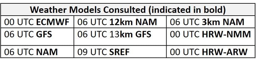
Aside from a few minor differences, the weather models remain in close agreement with the evolution of synoptic scale features throughout the medium range period. What remains of the weakening Mississippi River Valley trough will lift northeastward today, with the base of the trough over the NMA/CMA by 12Z Saturday. This weak upper level troughing will quickly be pushed eastward out of the Mid-Atlantic by a low amplitude ridge building eastward into the Ohio River Valley by 00Z Sunday; the axis this feature will move over the Mid-Atlantic by 12Z Sunday and progress quickly, reaching the Atlantic coast by 00Z Monday. As the low amplitude ridge exits to the east, mostly zonal flow will set up over the Mid-Atlantic on Monday. The westward building of the Bermuda High at mid-levels, beginning on Saturday, will place the entire Mid-Atlantic under mid-level ridging on Sunday and Monday. By 18Z Monday, shortwave energy passing over the Upper Midwest will begin to dig out a weak longwave trough that will be centered across the Great Lakes by 12Z Tuesday. The GFS and ECMWF still have some minor timing discrepancies with this feature, but both solutions bring upper level troughing into the Mid-Atlantic between 12Z and 18Z Tuesday. The upper level trough remains in place on Wednesday and extends further south, over the entire region.
The Dailies
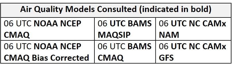
Day 1 (Saturday): Most of the Mid-Atlantic will begin to dry out of Saturday as mid-level high pressure builds westward under the departing upper level trough. The presence of the upper level trough for the first half of the day will keep unsettled conditions across the eastern edge of the region throughout the morning hours before dissipating throughout the afternoon. Morning and early afternoon precipitation, combined with mostly cloudy skies and strong southerly flow, will keep ozone formation in check along the I-95 Corridor throughout the NMA and CMA. Ozone formation will also be limited across the SMA as strong southerly flow continues in the morning despite the development of surface high pressure in western NC. Ozone is more likely to start climbing across the western portions of the NMA and CMA, where near average temperatures, mostly sunny skies, and weak surface winds will combine with weak westerly flow aloft. The primary forecast questions for Saturday will be the coverage of afternoon precipitation, cloud cover, and how quickly the air mass across the western NMA and CMA will be able to modify. The air quality models continue to appear too aggressive with rapid development of ozone across the northern half of the region as they develop widespread Moderate ozone with a few areas of USG ozone across PA and along I-95 and Good ozone across the southern half of the region. In particular, the 06Z NC NAM-2 and -3 runs once again appear to be poorly initialized, making them outliers. While it is unlikely that ozone reaches the USG range on Saturday, the models are in agreement that locations across the western Mid-Atlantic, specifically the PIT metro area, will have the highest ozone levels. Given these conditions, the risk of an ozone exceedance will rise to Marginal with a focus on locations across the western and central NMA.
Day 2 (Sunday): Aside from scattered showers and thunderstorms throughout the SMA, most of the Mid-Atlantic will feel the impacts of mid-level ridging overhead on Sunday. Mostly sunny skies, above average temperatures, weak surface winds, and a shift to slow westerly flow aloft will be conducive for ozone formation across the northern half of the region. In addition to these conditions, the shift to light westerly surface winds will lead to the development of sea/bay breezes along the eastern NMA and CMA that will concentrate ozone along and east of the I-95 Corridor. The primary forecast question for Sunday will be how quickly the air mass will be able to modify under the influence of high pressure given the recent stretch of unsettled conditions and lower Sunday emissions. Another consideration, once the flow aloft turns westerly, will be the possibility of dilute smoke transport. Thin density smoke blankets the region west of the Appalachians, with more moderate to thick density smoke across the Plains. So the smoke is out there, but as always, it’s not clear how much is mixing to the surface or will actually make it into the Mid-Atlantic, but it’s something to keep an eye on through the remainder of the medium range period. Southerly flow and scattered afternoon precipitation across the SMA will likely keep ozone in check across most of the southern half of the region. The air quality models continue to gradually increase regional ozone with widespread mid-Moderate ozone and strips of USG ozone along I-76 through PA, along the NMA/CMA I-95 Corridor. The air quality models also highlight coastal locations that will likely be impacted by the development of sea/bay breezes with strips of USG to Unhealthy ozone. Given the many ozone conducive weather conditions and uncertainty in the air quality model guidance, the risk of an ozone exceedance will rise to Appreciable with a focus on the I-95 Corridor from DC to NYC.
Day 3 (Monday): Monday remains the primary day of concern as ozone conducive conditions may persist under surface and mid-level high pressure centered in the western SMA. The GFS and ECMWF diverge with surface conditions on Monday as the GFS develop scattered showers and thunderstorms across much of the NMA and CMA, while the ECMWF keeps most of the precipitation across the SMA. The development and coverage of precipitation and associated cloud cover will be primary forecast questions on Monday due to conditions otherwise conducive for ozone formation. Mostly sunny skies, above average temperatures, weak westerly flow, and light/calm surface winds will allow ozone to continue to rise in locations that remain dry. Similar to Sunday, westerly surface flow will promote the development of sea/bay breezes throughout the eastern Mid-Atlantic that could help concentrate pollutants along and east of I-95. The biggest question for Monday’s forecast will be how quickly the regional air mass modifies, and whether any dilute smoke from the west makes its way into the region. The air quality models respond to these ozone conducive conditions across the NMA and CMA by developing widespread USG ozone across the NMA and CMA, especially along and east of I-81, with pockets of Unhealthy ozone along the I-95 Corridor from DC to NYC. These conditions will keep an Appreciable risk of an ozone exceedance with the highest ozone most likely in the PIT metro area, along the Chesapeake Bay, and along, south, and east of I-95.
Day 4-5 (Tuesday-Wednesday): Unsettled conditions will return to most of the Mid-Atlantic on Tuesday as upper and mid-level troughing moves into the region. Despite disagreement between the GFS and ECMWF in regards to the exact timing and strength of these features, both models bring scattered showers and thunderstorms into the NMA and CMA from west to east, beginning on Tuesday morning/afternoon. Both models push the bulk of precipitation as far east as I-81 by 00Z Wednesday but disagree on the coverage of precipitation along and east of I-81. The GFS (faster with the next weak front) develops scattered showers and thunderstorms along a surface trough draped along the I-95 Corridor, while the ECMWF (slower with the next weak front) keeps the I-95 Corridor dry through 00Z Wednesday. The coverage and timing of this precipitation will be the primary forecast questions for Tuesday. Another limiting factor may be a switch to faster and more southwesterly flow on Tuesday, that will bring humid (and presumably cleaner) air into the NMA and CMA. Across the SMA, widespread showers and thunderstorms and mostly cloudy skies will prevent excessive ozone formation. The air quality models respond to unsettled conditions across most of the Mid-Atlantic as they drop regional ozone into the Moderate range across the eastern half of the region with a few patches of USG along the I-95 Corridor in the NC-GFS2 (which we are discounting), and into the Good range across the SMA and eastern half of the region. The return of widespread unsettled weather and a shift to southwesterly flow will diminish the risk of an exceedance for most of the region, but uncertainty in the forecast across the eastern half of the region will warrant a Marginal risk of an ozone exceedance.
The weather models have two different solutions on Wednesday, stemming from differences in the upper levels. Since the ECMWF is slower with the eastward progression of the upper level trough and associated weak cold front, it brings widespread unsettled conditions through the Mid-Atlantic on Wednesday. The faster GFS pushes most of the precipitation through Tuesday and overnight into early Wednesday morning, resulting in scattered showers throughout the region in the morning. Despite these differences, unsettled conditions overnight or throughout the day and increasing surface winds should be enough to take the edge off of ozone. Given uncertainty in the air mass characteristics and coverage of precipitation, the risk of an ozone exceedance will remain Marginal on Wednesday.
-Enlow/Huff