

Medium Range Air Quality Outlook
Mid-Atlantic Region
Issued: Thursday, June 28, 2018
Valid: June 29- July 3 (Friday-Tuesday)
![]()

Summary
An extended ozone exceedance event is likely throughout the medium range period as a very strong ridge builds over the entire eastern CONUS, starting on Friday. There is excellent agreement between the weather models regarding the primary features throughout the forecast period, resulting in strong confidence through Monday. The guidance today is trending towards a stronger ridge, lasting longer into next week, which is increasing the chances for extended poor ozone air quality. At this point, Sunday and Monday seem like the worst days, with the focus on the entire I-95 Corridor from RIC to NYC. The only portion of the region that appears like it will be spared is NC, where onshore flow seems as if it will be sufficient to keep ozone from rising above the Moderate range. On Saturday, fast northwesterly flow aloft in the NMA will limit rising ozone along the northern I-95 Corridor, making the chance for an exceedance most likely in western PA (PIT), which will feel the effects of the approaching ridge first, and at locations from DC to BAL along the Chesapeake Bay, which will be affected by a bay breeze. Sunday and Monday, temperatures will approach or exceed 100 °F along I-95, with essentially calm or very light surface winds. Back trajectories are slow westerly (Sun) and localized (Mon). Although Sunday emissions may be lower, the extreme heat and strong subsidence associated with the ridge aloft will likely be sufficient to drive ozone into the USG range at multiple locations. The potentially limiting southerly flow that was in the guidance yesterday is gone today, making Monday possibly the highest ozone day of the period. Uncertainty enters the forecast on Tuesday. The guidance points to a tropical cyclone approaching the Southeastern US coast, which helps to develop a weak onshore flow across the NMA and CMA. This shift in transport could take the edge off ozone for locations along the east coast, but the flow may not be strong enough to impact locations further inland, especially along and west/north of I-95. The trend in the models has also been to slow the progression of a weak cold front that may move into northwestern PA on Tuesday. As a result, the chances for an ozone exceedance extend into Tuesday, with a focus on locations west of I-95 across the NMA and CMA.
NWP Model Discussion
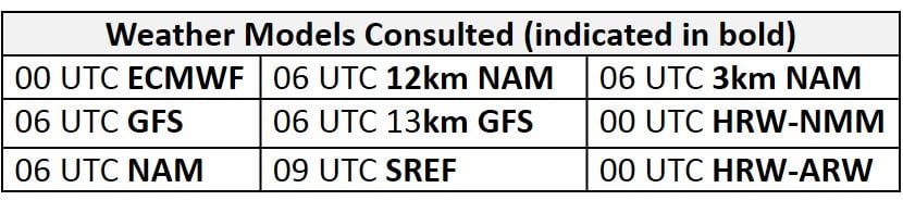
The weather models remain in strong consensus with the synoptic pattern throughout the medium range period. The longwave trough currently passing over the northeast U.S. will continue to push eastward, moving out to sea by 12Z Friday. As this trough departs to the east, the axis of a very strong upper level ridge will move over the Mississippi River Valley, encompassing most of the eastern CONUS by 12Z Friday. The arrival of this ridge will set the stage for a multi-day poor air quality event across the entire Mid-Atlantic region. The trend in the guidance today is for a stronger ridge, lasting longer into next week. The center of this ridge will progress eastward, along the Ohio River Valley, before settling over the NMA on Saturday; although the center of the ridge will tilt slightly, it will remain in place over the Mid-Atlantic through the end of the period (and possibly beyond). Around 12Z Sunday, a shortwave trough moving into the Upper Midwest will attempt to push into the Great Lakes. This feature will begin to dampen the ridge over the Great Lakes region, but it will quickly weaken as it deflects to the northeast over the ridge and into ON by 00Z Monday. This is a change from yesterday’s guidance, helping to keep the ridge in place into next week. The upper level trough will pull a weak shortwave trough and associated cold front southeastward towards the Mid-Atlantic on Monday/Tuesday. The weather models slightly disagree with the strength and southeastward push of this feature as it moves towards the center of upper-level high pressure over the Mid-Atlantic. The GFS keeps this shortwave trough slightly stronger as it lingers along Lake Erie/Ontario through the end of the period, while the ECMWF pushes the shortwave trough into the NMA by 06Z Tuesday and slowly dissipates it by the end of the medium range period. The GFS and ECMWF both have shortwave energy breaking off the downwind side of the ridge that drops down southward and eventually develops into a possible tropical disturbance off of the FL/GA/SC coasts on Monday/Tuesday. Both the GFS and EC bring this tropical cyclone northward, but well off the Atlantic coast, which allows a weak onshore flow to develop in the NMA and CMA on Tuesday. The NHC isn’t mentioning this potential system yet, as it’s too far out, but we will keep a close eye on it as the period progresses. The fact that the GFS and EC both develop the system in almost the same place and at the same time lends confidence.
The Dailies
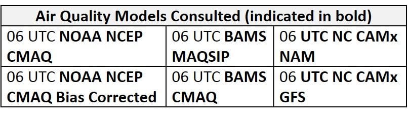
Day 1 (Friday): Friday will be the first in a string of days where conditions will be favorable for ozone exceedances, as a dome of high pressure begins to move overhead. Sunny skies across most of the region will allow temperatures to surge above average values with many locations reaching into the 90s °F. Surface high pressure in the CMA will promote weak surface winds throughout the region with sea/bay breezes likely along coastal regions, especially the Chesapeake Bay. The ridge axis to the west will promote back trajectories from the northwest across the NMA, which are still quite fast (e.g., from northern WI for 36hr ending at 12Z Friday at KPHL). This transport pattern has the potential to keep ozone below the USG threshold along the northern branch of the I-95 Corridor, since the residual layer will likely be clean. Transport will be localized across the SMA, but today’s (Thursday’s) weak cold, which will stall in the vicinity of the NC/SC border, will promote a few patches of clouds and isolated showers in the afternoon hours along southern NC. As a result, there is uncertainty in how quickly ozone may rise in the CLT metro area due to the potential for afternoon clouds and precipitation. The air quality models are generally in agreement with widespread Moderate ozone and a few scattered areas of USG ozone across the region. The models highlight the BAL-DC coast along the Chesapeake Bay with USG ozone in response to sunny skies and the likely development of a bay breeze. The models also highlight western PA (PIT) with USG ozone likely in response to weaker transport aloft and calm surface winds. Similar to yesterday’s air quality model runs, the models develop Good range ozone across the northeastern portion of the NMA, along and north/west of I-95 from PHL to NYC, likely in response to stronger northwesterly transport aloft. The primary forecast question will be how strong the influence of northwesterly transport across the NMA will impact ozone and precursors in the residual layer. It will be important to closely monitor today’s conditions locally and upwind to get a feel for how quickly the air mass is beginning to modify. The risk of an ozone exceedance will remain High with a focus on western PA and the western bank of the Chesapeake Bay.
Day 2 (Saturday): Conditions will be favorable for multiple ozone exceedances across the Mid-Atlantic on Saturday as the upper level ridge builds directly overhead. The presence of strong high pressure and associated subsidence will prevent the development of optically thick clouds, keeping sunny skies across the region. Temperatures will continue to rise with most of the region reaching into the upper 90s °F. Light variable surface winds, localized transport, and above average temperatures are pushing regional ozone higher in the air quality models as they develop widespread USG ozone across the NMA and eastern CMA. The BAMS and NC models both highlight the Chesapeake Bay region and I-95 Corridor from RIC to NJ with USG ozone. The NC models are the most aggressive across the rest of the NMA with large pockets of USG ozone and isolated Unhealthy ozone across western PA. Similar to yesterday’s air quality model runs, the models are holding off on USG ozone across NC, likely due to weak onshore flow. The risk of an ozone exceedance will remain High with a focus across the entire NMA and CMA, with the highest ozone most like along the entire extent of I-95 from RIC to NYC, as well as western PA. There do not look to be any limiting factors for rising ozone at this point.
Day 3 (Sunday): Summer will be in full swing for the start of July as the center of high pressure passes over the NMA. Oppressive conditions will impact most of the Mid-Atlantic as temperatures rise to upper 90s °F with temperatures possibly surpassing 100 °F in the CMA and along the I-95 heat island. Another day of sunny skies, more localized back trajectories and weak surface winds will result in ozone exceedances across the northern half of the Mid-Atlantic region. In a change from yesterday, flow aloft will be more westerly than weakly southerly in the NMA and CMA, increasing the chances for rising ozone. The gradual eastward push of the ridge/high pressure will continue to slowly place NC under increasing influence of onshore flow through the end of the medium range period, diminishing the risk of an ozone exceedance in NC. Ozone conducive conditions across the northern two-thirds of the Mid-Atlantic are resulting in widespread USG ozone across the NMA in the air quality models with scattered Unhealthy ozone along the I-95 Corridor from RIC to NYC. Although Sunday emissions may be lower, the extreme heat and strong subsidence associated with the ridge aloft will likely be sufficient to drive ozone into the USG range at multiple locations. As a result, the risk of an ozone exceedance will remain High on Sunday.
Day 4-5 (Monday-Tuesday): Again, in a change from yesterday, the stronger ridge will diminish chances for cleaner southerly flow on Monday. Widespread poor air quality will likely pour into the work week as the heat wave continues across the Mid-Atlantic. Yesterday’s forecast mentioned the possible arrival of a shortwave trough and associated weak cold front in the northwestern NMA but the today’s model runs have suggested that this feature will weaken and slow as it pushes southward through the Great Lakes. As a result, persistent high pressure will keep skies clear and temperatures on Monday just as hot as on Sunday, with even higher heat indices due to increasing humidity. The air quality models continue to increase regional ozone with widespread USG ozone across the eastern NMA/CMA and western PA. They also continue to develop a large patch of Unhealthy ozone along the I-95 Corridor from DC reaching northeastward through NJ and into NY. The air quality models place most of the SMA and western CMA under Good ozone possibly in response to increasingly south/southeasterly transport of presumably clean air. Ozone exceedances across the northern half of the Mid-Atlantic remain likely on Monday keeping a High risk.
Uncertainty enters the forecast on Tuesday. A very broad center of upper level high pressure will remain over the NMA but an elongated center and a potential tropical disturbance in the Atlantic, off of the Southeastern US coast, may develop weak onshore flow for most of the Mid-Atlantic on Tuesday. This shift in transport could take the edge off ozone for locations along the east coast but the flow may not be strong enough to impact locations further inland, especially along and west/north of I-95. The trend in the models has been to slow the progression of a weak cold front that may move into northwestern PA on Tuesday. This trend will likely continue, given that there is weak support for the front aloft, and it will be moving into an extremely hot air mass. Despite these uncertainties, mostly sunny skies and another day with temperatures across the region in the mid-to-upper 90s °F will keep conditions generally conducive for another day of high ozone on Tuesday. As a result, a High risk of an ozone exceedance will continue on Tuesday, with a focus on locations west of I-95 across the NMA and CMA.
-Enlow/Huff