

Medium Range Air Quality Outlook
Mid-Atlantic Region
Issued: Wednesday, June 13, 2018
Valid: June 13-17 (Thursday-Monday)
![]()

Summary
The arrival of an upper/mid-level ridge on Saturday will last into early next week, resulting in conditions favorable for an ozone exceedance through the weekend and early next week. Thursday will be a pleasant day for most of the Mid-Atlantic as a noticeably drier air mass filters in behind today’s cold front. Weaker surface winds and near average temperatures under the strong June sun will result in a Marginal risk of an ozone exceedance with a focus on the SMA. High pressure moving into the region Friday will result in another pleasant day to end the work week. Mostly sunny skies and a slight shift to northerly flow will keep temperatures at or slightly below average. Winds across the region will gradually diminish by the afternoon/evening as the center of surface high pressure moves into the CMA. The risk of an ozone exceedance will remain Marginal with a focus on the SMA. Saturday will be the first in a string of days with elevated risk for an ozone exceedance as an upper/mid-level ridge impacts most of the eastern US. Back trajectories in the NMA are still forecast to originate near James Bay through 00Z Sunday. This suggests the regional load of ozone will be low. Light/calm surface winds, mostly sunny skies and subsidence from high pressure will be favorable for ozone formation, but the primary forecast question will be how quickly the regional air mass modifies. The risk of an ozone exceedance will remain Marginal with a focus on the I-95 Corridor, southwestern PA, and west central NC. Sunday and Monday will continue to be the primary concern for the medium range forecast and beyond. Persistent mid and upper level ridging will continue conditions favorable for ozone formation, increasing the risk for an exceedance to Appreciable on Sunday. By Monday, a classic high ozone pattern will be in place with a substantial lee trough forming along the I-95 Corridor. The risk for an ozone exceedance is High on Monday throughout the region.
NWP Model Discussion

The weather models have come into closer agreement with the evolution of the synoptic pattern until the end of the medium range period. Two main features will impact the Mid-Atlantic through Monday. The first feature is the longwave trough currently moving through the Great Lakes, reinforced by shortwaves through Saturday morning that will linger along the east coast until around 18Z Saturday. The second feature is an upper/mid-level ridge that will build over the interior US through the end of the work week before migrating eastward, over the eastern CONUS by 00Z Sunday. The longwave trough moving through the Great Lakes today will reach southern QC/ME by 12Z Thursday as shortwave energy dropping across ON reinforcing the trough over the entire Northeast region by 12Z Friday. The reinforced trough will sweep southeasterly, with the axis moving off the Atlantic coast by 12Z Saturday. Although locations in the Southeast and SMA will already be under its influence, the departure of this upper level trough will allow the ridge to move eastward into the entire Mid-Atlantic region. The GFS and ECMWF have a few slight differences with “ring of fire” shortwaves cresting the ridge along the Great Lakes and into the NMA on Saturday and Sunday, although neither solutions appear to develop widespread unsettled conditions. The ridge will remain in place over the eastern US through the end of the medium range period, however, the GFS and ECMWF diverge with the potential merging of longwave trough moving over Hudson’s Bay between 00Z and 12Z Monday and shortwave energy ejecting northward from the four corners region reaching the Dakotas around 06Z Monday. The GFS merges the two features over the Upper Midwest by 12Z Monday, developing a longwave trough that extends into the Upper Midwest/Great Lake region by 00Z Tuesday. The ECMWF continues to build the ridge over the Mississippi River Valley, never allowing a weaker Canadian trough and weaker shortwaves to interact. These differences will impact the influence of the ridge over the Mid-Atlantic as the GFS solution would result in unsettled conditions across the region on Monday and into Tuesday. The ECMWF solution would keep the region under high pressure, resulting in conditions conducive for high ozone into the middle of the week.
The Dailies
Day 1 (Thursday): Thursday will be a pleasant day for most of the Mid-Atlantic as a noticeably drier air mass filters in behind today’s arriving cold front. The cold front is forecasted to push southward into the CMA/SMA by 12Z Thursday but precipitation and cloud cover will be limited. Surface high pressure moving through the Ohio River Valley will promote sunny skies across most of the region. Cold air advection due to northwesterly flow aloft in the NMA and CMA will be countered by subsidence warming, keeping temperatures near average values. The air quality models are responding to fast back trajectories and breezy surface winds with widespread Good range ozone. In the SMA, slightly weaker flow and temperatures reaching into the upper 80s F will allow pockets of Moderate ozone to develop across the region. Weaker surface winds and near average temperatures under the strong June sun will result in a Marginal risk of an ozone exceedance with a focus on the SMA.
Day 2 (Friday): High pressure moving into the region will result in another pleasant day to end the work week. Mostly sunny skies and a slight shift to northerly flow will keep temperatures at or slightly below average. Light morning surface winds across the region will gradually diminish by the afternoon/evening as the center of surface high pressure moves into the CMA. Continued northerly/northwesterly flow across the NMA and CMA is resulting in widespread Good range ozone in the air quality models, while weak southerly surface winds under sunny skies promote Moderate ozone across the SMA. Similar to the last few 06Z runs of the air quality models, west central NC is likely to observe the highest ozone concentrations. The risk of an ozone exceedance will remain Marginal with a focus on the SMA.
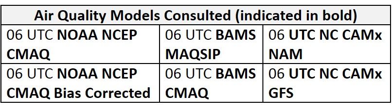
Day 3 (Saturday): Saturday will be the first in a string of days with elevated risk for an ozone exceedance as an upper/mid-level ridge moves over the eastern US. Surface high pressure centered in the CMA/SMA will promote clear skies at low and mid-levels allowing temperatures to rise to near/slightly above average values. The GFS and ECMWF have weak shortwave energy moving across the region, possibly promoting upper level clouds, but precipitation does not appear to be likely at this time. The air quality models develop more widespread Moderate ozone across the region. The BAMS models are fairly similar to each other, with strips of Moderate ozone across southwestern PA, the I-95 Corridor and again in west central NC. The NC-NAM1 and NAM2 are more conservative with Good range ozone across the region except for a strip of Moderate in western VA and NC. The NC-GFS2 is the most aggressive of the air quality models, with Moderate ozone across the entire region and a few isolated pockets of USG ozone throughout the region. Forecast back trajectories in the NMA still originate near James Bay through 00Z Sunday, suggesting the regional load of ozone will be low until Sunday. Light/calm surface winds, mostly sunny skies and subsidence from high pressure will be favorable for ozone formation, but the primary forecast question will be how quickly the regional air mass modifies. The risk of an ozone exceedance will remain Marginal with a focus on the I-95 Corridor, southwestern PA, and west central NC.
Day 4-5 (Sunday-Monday): Sunday and Monday will continue to be the primary concern for the medium range forecast. With a strong ridge in place, conditions will be favorable for ozone formation, and we have increased the risk for an exceedance to Appreciable on Sunday. Surface high pressure is forecasted to move southward into the SMA/Southeast US on Sunday. Temperatures across the NMA and CMA will rise into the upper 80s/low90s °F as a shift to westerly flow promotes warm air advection. The air quality models continue to increase regional ozone concentration on Sunday, with widespread Moderate and the development of scattered USG. Both BAMS models and the NG-GFS2 highlight the I-95 Corridor, CMA/NMA coastal regions, western PA and portions of WV for upper Moderate/USG ozone development due to light southwesterly/westerly surface winds and above average temperatures. By Monday, a classic high ozone pattern will be in place with a substantial lee trough forming along the I-95 Corridor. The risk for an ozone exceedance is High on Monday throughout the region. Temperatures across the CMA and NMA will likely rise into the 90s °F with humidity surging beginning Sunday evening. Conditions will be favorable to ozone and fine particle formation in the ORV beginning Friday. As a result, westerly transport aloft will bring high modified air, rich in ozone and fine particles, in the region by Monday. The extent of this expected poor air quality event is uncertain after Monday due to differences in the forecast models.
-Enlow/Ryan