

Medium Range Air Quality Outlook
Mid-Atlantic Region
Issued: Monday, June 25, 2018
Valid: June 26-30 (Tuesday-Saturday)
![]()

Summary
Periods of unsettled conditions will keep a low risk of an ozone exceedance through most of the work week before the arrival of a strong upper level ridge on Friday poses an exceedance threat through the weekend. Surface high pressure currently in ON will migrate southeastward into the NMA by Tuesday morning, promoting dry conditions across the northern half of the Mid-Atlantic, while a shortwave brings unsettled conditions to the southern half of the region. Light surface winds and periods of late June sun will result in a Marginal risk of an ozone exceedance with a focus of the NMA/CMA I-95 Corridor. A low pressure system moving across the Great Lakes will bring unsettled conditions to the northern half of the Mid-Atlantic on Wednesday. Mostly cloudy skies, breezy southerly surface winds, and below average temperatures will keep ozone formation in check. The risk of an ozone exceedance will decrease to Slight on Wednesday. Wednesday’s approaching low pressure system will skirt the region to the northwest on Thursday as it pulls a weak cold front eastward into the NMA during the day, with a pre-frontal trough reaching the vicinity of I-95 in the late morning. Precipitation will taper off from west to east but uncertainty remains for locations east of I-81. If precipitation clears the eastern NMA/CMA early enough, above average temperatures and weakening surface winds from the west could allow ozone concentrations to rise. The primary forecast questions will be the impact of the pre-frontal trough (on surface winds and precipitation) and amount of afternoon sunshine across the eastern NMA/CMA. Given the uncertainty, the risk on an ozone exceedance will remain Marginal with a focus on the I-95 Corridor. Friday will probably be the start of a multi-day ozone event as mid- and upper-level ridges begin to move overhead, promoting hot and sunny conditions. Surface high pressure in the Ohio River Valley will allow temperatures to rise to well above average values across the entire Mid-Atlantic. The risk of an exceedance will increase to Appreciable with a focus on the eastern NMA/CMA and western PA. Ozone conducive conditions will continue on Saturday as a broad upper level ridge moves directly over the Mid-Atlantic. Surface high pressure in the western CMA/SMA will result in another day with mostly sunny skies, above average temperatures and weak surface winds. The risk of an ozone exceedance will increase to High on Saturday with exceedances possible throughout the Mid-Atlantic.
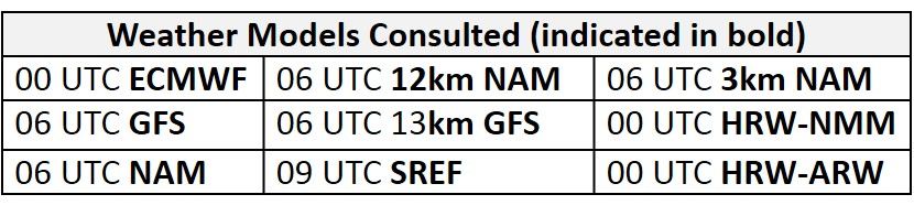
NWP Model Discussion
Aside from a few minor differences, the weather models are in agreement with the synoptic pattern throughout the medium range period. By 12Z Tuesday, an upper level trough departing eastern Canada will allow an upper level ridge to build over the eastern US. This ridge axis will move over the Mid-Atlantic between 18Z Tuesday and 00Z Wednesday. A lingering shortwave perturbation traversing the base of the ridge across the SMA will keep the impact of high pressure to the north. Upstream, a longwave trough currently moving across the central US will move into the Great Lakes by 12Z Wednesday as it begins to flatten the upper level ridge over the Mid-Atlantic and push it eastward. This trough axis will continue to push eastward, moving directly over the Mid-Atlantic by 12Z Thursday and to the eastern coast by 00Z Friday. A broad dome of high pressure building over the south-central US on Thursday will build northward and eastward in the wake of this trough, resulting in an upper level ridge centered over the Mississippi River Valley by 12Z Friday, with its eastern edge moving over the Mid-Atlantic as the day progresses. The center of high pressure aloft will move along the Ohio River Valley throughout the day on Friday before setting up over the Mid-Atlantic on Saturday. At mid-levels, the ridge will be centered over the Gulf of Mexico and Gulf Coast through the period, gradually building northeastward into the Mid-Atlantic beginning on Friday, in the wake of the departing mid- and upper-level trough. The mid- and upper-level ridging will set the stage for a probable poor air quality event across the Mid-Atlantic through the weekend and into the first week of July.
The Dailies
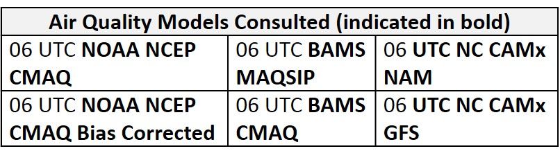
Day 1 (Tuesday): Surface high pressure currently in ON will migrate southeastward into the NMA by Tuesday morning, promoting dry conditions across the northern half of the Mid-Atlantic. A seasonable air mass will continue to filter into the NMA behind today’s cold frontal passage, resulting in another day of near average temperatures under mostly sunny skies. A shortwave will bring unsettled conditions to the southern half of the Mid-Atlantic, forming a surface wave along today’s cold front, which will stall over NC. Widespread heavy precipitation overnight will gradually lighten in the morning hours before more scattered thunderstorms develop in the afternoon. Widespread cloud cover and onshore surface winds will limit temperatures to well below average values across the CMA and SMA. The air quality models are responding to high pressure in the NMA with a mix of Moderate and upper Good range ozone. The BAMS models are not in close agreement as the more conservative MAQSIP develops widespread Good range ozone across the NMA, while the CMAQ highlights the eastern NMA and CMA with widespread Moderate range ozone. Although slightly more aggressive, the NC models are similar to the BAMS-MAQSIP with Moderate ozone across the NMA and eastern CMA, with a few isolated patches of USG ozone along the I-95 Corridor in PA/NJ. The focus on the eastern NMA/CMA in the air quality models is likely due to light surface winds (although onshore) and mostly sunny skies, with strong late June sun. The locations of the highest magnitude ozone in the models seem correct, but ozone maxima seem much too high, given the clean air mass currently in place and upwind. In the SMA, the air quality models still keep ozone concentrations in the upper Good/Moderate range despite heavy precipitation and persistent cloud cover; the magnitude here also seems overdone. Given mostly sunny skies and light surface winds, with surface high pressure moving nearby in the morning, the risk of an ozone exceedance will be Marginal with a focus on the I-95 Corridor in the NMA and CMA.
Day 2 (Wednesday): A low pressure system moving across the Great Lakes will bring unsettled conditions to the northern half of the Mid-Atlantic on Wednesday. A shift to southwesterly flow will lift Monday’s cold front back northward into the NMA as a warm front, allowing a more humid air mass to filter into the region. Scattered showers and thunderstorms are forecast to impact the NMA and CMA, but the models are not in agreement with how far east precipitation will be able to push by 00Z Thursday. The NAM and ECMWF keep precipitation west of I-81 until after 00Z Thursday while the GFS is the lone model pushing showers and thunderstorms to the I-95 corridor in the afternoon. Despite uncertainty in the precipitation forecast, mostly cloudy skies, breezy southerly surface winds and below average temperatures will keep ozone formation in check across the northern half of the region. In the SMA, slightly below average temperatures, periods of sunshine and a humid air mass will provide the opportunity for scattered showers and thunderstorms in the afternoon, with Tuesday’s surface wave lingering nearby. The air quality models are generally in agreement with Good ozone across most of the Mid-Atlantic. They highlight northeastern PA, northern NJ, and west-central NC with areas of low Moderate ozone. The risk of an ozone exceedance will decrease to Slight on Wednesday.
Day 3 (Thursday): Wednesday’s low pressure system will skirt the region to the northwest on Thursday as it pulls a weak cold front eastward into the NMA during the day, with a pre-frontal trough reaching the vicinity of I-95 in the late morning. Scattered showers and thunderstorms will taper off as the front pushes eastward, but it is not clear how long they will linger into the afternoon. Temperatures will remain near/slightly below average in locations west of I-81 as mostly cloudy skies linger into the early afternoon. A shift to southwesterly flow along and east of I-81 will allow temperatures to surge above average. If precipitation clears the eastern NMA/CMA early enough, above average temperatures and weakening surface winds from the west could allow ozone concentrations to rise. In the SMA, mostly sunny skies will promote near average temperatures. The air quality models all have the same idea as they increase regional ozone concentrations. The BAMS models place most of the Mid-Atlantic under upper Good/low Moderate ozone with a patch of Moderate ozone over the eastern NMA/CMA. The NC models are slightly more aggressive with more widespread Moderate range ozone across the entire region. The primary forecast questions will be the impact of the pre-frontal trough (on surface winds and precipitation) and amount of afternoon sunshine across the eastern NMA/CMA. Given the uncertainty, the risk on an ozone exceedance will remain Marginal with a focus on the I-95 Corridor.
Day 4-5 (Friday-Saturday): Friday will probably be the start of a multi-day ozone event as mid- and upper-level ridges begin to move overhead. Surface high pressure in the Ohio River Valley will promote mostly sunny skies allowing temperatures to rise well above average values across the entire Mid-Atlantic. The air quality models are responding to weak surface winds under the strong late June sun as they develop widespread Moderate ozone, with pockets of USG ozone in PIT, CLT, and along the I-95 Corridor. Conditions favorable for ozone formation will bring the risk of an ozone exceedance to Appreciable on Friday, with a focus on the eastern NMA/CMA and western PA. Ozone conducive conditions will continue on Saturday as a broad upper level ridge moves directly over the Mid-Atlantic and the mid-level ridge builds northeastward as well. Surface high pressure in the western CMA/SMA will result in another day with mostly sunny skies, above average temperatures and weak surface winds. Back trajectories both Friday and Saturday for the NMA/CMA are weakly northerly (from southeastern ON), but this is not expected to be a limiting factor for rising ozone. The northerly direction of transport aloft is due to the somewhat unusual position of the mid-level ridge, to the south of the traditional ozone-conducive pattern. But the trajectories are slow and essentially localized, which will favor rising ozone. The risk of an ozone exceedance will increase to High on Saturday with exceedances possible throughout the Mid-Atlantic.
-Enlow/Huff