

Medium Range Air Quality Outlook
Mid-Atlantic Region
Issued: Thursday, June 14, 2018
Valid: June 15-19 (Friday-Tuesday)
![]()

Summary
The arrival of an upper/mid-level ridge on Saturday will result in days with Appreciable and High risk for an ozone exceedance through the weekend and into next week. Friday will be enjoyable weather-wise for most of the Mid-Atlantic region as high pressure moves eastward through the Ohio River Valley. Temperatures will remain near average values despite mostly sunny skies as forecast back trajectories are swift and northerly for most of the region. The risk of an ozone exceedance will be Marginal with a focus on locations in the SMA.
The transition to a poor air quality pattern begins Saturday although sustained northerly transport aloft will limit ozone accumulation. By Sunday, conditions will be conducive to USG ozone levels. Westerly transport aloft will be in place along with light surface winds, sunny skies, and high temperatures. This episode is likely to peak on Monday as weekday emissions resume. Tuesday’s forecast is uncertain as a “backdoor” cold front is expected to move into the Mid-Atlantic. The return of unsettled conditions and afternoon cloud cover should be enough to keep ozone out of the USG range on Tuesday, but uncertainty in the forecast will lower the risk for an exceedance to Appreciable.
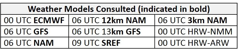
NWP Model Discussion

A few minor details aside, the weather models are in agreement with the progression of the synoptic pattern until late in the medium range period. Not much has changed in the upper level forecast even as forecast lead times shorten. The upper level trough currently over southern QC/NY will be reinforced over the Northeast US by 12Z Friday before sweeping southeastward, moving off the Atlantic coast by 12Z Saturday. As this occurs, an upper/mid-level ridge currently centered over the Mississippi River Valley will push eastward, impacting the Mid-Atlantic as early as 12Z Friday. The center of this feature will settle over KY/TN by 00Z Sunday where it will remain into the middle of next week. The upper level ridge will be challenged by a few shortwaves on Saturday and Sunday providing the opportunity for a few afternoon showers over the weekend but they will be scattered in nature. The persistent nature of this ridge and associated surface high pressure in the Mid-Atlantic will result in deteriorating air quality conditions through the weekend and into early next week. Late Sunday into Monday, an upper level trough passing over Hudson’s Bay will interact with shortwave energy ejected from a cut off low over the Great Basin. This interaction develops an elongated trough, paralleling the US/Canadian border by 12Z Monday. The progression of this feature will impact the forecast on Tuesday as there is uncertainty with a “back door” cold front that is expected to push southward into the NMA.
The Dailies
Day 1 (Friday): Friday will be enjoyable weatherwise for most of the Mid-Atlantic region as high pressure moves eastward through the Ohio River Valley. Temperatures will remain near average values despite mostly sunny skies as forecast back trajectories are swift and northerly for most of the region. In the NMA and CMA, breezy surface winds from the north will diminish during the evening hours as the center of high pressure moves into the western Mid-Atlantic. The air quality models are reacting to the strong northerly flow in the NMA/CMA and weak surface winds under mostly sunny skies in the SMA, developing Good range ozone across the NMA, with increasing Moderate ozone further south. The BAMS models keep most of the Moderate ozone in the SMA, while the NC model develops scattered Moderate ozone as far north as southwestern PA. The BAMS and NC models continue to develop a few isolated pockets of USG ozone in the Piedmont region of NC. The NOAA model, as usual, has lower ozone (Good range) across the region, however, it also highlights the Piedmont region of NC with Moderate ozone. The risk of an ozone exceedance will be Marginal with a focus on locations in the SMA.
Day 2 (Saturday): Saturday is the first of a string of days with elevated risk for an ozone exceedance. The arrival of the upper/mid-level ridge over most of the eastern US will result in conditions favorable for poor air quality. Surface high pressure will move southward into the SMA/CMA promoting mostly sunny skies across the region. The lingering upper level trough, just off the Atlantic coast will result in relatively cool air mass at 850mb, limiting daytime temperatures to near average values. Additionally, shortwave energy that is forecast to drop southward across the Great Lakes and into the NMA could result in clouds and scattered precipitation. Given the slight differences in the upper level solutions regarding the strength and placement of the shortwave energy, it seems that scattered thunderstorms are possible in parts of the NMA but will not have a widespread impact on the air quality forecast. The impact of weak surface winds and mostly sunny skies are evident in the air quality models as Moderate range ozone covers the Mid-Atlantic. The BAMS models highlight the I-95 Corridor with isolated USG ozone possibly in response to the development of a lee trough or inland push of a sea/bay breeze front. The NC models keep the I-95 Corridor upper Good/Moderate ozone with the exception of the NC-GFS2 that develops USG ozone in MD between DC and BAL. Both the BAMS and NC models highlight western PA and southwestward along the Ohio River with USG ozone in response to weak back trajectories (36hr sourcing from MI before slowing over PIT). In the SMA, weak onshore transport and southerly surface winds will take the edge off ozone for most coastal regions, however, weak localized back trajectories further inland (KCLT) under mostly sunny skies could allow for the development of isolated USG ozone. The air quality models support this with upper Moderate ozone and isolated USG in west-central NC. An increasingly humid air mass and seasonably warm conditions could lead to the development of afternoon cloud cover that impacts the development of ozone. This leads to uncertainty in how quickly the air mass will modify. Collectively, conditions across the Mid-Atlantic will be conducive for ozone formation, resulting in an Appreciable risk for an ozone exceedance. The risk will be focused on the I-95 Corridor from DC to TTN, western PA, and the NC Piedmont region.
Day 3 (Sunday): Sunday will be the first of two High risk days for an ozone exceedance. The mid-level ridge will settle over the CMA/SMA on Tuesday, resulting in a setup that is climatologically favorable for an ozone exceedance. Surface high pressure in the CMA and SMA will promote mostly sunny skies, however, weak shortwave perturbations over the region and increasing atmospheric moisture could allow for higher clouds to develop and possibly scattered precipitation in the NMA. Warm air advection will allow temperatures to rise above average values across the region. Light/calm southwesterly surface winds and a shift to localized/westerly flow aloft is resulting in scattered pockets of USG ozone in the air quality models across the NMA and CMA. The NC-NAM models are the outliers with Good/Moderate ozone across the region, possibly in response to precipitation/cloud cover. The NC-GFS2 and BAMS models develop mid-upper Moderate ozone across the entire NMA and CMA with locations of USG ozone along the western edge of the Chesapeake Bay, I-95 Corridor, and western PA; these locations are the most likely to experience an ozone exceedance. In the SMA, the air quality models drop regional ozone into the lower Moderate/upper Good range in response to southerly surface winds.
Day 4-5 (Monday-Tuesday): Monday will be the second High risk day for an ozone exceedance as conditions remain favorable for ozone formation. Monday will be the hottest day of the week with temperatures reaching the low/mid 90 °F and dew points rising into the upper 60’s °F. Mostly sunny skies, westerly transport of pollutants and above average temperatures result in widespread forecast USG ozone across the NMA and CMA in the air quality models. Both the BAMS models and the NC-GFS2 highlight entire CMA and NMA east coast and locations along I-76 throughout PA. The High risk for an exceedance will be focused on the entire NMA and CMA. In the SMA, breezy southerly surface winds and periods of clouds will be able to limit any excessive ozone formation.
There is uncertainty in the forecast for Tuesday, as a “backdoor” cold front is expected to push southward into the NMA. Temperatures will remain above average but increasing cloud cover and breezy surface winds will limit ozone formation across most of the region. Precipitation appears to be scattered in nature, pushing as far south as central VA. Mostly sunny skies will give way to mostly cloudy skies by the afternoon. The return of unsettled conditions and afternoon cloud cover should be enough to keep ozone out of the USG range on Tuesday, but uncertainty in the forecast will lower the risk for an exceedance to Appreciable.
-Enlow/Ryan