

Medium Range Air Quality Outlook
Mid-Atlantic Region
Issued: Tuesday, June 12, 2018
Valid: June 13-17 (Wednesday-Sunday)
![]()

Summary
Unsettled conditions on Wednesday will keep a Slight risk of an exceedance before extended influence from high pressure increases the risk to Marginal through Saturday. A low pressure system and its associated front will result in unsettled conditions across most of the Mid-Atlantic on Wednesday. A weak, dissipating warm front lifting northward through the CMA and NMA will promote scattered showers in the morning and early afternoon before a cold front approaching from the west, bringing more widespread thunderstorms to the region. Breezy surface winds, mostly cloudy skies and widespread precipitation across the NMA and CMA and onshore flow in the SMA will result in a Slight risk of an ozone exceedance on Wednesday. Thursday will be dry and noticeably less humid for most of the Mid-Atlantic as a fresh air mass filters in behind Wednesday’s cold front. High pressure moving into the Ohio River Valley will push the lingering cold front southward into the CMA/SMA. Sunny skies, near average temperatures and breezy northwesterly winds, will result in a pleasant day across the NMA and CMA. Despite the possibility of precipitation, convergence along a lingering frontal boundary, slightly above average temperatures and weaker northwesterly transport in the SMA will bring the risk of an exceedance to Marginal. Uncertainty enters the forecast on Saturday, as disagreements between the models will impact cloud cover and precipitation. Although clear skies and subsidence will increase ozone concentrations, the air mass will likely not be sufficiently modified to support USG ozone levels. An ozone conducive weather pattern, beginning late Saturday will increase the risk of an ozone exceedance to Appreciable by Sunday.
NWP Model Discussion

The weather models have come into agreement with the synoptic pattern throughout the medium range period. An upper level longwave trough will move through the Great Lakes and into southeastern ON by 00Z Thursday. This trough will continue eastward, reaching southeastern QC/ME by 12Z Thursday before additional upper level disturbances reinvigorate the trough over New England by 06Z Friday. The eastward push of this trough will allow an upper level ridge to amplify over the Mississippi River Valley and into western ON by 12Z Friday. There are some slight differences between the GFS and ECMWF by the weekend. While both models initiate a disturbance near the four Corners region late in the workweek, the ECMWF, and the NAM, strengthen this feature as it crests the ridge axis and then descends into the mid-Atlantic in the form of a classic “ring of fire” mesoscale convective system. As a result, the ECMWF has more cloud cover and precipitation for the Mid-Atlantic on Saturday. Regardless of the exact placement and strength of these shortwaves, the models are in agreement that the ridge building over the Mississippi River Valley will continue to push over the Mid-Atlantic through the weekend, as it merges with the western edge of the Bermuda High by 18Z Saturday and encompasses the entire region by 12Z Sunday.
The Dailies
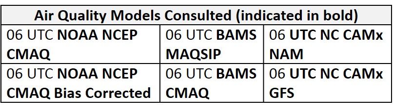
Day 1 (Wednesday): A low pressure system and its associated front will result in unsettled conditions across most of the Mid-Atlantic on Wednesday. A weak, dissipating warm front lifting northward through the CMA and NMA will promote scattered showers in the morning and early afternoon before a cold front approaching from the west brings more widespread thunderstorms to the region. The convection-allowing models are not in agreement with the eastward push of convection as the NAM-3km and HRW-NMMB only push thunderstorms as far east as central PA by 21Z-00Z Thursday. Mostly cloudy skies will persist in the NMA and CMA but southerly warm air advection will allow temperatures to reach above average values in locations along and south of the Mason-Dixon Line. In the SMA, weak surface high pressure will promote mostly sunny skies and onshore transport aloft. The air quality models are in agreement with a mix of Moderate and Good ozone across the region. The models highlight a stretch of Moderate ozone in southwestern PA, reaching southwestward along the Ohio River and a second stretch of Moderate ozone in west central NC. Breezy surface winds, mostly cloudy skies and widespread precipitation across the NMA and CMA and onshore flow in the SMA will result in a Slight risk of an ozone exceedance on Wednesday.
Day 2 (Thursday): Thursday will be dry and noticeably less humid for most of the Mid-Atlantic as a fresh air mass filters in behind Wednesday’s cold front. High pressure moving into the Ohio River Valley will push the cold front southward into the CMA/SMA. Sunny skies, near average temperatures and breezy northwesterly winds, will result in a pleasant day across the NMA and CMA. A surplus of moisture ahead of the lingering frontal boundary will promote scattered showers and thunderstorms across parts of the SMA in the afternoon. Periods of sun and clouds will allow slightly above average temperatures. The air quality models develop widespread Moderate ozone across the SMA, possibly due to the lingering frontal boundary, weaker back trajectories from the northwest (sourced from the Midwest) and periods of sunshine. The NC models seem to place the front along central VA, as it develops widespread Moderate ozone to the south. All of the air quality models are in agreement with widespread Good ozone to the north of the front, as back trajectories are swift and from the northwest, reaching well into south central Canada. Despite the possibility of precipitation, convergence along a lingering frontal boundary, slightly above average temperatures and weaker northwesterly transport in the SMA will bring the risk of an exceedance to Marginal.
Day 3 (Friday): Friday will be a dry and pleasant day across the entire Mid-Atlantic region as high pressure moves into the NMA. Although weaker than Thursday, northwesterly back trajectories in the NMA and CMA will continue to usher a relatively dry and seasonably warm air mass into the region. Temperatures will remain near average values under mostly sunny skies across the region. In the NMA, persistent northwesterly flow and light/breezy surface winds result in Good range ozone in the air quality models. Slow, recirculating transport of pollutants in the SMA is most likely the driver for the development of mid-to-upper Moderate ozone in the SMA. Again, the Piedmont region of NC is the highlight with the highest concentrations in the models. How much the SMA air mass modifies on Thursday will have a large impact on the air quality forecast for Friday. The risk of an ozone exceedance will remain Marginal for now and will be focused on the SMA.
Day 4-5 (Saturday-Sunday): Uncertainty enters the forecast on Saturday, as disagreements between the models will impact cloud cover and precipitation. The ECMWF brings an MCS-like feature southward into the NMA Saturday afternoon, resulting in mostly cloudy skies, below average temperatures and thunderstorms across the NMA. The drier GFS keeps surface high pressure over the NMA/CMA promoting sunny skies, near average temperatures and weakening surface winds. In the SMA, both the GFS and ECMWF solutions are similar with slightly above average temperatures under mostly sunny skies. The GFS, though less convectively active than the ECMWF still has fast transport of clean air from James Bay into the mid-Atlantic well into Saturday. Although clear skies and subsidence will increase ozone concentrations, the air mass will likely not be sufficiently modified to support USG ozone levels. By Sunday, however, back trajectories show recirculation followed by western transport, both conducive to high ozone concentrations. In addition, warm air advection will allow temperatures across the region to reach above average values in an increasingly humid air mass. Weak westerly transport and surface winds will keep ozone concentration elevated, however, lower Sunday emissions will act as a limiting force. As the beginning of next week will likely feature areas of USG ozone, and the onset of high ozone is often difficult to pinpoint in time, prudence suggests we raise the forecast to Appreciable for Sunday.
-Enlow/Ryan