

Medium Range Air Quality Outlook
Mid-Atlantic Region
Issued: Wednesday, June 6, 2018
Valid: June 7-11 (Thursday-Monday)
![]()

Summary
Influence from high pressure will result in three days of elevated risk for an ozone exceedance Thursday through Saturday. High pressure at mid-levels over the Southeast US on Thursday, will keep the Mid-Atlantic dry with mostly sunny skies throughout the day allowing temperatures to rebound to near average values. The risk of an ozone exceedance will rise to Appreciable due to increasingly favorable conditions for ozone formation. The risk will be focused on locations along the I-95 Corridor from BAL to TTN and locations in west-central NC. Friday is the most likely day for an ozone exceedance as persistence adds to favorable ozone weather conditions. A weak cold front will seemingly stall along the NY/PA border promoting increasing cloud cover and the possibility of thunderstorms across the NMA in the afternoon. If and when these thunderstorms develop in the NMA is the primary forecast question. Localized back trajectories, above average temperatures and light southwesterly surface winds will result in a High risk for an ozone exceedance. The risk is focused again along the I-95 Corridor from BAL to TTN and along the western edge of the NMA and CMA. Unsettled conditions will return to the Mid-Atlantic on Saturday as a cold front pushes southward into the NMA. Uncertainty in the coverage of thunderstorms across the CMA will bring the risk of an ozone exceedance to Appreciable. The risk of an ozone exceedance returns to Slight for Sunday and Monday as unsettled conditions appear likely. Differences in the weather models produce uncertainty in the forecast but conditions do not appear favorable for ozone formation.
NWP Model Discussion

The weather models have come into closer agreement with the key synoptic scale features throughout the medium range period. An upper level trough centered along the Atlantic coast will pull eastward today, weakening its influence over the Mid-Atlantic by 12Z Thursday. The departure of this trough will allow a broad ridge over the central US to nudge into the eastern half of the US by 00Z Friday. At mid-levels, the central US ridge will be centered over the Mississippi River Valley, extending northwestward into the southern Canadian Prairies at 12Z Thursday. The departure of the upper level trough will also allow mid-level ridging to move eastward, combining with the westward edge of the Bermuda High, and enveloping the entire Southeast US, Ohio River Valley and the Mississippi River Valley by 06Z Friday. As this occurs, shortwave perturbations will crest the ridge across the High Plains on Thursday and Friday. The GFS and ECMWF solutions are similar to the placement and progression of these perturbations, moving them into the Upper Midwest/Great Lakes region by 00Z Saturday. The GFS solution is slightly stronger with this feature, resulting in some variability in the mid and lower levels over the weekend. The weaker ECMWF brings the weaker shortwave energy over the NMA by 00Z Sunday, resulting in weak troughing over the Northeastern US. The stronger GFS, reinforces this weak trough on Saturday, resulting in a slightly stronger positively tilted longwave trough, centered along the western edge of the NMA by 06Z Sunday.
These differences will impact our forecasts as the stronger GFS would develop a wave of low pressure along a frontal boundary draped across the Great Lakes, splitting the mid-level ridge across the Mid-Atlantic with a mid-level trough. The weaker ECMWF solution does not develop a wave of low pressure along the frontal boundary, allowing the mid-level ridge split into two areas of broad high pressure, with the first over southern ON/Great Lakes and the second broadly over the Southeast US. The differences begin to amplify in the finer details throughout Sunday and Monday, as the GFS pushes a cold front deep into the Southeast by 18Z Monday where the ECMWF drapes the front across the NMA/CMA. In terms of air quality, the ECMWF solution is more conducive to ozone formation in the mid-Atlantic.
There are two additional areas of transported pollutants that are of note. A plume of Saharan dust is making its way westward across the Atlantic. The extent of the plume is easily visible using GOES-16 True-Color band and reaches as far west as the eastern Caribbean. The other location of transported pollutants is located over the Northwestern US and is of “unknown source” according to the NOAA Hazard Mapping System. This plume of moderate remnant smoke currently stretches from off the west coast of CA, riding the crest of the central US ridge, reaching the Upper Great Plains and southern Canadian Prairies. This plume of “unknown” sourced smoke will be something to keep an eye on, as the differences between the ECMWF and GFS over the weekend will impact the transport of these pollutants.
The Dailies
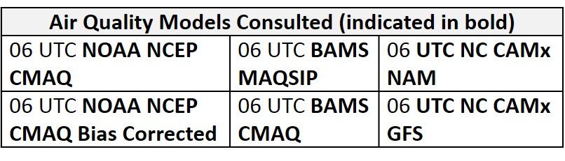
Day 1 (Thursday): Thursday will begin a period of increased risk for an ozone exceedance. High pressure at mid-levels over the Southeast US will keep the Mid-Atlantic dry on Thursday. A relatively dry air mass over much of the NMA and CMA will promote mostly sunny skies throughout the day allowing temperatures to rebound to near average values. Influence from high pressure will result in light/calm surface winds and localized back trajectories throughout the region. The return of ozone-favorable conditions across the region is evident in the air quality models. The BAMS models develop Moderate ozone along the I-95 Corridor from BAL to TTN in response to weak surface winds and the possibility of a sea/bay breeze front advancing inland. The BAMS models also develop areas of Moderate ozone in the SMA where near average temperatures and mostly sunny skies are expected but onshore surface winds should limit ozone production in the eastern half of the state. The NC model continues to be aggressive as it follows the same pattern as the BAMS models, but with larger magnitude. The NC models develop pockets of USG ozone along I-95, and the western edge of the Mid-Atlantic. The risk of an ozone exceedance will rise to Appreciable due to increasingly favorable conditions for ozone formation. The risk will be focused on locations along the I-95 Corridor from BAL to TTN and locations in west-central NC.
Day 2 (Friday): Friday is the most likely day for an ozone exceedance as persistence adds to favorable ozone weather conditions. High pressure building over the SMA will promote warm air advection at mid-levels, pushing temperatures to above average values for most of the region. A weak cold front will seemingly stall along the NY/PA border promoting increasing cloud cover over the NMA in the afternoon. The convection-allowing models, as well as the parameterized operational models, keep most of the precipitation north of I-80 until after 00Z. The rest of the Mid-Atlantic will remain dry with mostly sunny skies. The NAM suite of models, however, bring some scattered thunderstorms into the NMA in the afternoon. This remains a possibility but the drier solution seems the most likely at this time. The air quality models are responding to another day of ozone conducive conditions with regional ozone increases. The BAMS models are again more conservative with widespread Moderate ozone across the region and a single area of USG ozone near BAL. The NC models continue to increase regional ozone with more scattered USG ozone along the I-95 Corridor, western PA and along the western edge of the SMA/CMA. The NC-GFS versions and the NC-NAM3 develop isolated areas of Unhealthy ozone in southwestern WV and in western PA. Localized back trajectories, above average temperatures and light southwesterly surface winds will result in a High risk for an ozone exceedance. The risk is focused again along the I-95 Corridor from BAL to TTN and along the western areas of the NMA and CMA. Additionally, the return of a humid air mass and conditions conducive for poor air quality will allow regional particle concentrations to increase. The BAMS-CMAQ develops upper Moderate particles across Central PA. The NC-GFS3 and NC-NAM3 models also develop areas of upper Moderate particles but are more focused across southeastern PA.
Day 3 (Saturday): Unsettled conditions will return to the Mid-Atlantic on Saturday as a cold front pushes southward into the NMA. There is uncertainty with the southward push of this front as the GFS and ECMWF handle the associated upper and mid-level features differently. Nevertheless, above average temperatures and a moist air mass ahead of the front will trigger thunderstorms throughout most of the NMA and CMA in the afternoon. Uncertainty in the coverage of these thunderstorms across the CMA will keep the risk of an exceedance elevated. In the SMA, high pressure building overhead will promote mostly sunny skies and above average temperatures, but weak onshore flow aloft and surface winds from the southeast should be enough to take the edge off ozone and particles. The air quality models seem to keep precipitation more northward as they maintain regional ozone and particle concentrations in the NMA and CMA. The BAMS models keep upper Moderate ozone along the I-95 Corridor and across central PA. The BAMS models are also responding to the shift in flow across the eastern SMA as they drop ozone back into the Good range. The NC-GFS2 and NC-GFS3 still keep widespread Moderate ozone across the NMA and CMA with scattered USG ozone across central PA and along I-95. The risk of an ozone exceedance will only decrease to Appreciable due to uncertainty in the occurrence of thunderstorms across the CMA.
Day 4-5 (Sunday-Monday): The slow moving cold front in the NMA will continue to push southward on Sunday, promoting widespread unsettled conditions across the CMA and SMA. A considerably drier air mass will filter into the NMA following the front, promoting mostly sunny skies. A shift to northerly flow aloft will limit temperatures to near average values. Mostly cloudy skies in the CMA and SMA are expected ahead of the front while showers and thunderstorms advance southward along the front. The risk of an ozone exceedance will finally return to Slight on Sunday. Disagreement between the models on Monday creates uncertainty in the forecast. As of now, conditions do not appear to be favorable for ozone formation as the recent frontal passage should usher in a fresh air mass. The risk of an ozone exceedance will remain Slight.
-Enlow/Ryan