Medium Range Air Quality Outlook
Mid-Atlantic Region
Issued: Tuesday, July 24, 2018
Valid: July 25-29 (Wednesday-Sunday)
![]()

Summary
One final day of widespread heavy rain on Wednesday will give way to more scattered precipitation for the rest of the period as weak upper level troughing lingers over the Mid-Atlantic. On Wednesday, the stalled upper level trough will finally begin to lift northeastward and a weak cold front will push into the western Mid-Atlantic from the west. A combination of widespread precipitation and continued onshore flow for most of the region will keep the risk of an ozone exceedance Slight. While the western half of the Mid-Atlantic may finally dry out on Thursday, Wednesday’s weak cold front will likely promote widespread precipitation throughout the eastern half of the region. Even though mostly sunny skies, weaker southwesterly transport, and light surface winds could be favorable for gradually increasing ozone, the air mass should be very clean given several days of heavy rain. As a result, the risk of an ozone exceedance will remain Slight, with the best chance for Moderate ozone in the western part of the region. Another weak cold front will push into the Mid-Atlantic on Friday, potentially promoting widespread unsettled conditions throughout the NMA and CMA. There is uncertainty in how far east clouds and precipitation will push, with the potential for periods of afternoon sun along the I-95 corridor. In addition, the western SMA will see light westerly flow, mostly sunny skies and slightly above average temperatures. Given uncertainty in the precipitation forecast along the I-95 Corridor and the possibility for ozone conducive conditions throughout the western SMA, the risk of an ozone exceedance will rise to Marginal. Although surface high pressure will build eastward into the region following Friday’s weak cold front, broad upper level troughing overhead on Saturday will keep unsettled conditions possible throughout most of the Mid-Atlantic. Although the bulk of precipitation will be confined to the SMA, a few scattered showers across the NMA and CMA cannot be ruled out. But in general, mostly sunny skies, westerly flow, light surface winds and near average temperatures along the I-95 Corridor from DC to NYC will result in a Marginal risk of an ozone exceedance. On Sunday, the Mid-Atlantic will be sandwiched between the Bermuda high building westward into the Southeast U.S. and broad troughing across the northern half of the CONUS. There is a considerable amount of uncertainty in the forecast as the weather models diverge on bringing Friday’s frontal back northward as a warm front. Given the uncertainty in the forecast, the risk of an exceedance will remain Marginal on Sunday.
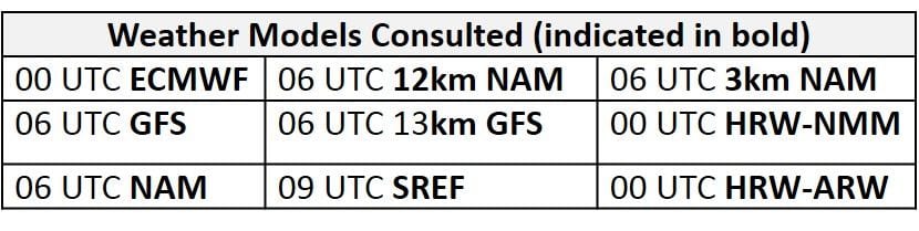
NWP Model Discussion


The weather models remain in fairly close agreement with synoptic scale features throughout the medium range period until Sunday when the GFS and EC diverge at mid-levels. The upper level trough currently stalled over the eastern U.S. will continue to weaken and slowly contract northward on Wednesday and Thursday, with the base of the trough pulling northward into the SMA by 12Z Thursday. By this time, the next upper level disturbance in the northern stream flow will be approaching the Mid-Atlantic from the northwest: an upper level closed low will slowly move eastward over ON, getting reinforced by a strong shortwave dropping down across the Canadian Prairies. This closed low will begin to eke out a new longwave trough that will combine with the shrinking eastern U.S. trough to promote broad troughing over most of the eastern half of the U.S. by 00Z Friday. The ON closed low will continue to push eastward very slowly, moving over eastern ON by 12Z Friday and only reaching the ON/QC border by 12Z Saturday. This feature and the arrival of additional embedded shortwave energy across the upper Great Plains on Saturday will keep broad upper level troughing across the northern half of the U.S. through the end of the period. At the same time, the southwestern edge of the strong Bermuda ridge in the Atlantic will slowly build westward into the Gulf of Mexico and extreme Southeast U.S. throughout the weekend. The interaction between the Bermuda high and Northeastern U.S. through will play a major role in the forecast for Sunday. The GFS and EC diverge slightly at this point. Both models bring reinforcing shortwaves into the Midwest, but the GFS is about 24 hours faster, with the shortwaves arriving on Sunday, while the EC holds back their progression until Monday. This difference translates into a substantial variation at mid-levels for Sunday: the GFS brings Friday’s stalled frontal boundary back northward as a warm front, with a wave of low pressure bringing widespread precipitation to the Mid-Atlantic. In contrast, the EC keeps the front stalled across the eastern edge of the SMA, which keeps the SMA wet but the NMA and CMA dry.
The Dailies
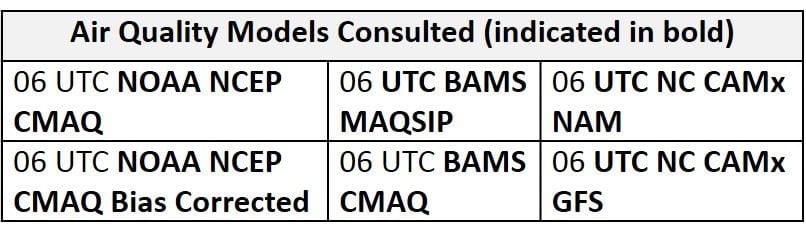
Day 1 (Wednesday): On Wednesday, the stalled upper level trough will finally begin to lift northeastward and a weak cold front will push into the western Mid-Atlantic from the west. As a result, Wednesday will be the last day of widespread heavy precipitation and strong southerly flow aloft. The cold front is expected to slowly edge into the western Mid-Atlantic Wednesday afternoon and push into the central Mid-Atlantic by 00Z Thursday. The arrival of this weak front will promote the heaviest precipitation across the eastern half of the NMA and CMA throughout the afternoon, and precipitation will slowly begin to clear from west to east following the front. A combination of widespread precipitation and continued onshore flow ahead of the front will keep ozone formation minimal. The air quality models respond to these conditions by developing widespread Good ozone throughout the eastern half of the region. The air quality models unreasonably develop pockets of Moderate (in some cases upper Moderate) ozone throughout the western half of the region. This elevated ozone is likely in response to light surface winds, a few periods of sun, and a shift to westerly flow following the front, but given a recent extended period of unsettled conditions throughout much of the eastern U.S., it seems unlikely that the air mass will modify quickly enough to allow ozone to reach far, if at all, into the Moderate range. As a result, there will be a Slight risk of an ozone exceedance on Wednesday.
Day 2 (Thursday): While most of the western half of the Mid-Atlantic may finally dry out on Thursday, the weak cold front will likely promote widespread precipitation throughout the eastern half of the region. The cold front will push through the eastern half of the region in the morning and afternoon, promoting locally heavy precipitation along and east of I-95 throughout the entire region. Although a few isolated showers are possible west of I-95, mostly sunny skies, weaker southwesterly transport, and light surface winds could be favorable for gradually increasing ozone. The primary forecast questions for Thursday will be how far east the weak front is able to push, the coverage of lingering cloud cover and precipitation across the western Mid-Atlantic, and how quickly the air mass is able to modify across the western Mid-Atlantic under ozone conducive conditions. Similar to yesterday’s model runs, the air quality models continue to quickly increase ozone throughout the region despite unsettled conditions across the eastern Mid-Atlantic, as they develop a few pockets of upper Moderate/USG ozone along the I-95 corridor. The models are possibly responding to converging surface winds along the front as it slowly pushes through the area. Throughout the rest of the Mid-Atlantic, the air quality models develop a mix of Moderate and upper Good ozone in response to light surface winds and periods of sunshine. At this time, any quick rise in ozone on Thursday seems unlikely, given the probably very clean air mass in place after days of heavy rain. As a result, the risk of an ozone exceedance will remain Slight, with the best chance for Moderate ozone in the western part of the region.
Day 3 (Friday): Another weak cold front will push into the Mid-Atlantic on Friday, potentially promoting widespread unsettled conditions throughout the NMA and CMA. The consensus between model guidance suggests that the weak cold front will enter the western Mid-Atlantic from the northwest in the late morning and slowly progress eastward into the central NMA and western CMA by 00Z Saturday. Precipitation appears likely throughout most of the western NMA and CMA with more scattered showers and thunderstorms across the eastern NMA and CMA. While this newly arrived cold front promotes unsettled conditions throughout the NMA and CMA, what remains of Wednesday’s cold front will be draped across the eastern SMA, resulting in mostly cloudy skies and precipitation along the coast. With a shift to westerly flow aloft and light southwesterly surface winds throughout most of the region, the primary forecast question will be the coverage of precipitation and associated cloud cover throughout the NMA and CMA, especially along the I-95 corridor. The air quality models continue to highlight the I-95 Corridor with elevated ozone as they develop a few strips of USG ozone, possibly in response to converging winds under periods of afternoon sunshine. The air quality models also highlight western NC with upper Moderate/USG ozone; light westerly flow, mostly sunny skies and slightly above average temperatures could be favorable for ozone formation. The air quality models place the rest of the region under widespread Moderate ozone despite the presence of clouds and precipitation likely throughout the NMA and CMA. Given uncertainty in the precipitation forecast along the I-95 Corridor and the possibility for ozone conducive conditions throughout the western SMA, the risk of an ozone exceedance will rise to Marginal.
Day 4-5 (Saturday-Sunday): Although surface high pressure will build eastward into the region following Friday’s weak cold front, broad upper level troughing overhead on Saturday will keep unsettled conditions possible throughout most of the Mid-Atlantic. The bulk of precipitation will be confined to the SMA as Friday’s cold front stalls across NC but shortwave energy passing over the NMA and CMA could promote a few scattered showers throughout the afternoon. Nearby surface high pressure will promote mostly sunny skies, westerly flow and light surface winds across the NMA and CMA. The primary forecast questions will be the coverage of afternoon precipitation/cloud cover across the NMA/CMA and regional air mass characteristics. The air quality models develop widespread Good range ozone across most of the region, especially north/west of I-95, due to presumably clean northwesterly flow but highlight the SMA and eastern NMA/CMA (along/south/east of I-95) with widespread Moderate and isolated USG ozone. Given unsettled conditions anticipated throughout the SMA, Moderate ozone is unlikely; the models may be responding to convergence along the front and light southwesterly flow aloft. Elevated ozone along the eastern NMA/CMA in the air quality models is likely in response to mostly sunny skies, light surface winds, westerly flow aloft, and the development of sea/bay breezes in the afternoon. For now, the risk of an ozone exceedance will remain Marginal with a focus on locations along the I-95 Corridor from DC to NYC.
There is a considerable amount of uncertainty in the forecast for Sunday as the weather models diverge. The Mid-Atlantic will be sandwiched between the Bermuda high building westward into the Southeast U.S. and broad troughing across the northern half of the CONUS. While southerly flow running over a frontal boundary across the SMA will promote unsettled conditions, it remains unclear if the boundary will begin to lift northward on Sunday (GFS solution), and if so, how far. The more progressive GFS brings precipitation as far north as southern PA while the ECMWF keeps the NMA and CMA dry. If conditions remain dry throughout the NMA and CMA, westerly flow, mostly sunny skies, light surface winds and near/slightly below average temperatures could be favorable for some ozone formation. If a solution closer to the GFS verifies, mostly cloudy skies, scattered showers and sustained southeasterly afternoon surface winds will keep ozone formation minimal. Given uncertainty in the forecast, the risk of an ozone exceedance will remain Marginal with a focus on locations across the NMA and CMA.
-Enlow/Huff