

Medium Range Air Quality Outlook
Mid-Atlantic Region
Issued: Tuesday, July 10, 2018
Valid: July 11-15 (Wednesday-Sunday)
![]()

Summary
The air quality forecast for the Mid-Atlantic has quickly taken a turn for the worse, as a large plume of thick smoke over Canada will combine with mostly sunny skies and near-to-above average temperatures to keep an Appreciable risk of an ozone exceedance through Friday. Uncertainty regarding the smoke transport is the only reason for dropping the risk to Appreciable – otherwise, conditions seem likely for a High risk of an exceedance through the end of the work week. Currently, a large plume of high density smoke can be seen in visible and true color satellite imagery stretching across SK, MB, and ON. The smoke encompasses the Lake Huron area, which is the source region for Wednesday’s back trajectories. It is extremely likely that this smoke will be transported into the NMA and CMA on Wednesday, behind today’s weak cold frontal passage, and given the high pressure moving into the region, the smoke will likely mix to the surface. The presence of this smoke will negate most limiting factors typically associated with a post-frontal air mass throughout the NMA and CMA. The SMA is at risk as well, with northwesterly transport aloft (sourced from the Ohio River Valley), with mostly sunny skies, light surface winds, and the presence of the slow moving frontal boundary. In addition, the air mass currently over the NMA and CMA, which will be pushed southward by the front, is extremely modified, with widespread ozone exceedances likely today. The smoke is expected to linger in the region on Thursday, despite a shift to northeasterly flow aloft. Due to the forecast flow pattern over Canada through the next few days and the large spatial extent of smoke across Canada and the northern CONUS, it appears that smoke will remain a factor given any sort of a northerly component to mid-level flow. Surface high pressure over the NMA on Friday morning will sink southward in the afternoon, keeping skies sunny and surface winds light, along with lingering smoke. Localized back trajectories and surface winds shifting to southwesterly in the afternoon will be favorable for ozone formation across the NMA and CMA. In the SMA, an onshore component to mid-level flow could have a large effect on the air quality forecast but the impact of this feature will be a primary forecast question for Friday. The best chances for an ozone exceedance on Friday will be focused on locations along the entire I-95 Corridor throughout the NMA and CMA as well as western PA (PIT). Uncomfortable conditions will return to most of the Mid-Atlantic on Saturday as a plume of moisture will precede shortwaves aloft and an associated surface trough moving into the NMA from the north. There is uncertainty regarding the timing of this feature and coverage of associated precipitation across the NMA and possibly the CMA. Given uncertainties in the forecast in the northern half of the region and the potential for onshore flow in the southern half of the region, the risk of an ozone exceedance will drop to Marginal. Persistent humid conditions and increased warmth on Sunday will extend the chances for scattered showers across the region throughout the day. There is a great deal of uncertainty in the specifics for Sunday’s forecast given a mix of conditions possible throughout the region, keeping a Marginal risk of an ozone exceedance in place.
NWP Model Discussion
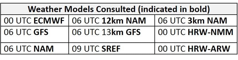
The weather models remain in strong agreement with synoptic scale features throughout the medium range period. An upper level trough moving over the Northeast U.S. will linger overhead through 12Z Wednesday. A shortwave disturbance will crest the western upper-level ridge and drop across the Great Lakes and into the NMA, reinforcing the trough axis over the Mid-Atlantic by 06Z Thursday. This upper level trough will slowly push eastward with its axis over the Atlantic coast by 18Z Thursday, allowing the center of the western upper level ridge to build westward over the Mississippi River Valley on Thursday and Friday. The associated mid-level ridge will edge into the Mid-Atlantic as this happens, remaining over the Mid-Atlantic through the end of the medium range period. The eastern upper level trough will try to close off, lingering off of the Atlantic coast of NC/VA through the end of the medium range period. By 00Z Saturday, another upper level, centered over Hudson Bay, trough moving in the northern stream flow will gradually depress the upper level ridge out of the Great Lakes and NMA, placing weak upper level troughing over the Northeast U.S. Both the GFS and ECMWF are now in agreement that a shortwave trough will develop across the Midwest on Saturday as it crests the top of the ridge, moving into the NMA by 12Z Sunday. This shortwave trough will accompany the lingering upper level trough, potentially lessening the impacts of the nearby upper level ridge and a persistent mid-level ridge over the eastern U.S.
The Dailies
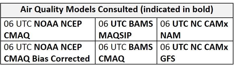
Day 1 (Wednesday): Wednesday is a day of concern due to the likely transport smoke from wildfires across Canada and the Western U.S. Currently, a large plume of high density smoke can be seen in visible and true color satellite imagery stretching across SK, MB, and ON. The smoke encompasses the Lake Huron area, which is the source region for Wednesday’s back trajectories. It is extremely likely that this smoke will be transported into the NMA and CMA on Wednesday, and given the high pressure moving into the region, the smoke will likely mix to the surface. The NAAPS model, similar to yesterday, shows the smoke plume moving into the Mid-Atlantic on Wednesday. The presence of this smoke will negate most limiting factors typically related with a post-frontal air mass throughout the NMA and CMA. Surface high pressure building eastward, centered over southern ON and MI, will result in mostly sunny skies and sustained northerly surface winds. The weak front will linger in the SMA on Wednesday, providing the possibility for a few scattered showers throughout the afternoon hours, but the precipitation may not be heavy enough to impact the regional air mass characteristics. Even if there were no threat for transport of smoke in the SMA, conditions appear favorable for ozone formation as flow aloft is from the northwest (sourced from the Ohio River Valley), with mostly sunny skies, light surface winds, and the presence of a slow moving frontal boundary. In addition, the air mass currently over the NMA and CMA, which will be pushed southward by the front, is extremely modified, with widespread ozone exceedances likely today. The air quality models, similar to yesterday’s runs, pick up on these conditions throughout the SMA with widespread Moderate ozone in the BAMS models and a few patches of USG in the NC models. Across the NMA and CMA, the air quality models respond to a post frontal air mass by lowering regional ozone into the Good range with a few patches of Moderate. Given that the models don’t account for the effect of smoke transported from outside the CONUS, they are probably not very reliable for Wednesday. The air quality forecast across the Mid-Atlantic will heavily depend on the density of smoke brought into the region and how localized mesoscale features enhance or limit the smoke’s influence on air quality. Given this uncertainty, the risk for an ozone exceedance will be Appreciable on Wednesday, with exceedances possible throughout the Mid-Atlantic.
Day 2 (Thursday): Thursday remains a day of interest due to the potential lingering effects of smoke. The NAAPS model keeps the smoke over the Mid-Atlantic through Friday. Despite the upper level trough overhead, surface and mid-level high pressure building into the Mid-Atlantic will keep an increased risk for an ozone exceedance on Thursday. A shift to northerly/northeasterly flow aloft will result in cold air advection at mid-levels, knocking temperatures across the NMA to near average values. Given this eastward shift in transport, a primary forecast question for Thursday will be if there is any lingering influence from transport smoke. Given the forecast flow pattern over Canada through the next few days and the large spatial extent of smoke across Canada and the northern CONUS, it appears that smoke will remain a factor given any sort of a northerly component to mid-level flow. Surface high pressure moving through west/central PA will promote mostly sunny skies and weakening surface winds throughout the northern half of the Mid-Atlantic. Unsettled conditions remain possible in the across the southern SMA on Thursday as the slow moving frontal boundary encounters a plume of moisture. Partly cloudy skies and near average temperatures are anticipated throughout the rest of the SMA. Once again, the air quality models are hinting at the possibility for unsettled conditions in the SMA as they develop a few small pockets of Good air quality along the NC/SC border. Given the influence of overhead high pressure, the air quality models gradually increase regional ozone compared to Wednesday, with a mix of Good and Moderate ozone throughout the rest of the region. The BAMS and NC models are in agreement that the I-95 Corridor will likely have the highest ozone levels as they develop a strip of Moderate ozone along the interstate throughout the CMA and into New England. Similar to Wednesday’s forecast, the air quality models will only be able to serve as a guide to where conditions may enhance the impact of a smoky air mass. Increasing influence from high pressure and the likely presence of a smoky air mass will keep an Appreciable risk of an ozone exceedance with a focus on locations across the NMA and CMA. Locations along the I-95 Corridor will likely experience the highest ozone levels.
Day 3 (Friday): Friday is also a day to watch, given the likely lingering effects of smoke, in conjunction with ozone-favorable weather conditions. Surface high pressure over the NMA in the morning will sink southward in the afternoon, keeping skies sunny and surface winds light. Although there may be a few high level clouds, coverage will likely be too thin and too high to have a profound impact on air quality, given stagnant surface conditions overnight and through the morning hours. Localized back trajectories, and surface winds shifting to southwesterly in the afternoon will be favorable for ozone formation across the NMA and CMA. In the SMA, an onshore component to mid-level flow could have a large impact on the air quality forecast but the impact of this feature will be a primary forecast question for Friday. The air quality models are not in agreement with this impact across the SMA as the BAMS models clean out most of the SMA with Good air quality while the NC-GFS2 keep regional ozone in the Moderate range with a few pockets of USG ozone throughout VA and NC. The air quality models are in closer agreement across the NMA and CMA as they continue to gradually increase regional ozone with widespread upper Moderate ozone and scattered USG ozone across the region. The Appreciable risk of an ozone exceedance will be focused on locations along the entire I-95 Corridor throughout the NMA and CMA as well as western PA (PIT).
Day 4-5 (Saturday-Sunday): Uncomfortable conditions will return to most of the Mid-Atlantic on Saturday as a plume of moisture will precede shortwaves aloft and an associated surface trough moving into the NMA from the north. There is uncertainty regarding the timing of this feature and coverage of associated precipitation across the NMA and possibly the CMA. Given increasing moisture ahead of the boundary, cloud cover and precipitation could be widespread enough to impact air quality for most of the NMA. The trough is currently modeled to push into the central NMA by 00Z Sunday, with showers and cloud cover remaining to the west of I-95 and north of I-76. If this solution verifies, southwesterly surface winds and near average temperatures could be favorable for ozone formation for locations in the NMA that are not affected by precipitation. Onshore flow could clean out locations across the CMA and SMA as overnight and morning back trajectories shift weakly onshore. This is evident in the BAMS air quality models as they drop ozone across the SMA into the Good range. The NC-GFS2 keeps regional ozone in the upper Moderate range with scattered USG ozone in west-central NC. In the NMA and CMA, the air quality models keep regional ozone in the upper Moderate to low USG range despite the arrival of the trough. The NC model highlights the southern push of the trough as it blankets locations along and south of I-76 under USG ozone. Given uncertainties in the forecast, the risk of an ozone exceedance will drop to Marginal with exceedances possible throughout the region, especially along I-76 and the I-95 Corridor.
Persistent humid conditions and increased warmth on Sunday will extend the chances for scattered showers across the region throughout the day. There is a great deal of uncertainty in the specifics for Sunday’s forecast given a mix of conditions possible throughout the region. Onshore flow and cloud cover across the SMA and scattered showers possible across most of the Mid-Atlantic could take the edge off ozone, resulting in a Marginal risk of an ozone exceedance.
-Enlow/Huff