

Medium Range Air Quality Outlook
Mid-Atlantic Region
Issued: Wednesday, July 25, 2018
Valid: July 26-30 (Thursday-Monday)
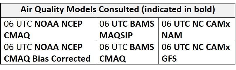
![]()

Summary
Unsettled conditions will keep a Slight risk of an ozone exceedance throughout the latter half of the medium range period but a lull in precipitation and cloud cover warrant a Marginal risk Thursday through Saturday. Although most of the region will dry out on Thursday, Wednesday’s cold front will stall in in the vicinity of the I-95 Corridor, keeping unsettled conditions across the eastern portion of the region. While scattered showers and partly cloudy skies blanket the east coast, mostly sunny skies and light westerly surface winds could be favorable for ozone formation in the west. In addition to these conditions, the latest satellite imagery reveals a large plume of moderate to high density smoke spread north/south across the Great Lakes region, originating from wildfires burning in ON. This plume seems to be mixing to the ground across the affected region, with mid-Moderate PM2.5 observations in IN, KY and western TN this morning. The possible transport of this remnant smoke may be an issue through the weekend, and should be monitored closely. On Thursday, ozone-conducive weather in the west, in conjunction with possible smoke transport, will result in a Marginal risk of an ozone exceedance. Another weak cold front will push into the region on Friday, keeping unsettled conditions likely throughout most of the region. Despite the opportunity for scattered showers, light westerly flow, mostly sunny skies for most of the day, slightly above average temperatures, and possible continued smoke transport could be favorable for ozone formation along eastern portions of the CMA and NMA. The risk of an ozone exceedance will remain Marginal on Friday. Although surface high pressure will build eastward into the region following Friday’s weak cold front, broad upper level troughing overhead on Saturday will keep scattered unsettled conditions possible throughout parts of the Mid-Atlantic. Mostly sunny skies, near average temperatures and light westerly flow, in addition to possible remnant ON wildfire smoke transport from the west could be favorable for ozone formation across locations that remain dry. Given these conditions and uncertainty in the precipitation forecast, the risk of an ozone exceedance will remain Marginal with a focus on locations along the I-95 Corridor. Model guidance continues to disagree on Sunday with the development of a low pressure system in the Midwest and associated warm front across the Mid-Atlantic. Despite this uncertainty, surface winds will shift south/southeasterly throughout the afternoon, possibly keeping ozone in check. The risk of an ozone exceedance will drop to Slight given these conditions in conjunction with lower Sunday emissions. Although there is uncertainty in the progression of the warm front on Monday, unsettled conditions appear likely throughout the Mid-Atlantic. Widespread precipitation and cloud cover will combine with strong southerly flow to keep ozone formation minimal. The risk of an ozone exceedance will remain Slight on Monday.
NWP Model Discussion

The weather models are generally in consensus with synoptic scale features until the end of the medium range period where they continue to diverge with the strength of an upper level trough over the Midwest and associated warm front in the Mid-Atlantic. Although the upper level trough currently over the eastern U.S. will be contracting to the northeast on Thursday, the arrival of a new longwave trough/closed low over southern ON will replace the departing eastern U.S. trough and keep upper level troughing over the Mid-Atlantic through the medium range period. This new Canadian upper level trough/closed low will push eastward extremely slowly, only reaching the ON/QC border by 12Z Saturday. As this upper level trough slowly progresses across southeastern Canada, additional shortwave perturbations will drop southward across the upper Great Plains, reinforcing broad upper level troughing across much of the northern half of the CONUS by 12Z Sunday. The weather models continue to diverge with the strength and development of this reinforced longwave trough over the interior U.S. through the latter half of the weekend and into early next week. The GFS develops stronger embedded shortwaves over the Midwest on Sunday, resulting in a more pronounced longwave trough, with its axis along the Midwest by 12Z Monday. The ECMWF, in contrast, continues to be less aggressive with this feature, although it still develops a longwave trough in the same location as the GFS by 12Z Monday. The differences in the strength of the trough translate primarily into the fate of Friday’s stalled front across the SMA. The GFS brings this boundary northward as a warm front on Sunday, with associated widespread precipitation across the Mid-Atlantic. The EC, continuing its trend from yesterday, holds the front across the SMA on Sunday, not bringing it northward until Monday, and thus keeping the NMA and CMA dry on Sunday. The models seem to catch up with each other, in general, on Monday, with another round of strong southerly onshore flow setting up, as the new upper level trough abuts the persistent Bermuda ridge in the Atlantic.
The Dailies
Day 1 (Thursday): Although most of the region will dry out on Thursday, Wednesday’s cold front will stall in in the vicinity of the I-95 Corridor, keeping unsettled conditions across the eastern portion of the region. While scattered showers and partly cloudy skies blanket the east coast, mostly sunny skies and light westerly surface winds could be favorable for ozone formation in the west. In addition to these conditions, the latest satellite imagery reveals a large plume of moderate to high density smoke spread across the Great Lakes region, originating from wildfires burning throughout ON. This plume seems to be mixing to the ground across the affected region, with mid-Moderate PM2.5 observations in IN, KY and western TN this morning. The primary forecast questions for Thursday will be how far east the weak front (and associated precipitation) is able to push, the coverage of lingering cloud cover and precipitation across the western Mid-Atlantic, and the impacts of Canadian wildfire smoke transport. The air quality models respond to these conditions by developing widespread Moderate ozone throughout much of the region, with a strip of upper Moderate/USG ozone around the Chesapeake Bay. Although upper Moderate to USG ozone seems unlikely, given a presumably very clean air mass to start the day, along with morning southerly back trajectories and lack of continuous full afternoon sunshine, this feature in the air quality models is likely in response to the stalling front and associated converging surface winds. So for now, we continue to discount this feature in the air quality models. As a result, the risk of an ozone exceedance will be Marginal, with the best chance for Moderate ozone in the western part of the region.
Day 2 (Friday): Another weak cold front will push into the region from the west on Friday, keeping unsettled conditions likely throughout most of the region. The front is forecast to enter the northwestern Mid-Atlantic in the morning hours and slowly push eastward, roughly reaching the I-81 Corridor by 00Z Saturday. Precipitation appears likely throughout most of the western NMA and CMA with more scattered showers and thunderstorms across the eastern NMA and CMA. While this newly arrived cold front promotes unsettled conditions throughout the NMA and CMA, what remains of Wednesday’s cold front will be draped across the eastern SMA, resulting in mostly cloudy skies and precipitation along the coast. The air quality models continue to respond to the stalled frontal boundary along the I-95 Corridor as they develop a strip of USG ozone, while the rest of the region lies under Moderate and upper Good ozone. Despite the opportunity for scattered showers, light westerly flow, mostly sunny skies and slightly above average temperatures, and continued smoke transport could be favorable for ozone formation. The risk of an ozone exceedance will remain Marginal on Friday.
Day 3 (Saturday): Despite surface high pressure building eastward into the region following Friday’s weak cold front, broad upper level troughing overhead on Saturday will keep scattered unsettled conditions possible throughout parts of the Mid-Atlantic. The majority of precipitation appears to be confined to the SMA as Friday’s cold front lingers in the eastern SMA, but a few showers are possible across the NMA and CMA as shortwave perturbations move overhead throughout the afternoon. Mostly sunny skies, near average temperatures and light westerly flow, in addition to possible remnant ON wildfire smoke transport from the west could be favorable for ozone formation across locations that remain dry. The primary forecast questions will be the coverage of afternoon precipitation/cloud cover across the NMA/CMA and regional air mass characteristics. The air quality models keep the majority of the region under Good ozone despite continued westerly flow and mostly sunny skies. The air quality models highlight locations along the east coast (south/east of I-95) with elevated ozone, likely in response to the development of sea/bay breezes throughout the afternoon and evening. Given these conditions and uncertainty in the precipitation forecast, the risk of an ozone exceedance will remain Marginal with a focus on locations along the I-95 Corridor.
Day 4-5 (Sunday-Monday): Model guidance continues to disagree on Sunday with the development of a low pressure system in the Midwest and associated warm front across the Mid-Atlantic. With its stronger upper level trough, the GFS develops a low pressure system in the Midwest by 12Z Sunday that will slowly pull the stalled frontal boundary in the SMA northward as a warm front. The weaker ECMWF instead brings only a trough across the eastern U.S., allowing the stalled frontal boundary to remain in the SMA on Sunday. If a solution like the GFS verifies, widespread showers and thunderstorms are likely along and ahead of the lifting warm front. If a solution similar to the drier ECMWF verifies, conditions will likely remain dry throughout the NMA and CMA. At this time, the WPC is splitting the difference and going with a consensus forecast regarding the warm front. Regardless of the solution, surface winds will shift southerly throughout the afternoon, possibly keeping ozone in check. The air quality models respond with Moderate ozone along the stalled frontal boundary throughout the SMA, and widespread Good ozone elsewhere. The risk of an ozone exceedance will drop to Slight given these conditions in conjunction with lower Sunday emissions.
Although there is a great deal of uncertainty in the forecast for Monday, unsettled conditions appear likely throughout the Mid-Atlantic. The models seem to catch up with the progression of the warm front, with resulting widespread precipitation and cloud cover that will combine with strong southerly flow to keep ozone formation minimal. The risk of an ozone exceedance will remain Slight on Monday.
-Enlow/Huff