Author Archives: Gregory P. R. DeBoe

Mid-Atlantic Medium Range Air Quality Discussion, Issued Tuesday, July 21, 2015

Medium Range Air Quality Outlook
Mid-Atlantic Region

Issued: Tuesday, July 21, 2015
Valid: July 22 – 26, 2015 (Wednesday – Sunday)

MedRangeTable_20150722

MedRange_Cats_2

Summary:

Cleaner and drier air will filter into the mid-Atlantic in the wake of a cold front passing through the region today. This new air mass will limit ozone and PM2.5 to the Good range for most of the region on Wednesday. Persistent high pressure will be the rule for the region beginning Thursday. Light winds and clear skies will increase the chances for USG ozone to Marginal for the weekend. As of now, clean back trajectories from Canada should cap ozone production, limiting higher chances for USG ozone.

Discussion:

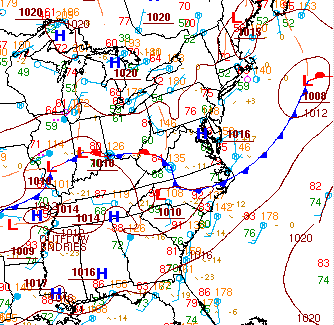
The weather models are in very good consensus throughout the medium range period. The 06Z NAM, 00Z GFS, and 00Z ECMWF were consulted for this analysis. A large trough currently over the ON/QC border will continue to slowly move eastward, reaching the Atlantic Ocean on Saturday. This trough will pull a cold front through the Mid-Atlantic today. The cold front will sweep from the northwest to the southeast, reaching SC by 12Z Wednesday. Behind this cold front, an upper level ridge will begin to build into the region. The ridge axis will move eastward from the Plains on Wednesday to the western periphery of the Appalachians on Saturday, maintaining its strength as moves. A weak back door front will reach MD on Friday and dissipate further south Saturday. Weak pressure gradients will be the rule over the mid-Atlantic after the front dissipates.

A cold front will pass through the Mid-Atlantic today, sweeping from northwest to southeast. Scattered convection Tuesday evening across the northern and central Mid-Atlantic (NMA, CMA) will help clean out the atmosphere ahead of the cold front. A drier, cleaner air mass will filter in behind the front on Wednesday. Surface high pressure will also build in behind the front leading to clear skies and steady NW winds across most of the region. The new air mass will limit ozone to the Good/Moderate range with PM2.5 concentrations, currently below 10 ug/m3 upwind behind the front, limited to the Good range.

Surface high pressure will dominate the weather on Thursday, leading to clear skies and slowly diminishing winds throughout much of the region. Scattered shortwaves moving overhead in the southern Mid-Atlantic (SMA) will promote clouds and convection in NC on Thursday, limiting ozone production. Throughout the rest of the region, clear skies and light winds will enhance ozone production, but peak concentrations will be limited to the Good/Moderate threshold for another day. The air quality models are showing upper Good ozone for much of the region, with a few locations in eastern VA seeing Moderate ozone. PM2.5 concentrations should be limited to the Good range on Thursday due to the continuing low humidity with the exception of a few locations in NC and the western Mid-Atlantic.

Clear and calm conditions over the region on Friday and Saturday, allowing ozone to reach into the Moderate range. The main uncertainty will be the possibility of slightly cleaner air behind the weak back door front Friday in the NMA. Emissions on Friday will be more spread out in the afternoon, allowing for a higher potential for late afternoon ozone production. The air quality models are responding by showing Moderate ozone just to the west of the coast on Friday and in DC and Baltimore on Saturday. Clean back trajectories from Canada should prevent ozone from reaching the USG range on both Friday and Saturday. PM2.5 will also reach into the low Moderate range on Friday and Saturday due to light winds. Back trajectories originating in Canada and continuing low humidity will help limit concentrations from rising beyond the mid to upper Moderate range.

Surface high pressure will continue on Sunday, allowing clear skies and light winds to continue for much of the region. Lower Sunday precursor emission will limit ozone to the Moderate range. Increasing humidity and the light winds will help keep PM2.5 concentrations in the Moderate range. The precipitation forecast for Sunday is still uncertain as the fate of the approaching frontal boundaries is to be determined. There will likely be scattered clouds and precipitation in the NMA.

-DeBoe/Ryan

Unexpectedly High Moderate Ozone in Delaware on June 26, 2015

Daily 8-hour average ozone unexpectedly reached the upper Moderate range in northern Delaware on Friday, June 26. The observed maximum 8-hour value was 70 parts per billion (ppb), but we forecasted 50 ppb, for a substantial under-forecast of 20 ppb.  Figure 1 shows ozone beginning to rise around 9 am EDT Friday and continuing to rise throughout the day until 8 pm EDT Saturday. Hourly mixing ratios did not start decreasing significantly until the evening hours.

20150626 Hourly Ozone

Figure 1. Hourly ozone mixing ratios, in parts per billion (ppb), for Delaware on Friday, June 26, 2015. The red line represents the monitor in Bellefonte, DE, which is the monitor that recorded a daily max 8-hour ozone mixing ratio of 70 ppb. The time along the x-axis is shown in EST, and is offset by two hours. For example, the time stamp of 11:00 represents 1 pm EDT.

We forecasted Good ozone on Friday in response to widespread clouds and precipitation associated with a stalled frontal boundary in the southern Delmarva and a clean persistence forecast. Most of the air quality model guidance was showing Good ozone throughout Delaware on Friday, with the 12Z NOAA model being the exception. The NOAA model was predicting mid to upper Moderate ozone in northern Delaware, but we deemed its forecast as an outlier (Figure 2). There was high confidence that widespread thunderstorms Thursday evening would clean out the atmosphere of ozone precursors for Friday. Figure 3 shows the heavy precipitation observed on radar Thursday evening. The bulk of the precipitation reached Delaware around 10 pm EDT Thursday as it moved from west to east. The heaviest precipitation was observed in southern Delaware, suggesting that the atmosphere in areas to the north, such as Bellefonte, did not clean out as much as areas to the south. Figure 4 shows the observed precipitation in Dover and Wilmington, respectively. Dover, in central Delaware, observed almost .5 inches more rainfall than Wilmington, in northern Delaware.

Forecast back trajectories ending at Philadelphia for Friday were showing slight low level onshore transport (Figure 5). Air from offshore locations would have been clean, resulting in a fairly clean residual layer. Our persistence forecast was based on hourly surface observations at 1pm EDT. At this time, many monitors in the area were observing ozone in the upper 40’s to low 50’s ppb, with a few monitors reaching the low 60’s ppb (Figure 6). We put confidence in the persistence forecast, thinking that the transport of the clean air would keep ozone in the Good range in Delaware on Friday. However, our persistence forecast ended up not being very accurate. Hourly surface ozone mixing ratios quickly began to rise after 1 pm EDT, reaching the upper 60’s to low 70’s ppb at 2pm EDT in some locations (Figure 7). Figure 8 shows analyzed back trajectories, ending at Philadelphia at 8 am EDT and 2 pm EDT, respectively. The analyzed back trajectories were different from the forecast trajectories, showing low level transport from the DC Metropolitan area and transport aloft from the Ohio River Valley. These trajectories suggest that there were high concentrations of ozone precursors in the residual layer over Delaware on Friday.

The lack of clearing in northern Delaware and transport of polluted air would not have mattered since overcast skies were expected, effectively shutting down substantial ozone production. Figure 9 shows the widespread cloud cover over the Mid-Atlantic region early Friday afternoon, but there were pockets of clearing over and around northern Delaware. Having just passed the summer solstice, the solar zenith was fairly close to its maximum. This suggests that there was enough sunlight in throughout the day to continue ozone production. If clouds were as thick as they were in Virginia at the time, then ozone production would have likely been limited. In Figure 10, WPC analyzed a center of high pressure over the Chesapeake Bay at 5 pm EDT Friday. The light winds in late afternoon and evening associated with this weak center of high pressure likely contributed to a buildup of ozone in northern Delaware, leading to the small spike in hourly ozone mixing ratios at the Bellefonte monitor in the late afternoon.

Looking back on our forecast, we feel that we put a lot of confidence in the factors limiting ozone production. The forecasted heavy precipitation did not clean out the atmosphere as expected, leading to a more polluted residual layer. Forecast back trajectories were showing clean transport into the region, but we didn’t notice the converging nature of the back trajectories in DC, Dover, and Philadelphia. The late day clearing coupled with long lasting Friday traffic emissions heightened our error even more. We should have been more cautious and banked on the possibility that one, if not all, of these ozone limiting factors would not have verified.

12Z_NOAA_O3_20150626

Figure 2. 8-hour average ozone forecast guidance for Friday, June 26 from the 12Z run of the NOAA/EPA model.

new_england_201506260200

Figure 3. Composite radar reflectivity on the evening of June 25, 2015.

Capture

Figure 4. The black dots represent the observed precipitation, in inches, at Dover, DE and Wilmington, DE from Thursday 2 am EDT to Sunday 12 am EDT.

132551_trj001

Figure 5. Forecast back trajectories from NOAA’s HYSPLIT Model for Philadelphia, ending at 8 am EDT June 26, 2015.

Observed O3 18Z20150625 Region

Figure 6. Observed ozone mixing ratios at 1 pm EDT on June 25, 2015 across the Central Mid-Atlantic.

Observed O3 18Z20150625

Figure 7. Observed ozone mixing ratios at 2pm EDT on June 25, 2015 in the DC Metro and Baltimore region.

PHL_18Z_36H_20150626 Archive

Figure 8. Analyzed back trajectories from NOAA’s HYSPLIT Model for Philadelphia, ending at 2 pm EDT June 26, 2015.

add_BWI_vis

Figure 9. Visible satellite image of the Mid-Atlantic valid at 1215 pm EDT June 26, 2015.

21Z 20150626 Surface Analysis

Figure 10. Surface analysis by the WPC at 5 pm EDT with a weak center of high pressure analyzed over the Chesapeake Bay.

Mid-Atlantic Medium Range Air Quality Discussion, Issued Wednesday, July 15, 2015

Medium Range Air Quality Outlook
Mid-Atlantic Region

Issued: Wednesday, July 15, 2015
Valid: July 16 – 20, 2015 (Thursday – Monday)

MedRangeTable_20150716

MedRange_Cats_2

Summary:

A dry, post-frontal air mass will affect the region Thursday with Good to low Moderate air quality expected. Stagnant conditions Friday, as high pressure builds overhead, will increase both PM and ozone levels with PM responding to rising humidity. Cloud cover and precipitation is likely Saturday as small upper level disturbance pass in northwest flow aloft. The presence of a warm front and/or Appalachian lee trough may serve as the focus for afternoon convection. As was the case yesterday, the medium range model forecast diverge after Saturday. The EC has a more active pattern with a much stronger short wave affecting the region Sunday and Monday. This would argue for continued Moderate air quality but the GFS is not in agreement so there remains a marginal risk for poor air quality Sunday and Monday as temperatures will be in the 90’s F.

Discussion:

The weather models are in general consensus on the synoptic features until Saturday, when they begin to diverge. The 06Z NAM, 00Z GFS, and 00Z ECMWF were consulted for this analysis. Shortwaves embedded within a trough over eastern Canada will pull a cold front through the Mid-Atlantic today from the northwest to the southeast. Behind this front, the southern US ridge that has been in place in recent days will strengthen on Thursday, with its axis just to the west of the Appalachian Mountains. On Friday, shortwaves over western ON will move eastward in the northern flow, developing a surface wave. This wave will begin to develop a southwesterly flow over the region as it moves a warm front northeastward on Friday. On Saturday, the weather models disagree on the fate of the shortwaves over ON. The GFS is much faster to move these shortwaves eastward than the EC or NAM. As these shortwaves reach the Canadian Maritimes on Sunday, the southern US ridge will strengthen, allowing high pressure to filter back into the region. At this time, another series of shortwaves will rotate around the base of a trough over the MB. The EC is the faster and stronger solution as it moves the trough axis over the Great Lakes by 12 Monday. In contrast, the slower GFS places the trough axis over the Dakotas by 12Z Monday. This difference in the models leads to a slightly different precipitation forecast for Monday ahead of the region’s next cold front, with the EC being the wetter solution.

A cold front will push through the Mid-Atlantic today, reaching SC by 12Z Thursday. A ridge of surface high pressure centered over the ON/QC border will build in behind the cold front, promoting clear skies and light winds, mainly in the northern Mid-Atlantic (NMA). Scattered clouds and light rain showers will remain in the southern Mid-Atlantic (SMA) in the vicinity of the cold front. The clear skies and light winds will promote rising ozone in the NMA, particularly along the I-95 Corridor. However, ozone will be limited to the low Moderate range due to a post-frontal air mass change and clean transport from ON and QC. Below average temperatures should also help to limit ozone production. PM2.5 concentrations will hover in the Good range for most of the region due to the drier air mass. The slight delay in air mass change along with scattered clouds and rain showers may push PM2.5 concentrations into the Moderate range at locations in NC.

The surface high pressure over the ON/QC border will move eastward to ME on Friday. Mostly clear skies and light winds will persist for another day. Along the coast, winds will be a little stronger, promoting an onshore flow and pushing pollutants inland. Short back trajectories indicate that stagnant conditions are probable, which would lead to a further buildup of pollutants. The air quality models agree with these conditions by showing Moderate ozone just to the west of the I-95 Corridor. Particle concentrations will be back on the rise as humidity will rebound on Friday. Moderate PM2.5 is expected along the western half of the Mid-Atlantic as dew points will rise there the quickest.

On Saturday, a surface wave will move through the Great Lakes into Canada, promoting a westerly flow along with scattered clouds and precipitation in the NMA. As a result, temperatures will rebound up into the upper 80’s F. Most of the region should remain mostly clear on Saturday. These conditions favor ozone production, and the air quality models are responding by showing Moderate ozone along the I-95 Corridor. PM2.5 concentrations will also hover in the Moderate range due to dew points rising into the upper 60’s F. The possibility of an Appalachian Lee trough on Saturday will also help to build up pollutants along the I-95 Corridor.

The precipitation forecast for Sunday and Monday is still uncertain at this time due to model discrepancies. The EC shows widespread precipitation on both Sunday and Monday while the GFS is much drier and keeps the bulk of the precipitation out of the region until Monday afternoon and evening. The EC’s solution would clean ozone and PM2.5, leading to Good air quality. The GFS solution would allow for Sunday to be a day of poor air quality as clear skies along with above average temperatures would enhance ozone production. The air quality models are showing upper Moderate ozone along the I-95 Corridor, DE, and NJ on Sunday.

– DeBoe/Ryan

Mid-Atlantic Medium Range Air Quality Discussion, Issued Thursday, July 9, 2015

Medium Range Air Quality Outlook
Mid-Atlantic Region

Issued: Thursday, July 9, 2015
Valid: July 10 – 14, 2015 (Friday – Tuesday)

MedRangeTable_20150710

MedRange_Cats_2

Summary:

A strengthening and retrograding upper level ridge will bring a period of sunny and calm weather to the Mid-Atlantic Friday through Sunday, leading to Marginal chances of USG ozone on Saturday and Appreciable chances on Sunday, mainly for the I-95 Corridor. Rising ozone on Friday will depend on air mass characteristics, with periods of very heavy rain today effectively cleaning out the atmosphere, and drier air arriving behind a southward moving cold front. Fast air mass transport from southern ON on Saturday may again limit how far ozone reaches into the Moderate range. On Sunday, stagnant conditions with localized back trajectories suggests a greater chance for mid-to-upper Moderate ozone along I-95. Uncertainty in the precipitation forecast at the end of the medium range period keeps the chances for USG ozone in the Marginal range on Monday. Both the EC and GFS are trending toward re-establishing an upper level longwave trough over the eastern US early next week, leading to a period of unsettled weather. The NRL NAAPS model shows another surge of light smoke arriving in the Mid-Atlantic on Friday, which will linger through Sunday, keeping chances for low Moderate PM2.5 conditions across much of the region, with the highest concentrations across the southern Mid-Atlantic.

Discussion:

The weather models are in general consensus on the synoptic features but they begin to diverge on Monday. The 06Z NAM, 00Z GFS, and 00Z ECMWF were consulted for this analysis, with an emphasis on a blend of the EC and GFS. Currently, a broad trough and accompanying shortwaves will move eastward from the Great Lakes today, dragging a surface wave and cold front along into the Mid-Atlantic. This front is expected to move through the northern Mid-Atlantic (NMA) Thursday evening into Friday morning, reaching the vicinity of the VA/NC border by 12Z Friday. A growing mid/upper level ridge over the southeastern US will prevent this front from advancing southward into NC until Saturday. This front will stall over the southern Mid-Atlantic (SMA) on Saturday, slowly dissipate and move off of the Atlantic coast by Sunday. The upper level ridge will strengthen and retrograde through Sunday, with its axis stretching along the western edge of the Mississippi River on Friday. By Saturday, this ridge will have strengthened to cover much of the southern and central US, with its axis roughly centered along the Plains. A shortwave will crest this upper level ridge and move over the SMA on Saturday, developing a surface wave along the stalled front along the SMA. The EC has a faster shortwave than the GFS, which leads to the EC producing clouds and precipitation about 6-12 hours earlier on Saturday in the SMA. The weather models agree on organizing a series of shortwaves and creating a small closed low at 500 mb over the Great Lakes around 06Z Monday. Although the GFS and EC progress this closed low very differently on Monday, both models are trending toward redeveloping a longwave trough over the eastern US early next week. This trend continues from yesterday, but the models are having trouble resolving the process by which the trough develops. The GFS has a more northerly track for the Great Lakes closed low, moving it from the Great Lakes to southeastern ON by 00Z Tuesday. In contrast, the EC has a more southerly track, moving the closed low from the Great Lakes to PA and NJ by 00Z Tuesday. The EC is different because a strong shortwave dropping down into northern QC suppresses any northward progression of the closed low. On Tuesday, both the models are showing signs to develop the winter-like pattern we saw recently of a ridge in the west and trough in the east. The EC has a much more amplified trough than the GFS due to the more southerly track of the closed low forcing shortwaves southward. Both of the models are developing widespread precipitation across the Mid-Atlantic on Monday and Tuesday, but in different places. The take away message is that the weather will become unsettled by the end of the period.

A surface wave currently in Indiana will move eastward today into PA, pushing the frontal boundary currently over PA southward to the vicinity of the VA/NC border by 12Z Friday. The cold front will weaken as it progresses southward through the NMA and CMA, eventually stalling Friday evening. Behind this front, high pressure will build into the NMA and CMA, leading to mostly clear skies throughout much of the region during the day on Friday. There may be a few scattered clouds and convection associated with the stalled frontal boundary in southern VA and NC. The NMA will be the clearest region on Friday. With clearing skies, near average temperatures, and light winds, isolated Moderate ozone is possible, especially in areas along the I-95 Corridor. The 06Z runs of the air quality models are predicting widespread Good ozone, most likely due to the fact that the NMA and CMA will be post-frontal, with a slightly less humid air mass moving into the region. Chances for Moderate ozone will depend on air mass characteristics, and with periods of very heavy rain likely today along much of the NMA and CMA, the atmosphere may be effectively scrubbed of ozone precursors. The Canadian wildfire smoke that impacted the region yesterday has dissipated, with mostly Good PM2.5 readings across the region this morning, with the exception the SMA, where conditions are still Moderate. The NAAPS model suggests that another pulse of light Canadian wildfire smoke will surge into the NMA and CMA on Friday behind the passing cold front. The NAAPS model also suggests that the Saharan dust in the CMA will be pushed southward due to the front, but it will linger in NC on Friday. As a result, PM2.5 concentrations will possibly rebound into the Moderate range in the NMA and CMA on Friday, with continuing Moderate conditions in the SMA.

Saturday’s weather will be similar to Friday’s as the upper level ridge continues to strengthen, resulting in dominating surface high pressure over the region. Skies will be the clear in the NMA and CMA, with very light surface winds. The air quality models (BAMS and NCDENR) are responding to this by showing Moderate ozone along the I-95 Corridor. The main limiting factor will be the northwest flow aloft from southern ON, which will continue to advect a drier air mass into the region. As a result, more widespread Moderate ozone is possible on Saturday, with scattered locations reaching the mid-Moderate range. Scattered clouds and precipitation will be in the SMA in association with the stalled frontal boundary and a strong shortwave that will move over the SMA sometime during the day. All the weather models agree on moving the shortwave through the area, but the EC is the fastest, bringing the surface wave and heaviest precipitation through in the morning. Regardless of the timing of the heaviest rain, mostly cloudy skies should limit ozone to the Good range in the SMA. The NAAPS model slowly pushes the smoke eastward on Saturday but still shows it impacting the region. The smoke will reach further south into eastern VA and NC while Saharan dust will retreat back into western NC. Low Moderate PM2.5 concentrations are possible on Saturday as a result.

Sunday looks to be the best day for ozone production as surface high pressure will continue to dominate the region and the stalled frontal boundary in the SMA will move off the coast. Skies look to be mostly clear across the region. Back trajectories are very short and localized, suggesting that the air mass will be stagnant. The air quality models are showing widespread upper Moderate ozone along the I-95 Corridor with small areas of USG ozone. Conditions will have to be monitored to see if the models continue to predict high ozone on Sunday. Traditionally, USG ozone does not occur on Sundays as emissions are at their minimum for the week. Most of the wildfire smoke should be dissipated by Sunday, but increasing humidity will promote particle formation, and the light winds associated with the high pressure will also help to keep local PM2.5 in the area, contributing to Moderate levels.

Monday and Tuesday look unsettled, with a developing trough aloft and warm and humid air promoting the chance for clouds and showers daily. The biggest uncertainty in the forecast for Monday and Tuesday is the location the precipitation. As discussed above, the EC and GFS disagree on the movement of a closed low over Great Lakes at 500 mb. Regardless of the exact track of precipitation, the forecast looks unsettled enough that ozone will be limited to the Good to low Moderate range, ending any possible regional increases in ozone over the weekend.

– DeBoe/Huff

Mid-Atlantic Medium Range Air Quality Discussion, Issued Thursday, July 7, 2015

Medium Range Air Quality Outlook
Mid-Atlantic Region

Issued: Thursday, July 7, 2015
Valid: July 8 – 12, 2015 (Friday – Tuesday)

MedRangeTable_20150708

MedRange_Cats_2

Summary:

The arrival of another weak frontal boundary on Wednesday and its subsequent stalling near the Mason-Dixon Line through Friday will keep the chances for USG ozone in the Slight range for the beginning of the medium range period. A very broad upper level ridge will develop across the CONUS over the weekend, which will increase the chances for USG ozone in the Mid-Atlantic to Marginal on Saturday and Sunday. The main uncertainties over the weekend that may prevent deteriorating air quality are the fate of the lingering front and the possible position of the Mid-Atlantic in the “ring of fire” of shortwaves cresting the upper level ridge. At this point, Saturday looks like the clearer of the two weekend days, with more chances for clouds and precipitation on Sunday. However, Sunday will be hotter and more humid. Smoke from Canadian wildfires and Saharan dust will impact the Mid-Atlantic on Wednesday, keeping PM2.5 concentrations in the Moderate range for another day – possibly as high as the mid-Moderate range. Saharan dust may continue to be a threat through Friday, especially for the southern part of the region.

Discussion:

The weather models are in general consensus on the synoptic features for the medium range period. The 06Z NAM, 00Z GFS, and 00Z ECMWF were consulted for this analysis, with an emphasis on a blend of the EC and GFS. A strong short wave currently over ON will move eastward today, reaching eastern QC by 18Z Wednesday. This feature will pull a cold front into the Mid-Atlantic early Wednesday morning. Zonal flow at 500 mb in association with developing mid-level ridge over the Southeastern US will slow the progression of this front as it moves toward southern PA on Wednesday. This front will stall in the vicinity of the Mason-Dixon Line (MDL) around 12Z Thursday. Shortwaves will move through the zonal flow on Thursday. The EC and GFS disagree slightly on location and track of a larger shortwave on Thursday, with the GFS moving it over PA, while the EC pushes it farther north over NY State. The GFS is also a bit faster than the EC moving this feature from west to east. These differences translate into some uncertainty about the precipitation forecast for Thursday. Periods of heavy rain are likely in the vicinity of the stalled front, but the exact location will depend on the track of the shortwaves. By Friday morning, the models begin to develop a broad upper level ridge over the northern Plains. The upper level ridge will move eastward on Friday and Saturday, with its axis just to the west of the Mississippi River, and merges with the mid-level ridge. The upper level ridge will extend westward on Sunday, reaching across most of CONUS, with is axis shifting to the central Plains. The GFS places the ridge slightly farther north than the EC, which has implications for the weekend’s precipitation forecast. Multiple shortwaves will crest the upper level ridge and move into the northern Mid-Atlantic (NMA) through the end of the medium range period. While yesterday’s model guidance showed the Mid-Atlantic in the ring of fire over the weekend, the more westward development of the upper level ridge in today’s guidance keeps our region clear on Saturday. By Sunday, however, the Mid-Atlantic is positioned on the eastern periphery of the ridge, which will place it back in the line of fire for the advancing shortwaves. At the surface, the building ridge will push the stalled front near the MDL slightly southward into central VA on Friday before moving it northward, possibly as early as Saturday. The GFS, with its stronger mid-level ridge, moves the front northward out of the Mid-Atlantic on Saturday. In contrast, the EC keeps the front over the Mid-Atlantic on Saturday before weakening it and moving it northeastward on Sunday.

Smoke from Canadian wildfires and Saharan dust will continue to have an impact on the region on Wednesday. The NAAPS model suggests that the Saharan dust currently over the Gulf Coast will flow northeastward on Wednesday. NC and southern VA will be the main locations impacted. The NAAPS model also suggests that the plume of Canadian smoke will linger in the NMA on Wednesday, but clear out of the region on Wednesday night. Currently, hourly surface PM2.5 observations in the Ohio River Valley (ORV) and PA are hovering in the low to mid 20s ug/m3. However, hourly concentrations behind the front across IA, CO, and MO have risen to 60-100 ug/m3. This morning’s visible satellite imagery showed another plume of thick smoke extending down from Canada into the central Plains. So currently, there are smoke plumes impacting surface PM2.5 concentrations ahead of and behind the approaching cold front. Some of this PM2.5 will be washed out as the approaching cold front sweeps through the ORV, but continued low to mid Moderate particle concentrations seem likely tomorrow across the region, with locally higher concentrations likely just ahead of the front.

The cold front will move into PA on Wednesday morning. By the time it reaches the Mid-Atlantic, the global and mesoscale models show it weakening considerably compared to today. As a result, the front is not expected to generate strong, organized lines of convection across the Mid-Atlantic. However, it will still trigger scattered showers and thunderstorms which will reach I-95 by about 19-21Z Wednesday. This precipitation, along with cloud cover, should return ozone to the Good range for the NMA and central Mid-Atlantic (CMA). Areas to the south, such as NC, will see another day of Moderate ozone.

On Thursday, the front will stall and oscillate around central VA, promoting clouds and precipitation. This front is expected to sit in the CMA through Friday. This will keep the chances for clouds and precipitation alive somewhere in the Mid-Atlantic through the period, mainly in the CMA and NMA. Numerous shortwaves moving overhead will also help to promote clouds and precipitation, although as discussed above, there is some question as to the track of the largest shortwave, which makes the areas of heaviest rainfall uncertain. As a result, ozone concentrations are expected to stay in the Good range on Thursday. The exception will be NC, where the building mid-level ridge will allow for Moderate ozone through the end of the period. Saharan dust will continue to have an impact on PM2.5 concentrations as the dust plume slowly creeps northward into the CMA. The northward extent of the dust plume will depend on the southward extent of the stalled front. Locations to the north of the front will not be impacted by the dust as much, with Good conditions more likely. Areas along and south of the frontal boundary will likely see the highest PM2.5 concentrations, with low to mid Moderate PM2.5 concentrations probable.

Two centers of surface high pressure will move over the Great Lakes and the southeastern US on Friday, which will sandwich the stalled frontal boundary in the CMA, moving it slightly southward into central VA. As a result, skies should be mostly clear across the region, except for the vicinity of the front. GFS in particular kept clouds and scattered showers around the location of the front. Clearing skies will allow ozone to rebound into the low-mid Moderate range in the NMA and parts of the CMA that are far enough away from the impacts of the front. PM2.5 concentrations are expected to stay in the Moderate range on Friday in areas along the front and the SMA, where the Saharan dust may be lingering.

Saturday and Sunday look to be the days with the potential for the highest ozone production as high pressure in place over the region will promote light winds and clear skies, which is a change from yesterday’s analysis. The air quality models are responding to these factors by showing Moderate ozone along the I-95 Corridor and in eastern VA and NC on Saturday. Sunday’s forecast is uncertain due to the possible impact of “ring of fire” shortwaves. Shortwaves cresting the upper level ridge and moving overhead may help limit ozone production in the NMA and CMA, but the exact location of these shortwaves is still uncertain. The fate of the stalled front is also uncertain, but if the EC’s solution verifies, it will linger through the weekend and possibly contribute to a buildup of pollutants along its boundary.

– DeBoe/Huff