Medium Range Air Quality Outlook
Mid-Atlantic Region
Issued: Wednesday, June 15, 2016
Valid: June 16-20, 2016 (Thursday-Monday)

Summary:
Although there is still discrepancy among the medium range weather models for the end of the period, consensus is building for the strong upper level ridge, currently over the western and central U.S., to move over the Mid-Atlantic beginning on Saturday. Concurrently, surface high pressure will drop down from southeastern ON on Saturday to VA on Sunday and western NC on Monday, where it will hook up with the Bermuda High. As a result, interest is rising for the weekend and Monday in particular for a possible high ozone event, with a Marginal chance for an exceedance on Saturday, mainly for the western Mid-Atlantic, as well as on Sunday, with an Appreciable chance on Monday. The short range forecast will be dominated by an area of low pressure moving into the region from the northwest on Thursday. There are still questions about the strength and location of precipitation associated with the low, but the general trend is toward a wet Thursday and Friday, with some clearing in the northern Mid-Atlantic on Friday. Therefore, only a Slight chance of an ozone exceedance is expected on Thursday and Friday.
Discussion:
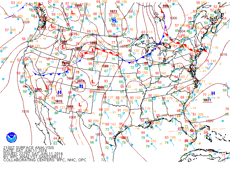
The weather forecast models are in relatively close agreement regarding the synoptic pattern through Friday, but they still diverge completely at the end of the period. The WPC’s discussion singles out the ECMWF solution as being inconsistent with other models after Friday evening, and it will therefore be considered an outlier from Saturday through the end of the medium range. The models consulted for this analysis were the 06Z NAM and GFS and 00Z ECMWF. The large 500mb omega block that has dominated this week’s weather will persist through Friday, keeping a warm front moving northward today across the central Mid-Atlantic on Thursday and Friday. Today’s guidance shows the same timing with the track of an upper level shortwave trough and its associated warm front on Thursday and Friday. This upper level shortwave currently over the northern Plains will drop southeastward across the Great Lakes throughout Thursday, reaching OH by 00Z Friday. This shortwave moves across the central Mid-Atlantic during Friday, with its associated surface low reaching HAT by Friday afternoon. There is much closer consensus in today’s deterministic models regarding the north-south placement of the shortwave on Friday. However, the EC is now considered an outlier, as it pulls down a vorticity lobe from the Canadian Maritimes closed low and forms a new, quasi-stationary closed low off of the coast of the Mid-Atlantic through the weekend. In contrast, the NAM and GFS allow the strong upper level ridge over the western and central U.S. to build eastward faster on Saturday, before completely engulfing the CONUS on Sunday and Monday. The upper level ridge will be impinged upon by a broad Canadian upper level trough pushing southward across the Northeast at the end of the period; this feature will pull a cold front into the region on Tuesday.
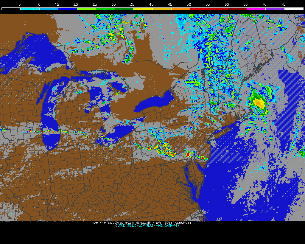
On Thursday, the approaching Great Lakes low will work its way southeastward across the Ohio River Valley. The coarse and Hi-Res models are still struggling to resolve the exact placement of the clouds and precipitation associated with this system, but they are in closer agreement than yesterday, and are trending back toward a much wetter day. The deterministic models keep the heaviest precipitation in western PA in the evening, associated with the low moving into the region, with scattered precipitation across the rest of the region. The Hi-Res models, however, have adjusted to the even slower track of the surface low, showing a wide swath of precipitation across the northern Mid-Atlantic during the morning and afternoon, with substantial convective development across the central Mid-Atlantic in the evening. This precipitation pattern is supported by the 03Z SREF, as well as the most recent WPC Short Range Forecast. The 06Z NOAA model has isolated USG ozone in Washington, DC and RIC tomorrow. We aren’t sure what to make of this guidance, since the weather models seem fairly certain of clouds and precipitation across these areas of VA, and the other air quality models have scattered to isolated Moderate ozone. As a result, the chances for an ozone exceedance are considered Slight for Thursday.
The low from Thursday will continue to track southeastward across the central Mid-Atlantic on Friday, reaching HAT by 00Z Saturday. Scattered showers and thunderstorms will linger across the northern and central Mid-Atlantic during the morning, but this precipitation will shift southward throughout the afternoon, following the low and its associated fronts. The NAM models in particular feature an area of heavy rain, moving from southwestern PA on Thursday evening, across MD and northern VA overnight, to eastern VA/NC on Friday morning, following the track of the low. Widespread clouds and precipitation are expected across the central and southern Mid-Atlantic as a result, promoting generally Good air quality in these areas. Locations north of the Mason-Dixon Line are expected to experience some clearing, but a shift to persistent onshore flow aloft should temper rising ozone, keeping the chance for an ozone exceedance Slight.
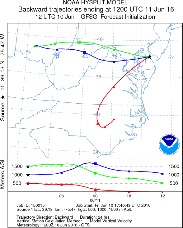
The weekend and Monday are potential days of interest, as the GFS solution has the strong upper level ridge building into the region, with surface high pressure from ON on Saturday dropping southward into VA on Sunday and settling over western NC on Monday and hooking up with the Bermuda High. The Mid-Atlantic will begin to the feel the effects of the broad upper level ridge on Saturday, with its eastern edge pushing into the western parts of the region by 12Z. Surface high pressure centered over southeastern ON will build into the region, causing winds to subside across the Mid-Atlantic as a result. The mid-levels will cool from north to south in response to the ridge, which will prevent temperatures from rebounding noticeably across Mid-Atlantic, as well as onshore flow aloft. Though there will be some local production of ozone in response to afternoon sunshine, the regional ozone levels will be low due to the persistent clouds and rain from Thursday and Friday. The mid-level transport pattern should also remain relatively clean, as 06Z GFS back trajectories for the I-95 Corridor show transport from northern ME/NB. The exception could be western portions of the region, which will feel the impact of the encroaching ridge first, with strong subsidence and rising temperatures. Therefore, the chance for an ozone exceedance will rise to Marginal for those locations for Saturday.
Sunday and Monday’s air quality will be primarily impacted by Saturday’s upper level ridge, which will fully build over the region on Sunday. Surface high pressure is expected to move across the central Mid-Atlantic on Sunday, and progress southward on Monday to its preferred position for high ozone, over western NC, where it will hook up with the Bermuda High. This will cause winds to stagnate across the region, allowing for two days of ample sunshine and widespread ozone production. In addition, with the return flow around the high on Monday, temperatures will quickly jump up into the upper 80s to 90s °F. Also, Monday will be pre-frontal, with a weak cold frontal passage expected on Tuesday. Working against possible rising ozone will be persistent strong onshore back trajectories through Monday morning, as well as lower anthropogenic emissions on Sundays. Nevertheless, the chance for an ozone exceedance will rise to Marginal on Sunday, and Appreciable on Monday to account for the continuously modifying air mass in place.
-Brown/Huff