Monthly Archives: July 2015

Mid-Atlantic Medium Range Air Quality Discussion, Issued Wednesday, July 8, 2015

Medium Range Air Quality Outlook
Mid-Atlantic Region

Issued: Wednesday, July 8, 2015
Valid: July 9 – 13, 2015 (Tuesday – Saturday)

MedRangeTable_20150709

MedRange_Cats_2

Summary:

The weather models are consistent in building a broad upper level ridge over the south/central US by Saturday, which will promote sunny skies over the Mid-Atlantic throughout the weekend. As a result, the chances for USG ozone will increase to Marginal on Saturday and Sunday. The location of the ridge will allow Moderate ozone and PM2.5 to persist across the southern Mid-Atlantic (e.g., southern VA, NC) through at least Sunday. Elsewhere, widespread clouds and showers today and tomorrow associated with a stalled frontal boundary will limit ozone precursors available on Friday when the sun first appears in full force. By Saturday, however, the atmosphere will be prime for ozone formation into the Moderate along the I-95 Corridor range with light westerly surface winds and a high pressure center over western VA keeping skies clear throughout the region. On Sunday, model discrepancies make the forecast uncertain, but clear skies are expected for most of the region. This will promote another day of rising ozone throughout most of the Mid-Atlantic, likely limited to the Moderate range due to the lack of workday traffic. By Monday, the weather models show very different upper level features above the region, but both create an area of widespread rain and scattered showers, bringing the ozone forecast back into the Good range. Particles are another story, however, as another plume of Canadian wildfire smoke will dip into the Mid-Atlantic Friday through Sunday. The impacts of this smoke will keep daily particle concentrations at varying Moderate concentrations throughout most of the period.

Discussion:

The weather models are in general consensus on the synoptic features for most of the medium range period, but diverge somewhat by Saturday evening. The 06Z NAM, 06Z GFS, and 00Z ECMWF were consulted for this analysis. Currently, a substantial shortwave over eastern Canada is dropping a slowing cold front through the northern Mid-Atlantic (NMA), which is expected to stall near the PA/MD border this evening. Shortwaves embedded in the flow will trigger a considerable surface wave that will move over PA tomorrow, bringing clouds, rain, and areas of convection to the NMA. An upper level ridge becomes apparent in the weather models early Friday, with its axis stretching from the Northern Plains southeastward to the northern Mississippi River Valley. As this feature slowly broadens and moves eastward, spanning almost the entire CONUS, the Mid-Atlantic will get a break from the clouds and rain for Friday and much of Saturday. Although there is model agreement in developing a “Ring of Fire” scenario of successive short waves cresting the ridge aloft on Sunday and Monday, discrepancies arise regarding the timing and impacts of the shortwaves themselves. The GFS brings a strong shortwave into PA around 00Z Sunday, with resulting clouds and precipitation moving through the central Mid-Atlantic (CMA) throughout the day Sunday before the upper level feature exits off the Delmarva coast. On the other hand, the EC solution brings no shortwaves over the Mid-Atlantic until 18Z Sunday, making for clear and calm weather throughout the entire weekend. Although there is general consensus between models regarding the large scale features throughout the medium range period, the timing of these shortwaves will have implications for air quality along the I-95 Corridor for the coming weekend. On Monday, although the characteristics of the embedded shortwaves over the Mid-Atlantic varies between models, they both show resultant cloudy skies and scattered showers across the region. Both of the models are trending toward re-developing a longwave trough over the Great Lakes/eastern US, with a corresponding area of low pressure at the surface. For future forecasts, it is worth noting that the GFS cuts off the upper level low over the Ohio River Valley (ORV) on Tuesday. As next week approaches, this feature may become an important factor in determining the Mid-Atlantic forecast if it continues to appear in the weather model solutions.

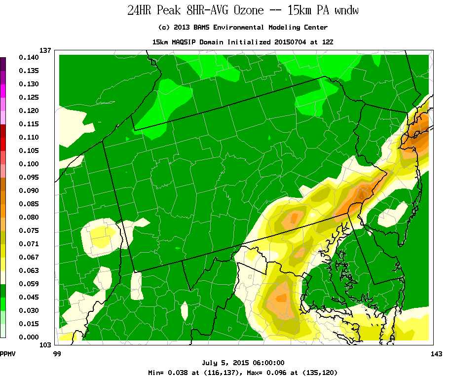
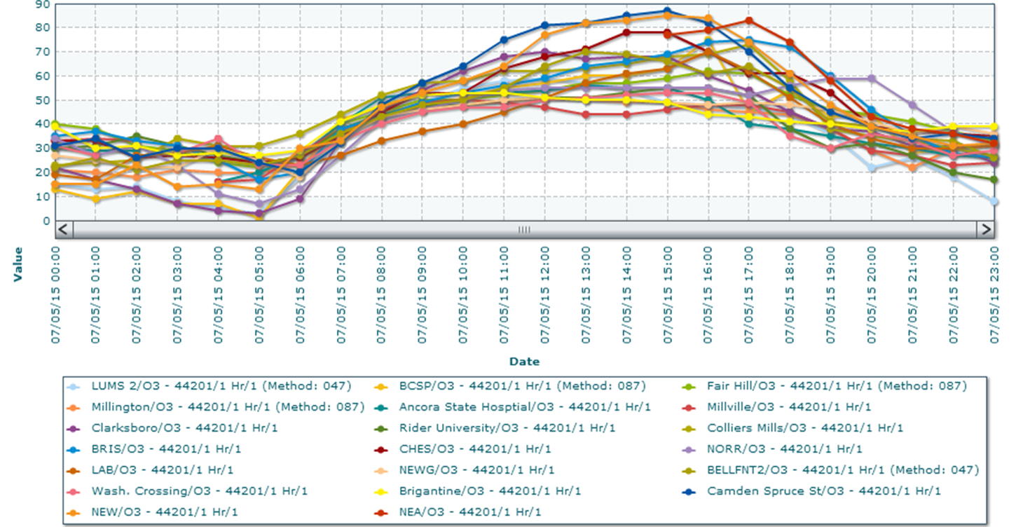
A surface wave currently over AR will move along the frontal boundary dipping southeastward as a cold front through PA today. By the time this surface wave reaches the Mid-Atlantic on Thursday, the front will still be stalled along the PA/MD border. There are still some differences among the forecast models regarding the timing of the wave, which will move into southwestern PA in the afternoon. The GFS and EC are about 3 hours faster than the NAM; we follow WPC, which sides with the GFS and EC. This wave will bring widespread heavy rain and convection to the NMA tomorrow afternoon and evening, with resultant cloud cover not reaching much farther south than northern VA as the front is dragged northward into PA. These clouds and rain will limit ozone to the Good range. PM2.5 continues in the mid-Moderate range this morning in locations along and ahead of the cold front, but has quickly dropped into the Good range behind the front. In particular, hourly concentrations are reaching into the 30s ug/m3 this morning at locations along the I-95 Corridor between DC and PHL. With the front stalling near the Mason-Dixon Line tomorrow, PM2.5 will likely linger in the Moderate range along and south of the front. However, we expected PM2.5 concentrations to decrease lower into the Moderate range due to periods of heavy rain this evening into tomorrow.

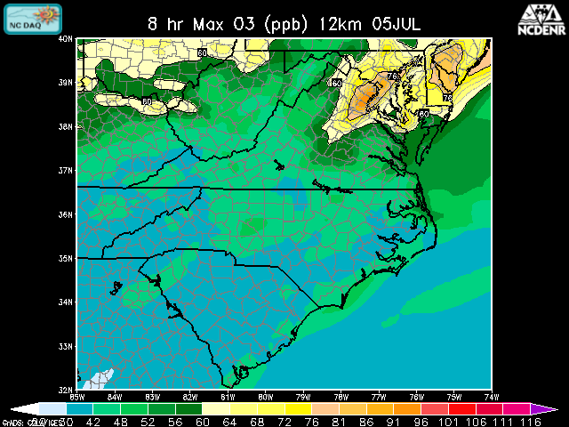
A mid-level ridge is developing today over the Southeastern US and will continue to build through the end of the medium range period. This feature will keep warm and sunny conditions across the southern Mid-Atlantic (SMA; e.g., southern VA and NC) at least through Sunday. As a result, the SMA will experience persistent Moderate ozone and PM2.5 conditions. PM2.5 buildup will be promoted by the continued presence of Saharan dust and Canadian wildfire smoke.

Early Friday, a developing area of surface high pressure over MI will help to push the frontal boundary southward towards the VA/NC border. Thursday’s clouds and showers will move eastward out to sea, allowing clear skies to take over the entire Mid-Atlantic by 18Z Friday. A ridge to our west is prominent in both the 850 and 500 mb analyses. Although ozone concentrations may rebound into the Moderate range at isolated locations, USG is very unlikely due to the plethora of clouds and rain over the region on Wednesday and Thursday, as well as the advection of slightly cooler and drier air from the northwest. The NRL NAAPS model shows another plume of smoke dipping southward into the region on Friday as surface winds shift northerly, which could push PM2.5 concentrations higher into the Moderate range throughout the region. As usual, the I-95 Corridor is of particular concern due to increased weekday emissions in the atmosphere along and downwind of the interstate.

Saturday is the first possible day of interest due to continued sunny skies and light, westerly surface winds as the upper level ridge continues to build. More widespread Moderate ozone is possible, particularly along the I-95 Corridor. But rising ozone should be kept in check by a variety of factors, including temperatures only slightly above average, a lack of a strong area of high pressure overhead, and back trajectories from the Great Lakes. The NAAPS model shows a large plume of wildfire smoke dipping into the Mid-Atlantic on Saturday, reaching as far south as the GA coastline. In the Mid-Atlantic, up to 8 additional ug/m3 of smoke is predicted to be present in the atmosphere. This smoke event is taking place on a weekend, which will help to limit additional particle buildup despite the relatively calm conditions. Since the air quality models do not take these plumes of smoke into account in their analyses, they are only showing narrow areas of Moderate ozone and PM2.5 on Saturday along the coastline. However, if the smoke forecast verifies, particles as well as ozone precursors will be abundant, causing widespread Moderate conditions of both PM2.5 and ozone.

By Sunday, model discrepancies make the air quality forecast for the end of the weekend a tricky one. If the GFS solution verifies, a surface wave will bring a period of clouds and rain eastward across the CMA throughout the day on Sunday, keeping ozone concentrations down and helping to rid the atmosphere of some of the lingering smoke. This solution shows the bulk of the rain staying south of the greater PHL area, making it the main metropolitan area of concern when it comes to air quality on Sunday. However, if the EC solution verifies, the entire Mid-Atlantic would see another day of clear skies, calm winds, and increasing ozone concentrations as well as the continued presence of several additional ug/m3 of smoke in the atmosphere. The WPC surface analysis is showing a blend of the two model solutions, with a surface high pressure center over WV taking the side of the EC, but also developing a surface wave of weak low pressure over the Delmarva around 12Z Sunday. At this time it is too early to deterministically select a model to believe, so a blend is best – meaning that scattered areas of clouds and some showers are most probable along the Chesapeake Bay area due to the developing surface wave, with neither completely clear skies nor a washout most likely.

On Monday, although the models fail to come back into agreement on upper level shortwave patterns, they do agree that some kind of widespread clouds and showers will impact the Mid-Atlantic due to increasing troughiness over the Great Lakes/eastern US. Regardless of the exact source of this cloud cover and rain, the consensus of shrouded skies and onshore transport aloft are enough to expect Good air quality on Monday at this time with some confidence.

– Eherts/Huff

Mid-Atlantic Medium Range Air Quality Discussion, Issued Thursday, July 7, 2015

Medium Range Air Quality Outlook
Mid-Atlantic Region

Issued: Thursday, July 7, 2015
Valid: July 8 – 12, 2015 (Friday – Tuesday)

MedRangeTable_20150708

MedRange_Cats_2

Summary:

The arrival of another weak frontal boundary on Wednesday and its subsequent stalling near the Mason-Dixon Line through Friday will keep the chances for USG ozone in the Slight range for the beginning of the medium range period. A very broad upper level ridge will develop across the CONUS over the weekend, which will increase the chances for USG ozone in the Mid-Atlantic to Marginal on Saturday and Sunday. The main uncertainties over the weekend that may prevent deteriorating air quality are the fate of the lingering front and the possible position of the Mid-Atlantic in the “ring of fire” of shortwaves cresting the upper level ridge. At this point, Saturday looks like the clearer of the two weekend days, with more chances for clouds and precipitation on Sunday. However, Sunday will be hotter and more humid. Smoke from Canadian wildfires and Saharan dust will impact the Mid-Atlantic on Wednesday, keeping PM2.5 concentrations in the Moderate range for another day – possibly as high as the mid-Moderate range. Saharan dust may continue to be a threat through Friday, especially for the southern part of the region.

Discussion:

The weather models are in general consensus on the synoptic features for the medium range period. The 06Z NAM, 00Z GFS, and 00Z ECMWF were consulted for this analysis, with an emphasis on a blend of the EC and GFS. A strong short wave currently over ON will move eastward today, reaching eastern QC by 18Z Wednesday. This feature will pull a cold front into the Mid-Atlantic early Wednesday morning. Zonal flow at 500 mb in association with developing mid-level ridge over the Southeastern US will slow the progression of this front as it moves toward southern PA on Wednesday. This front will stall in the vicinity of the Mason-Dixon Line (MDL) around 12Z Thursday. Shortwaves will move through the zonal flow on Thursday. The EC and GFS disagree slightly on location and track of a larger shortwave on Thursday, with the GFS moving it over PA, while the EC pushes it farther north over NY State. The GFS is also a bit faster than the EC moving this feature from west to east. These differences translate into some uncertainty about the precipitation forecast for Thursday. Periods of heavy rain are likely in the vicinity of the stalled front, but the exact location will depend on the track of the shortwaves. By Friday morning, the models begin to develop a broad upper level ridge over the northern Plains. The upper level ridge will move eastward on Friday and Saturday, with its axis just to the west of the Mississippi River, and merges with the mid-level ridge. The upper level ridge will extend westward on Sunday, reaching across most of CONUS, with is axis shifting to the central Plains. The GFS places the ridge slightly farther north than the EC, which has implications for the weekend’s precipitation forecast. Multiple shortwaves will crest the upper level ridge and move into the northern Mid-Atlantic (NMA) through the end of the medium range period. While yesterday’s model guidance showed the Mid-Atlantic in the ring of fire over the weekend, the more westward development of the upper level ridge in today’s guidance keeps our region clear on Saturday. By Sunday, however, the Mid-Atlantic is positioned on the eastern periphery of the ridge, which will place it back in the line of fire for the advancing shortwaves. At the surface, the building ridge will push the stalled front near the MDL slightly southward into central VA on Friday before moving it northward, possibly as early as Saturday. The GFS, with its stronger mid-level ridge, moves the front northward out of the Mid-Atlantic on Saturday. In contrast, the EC keeps the front over the Mid-Atlantic on Saturday before weakening it and moving it northeastward on Sunday.

Smoke from Canadian wildfires and Saharan dust will continue to have an impact on the region on Wednesday. The NAAPS model suggests that the Saharan dust currently over the Gulf Coast will flow northeastward on Wednesday. NC and southern VA will be the main locations impacted. The NAAPS model also suggests that the plume of Canadian smoke will linger in the NMA on Wednesday, but clear out of the region on Wednesday night. Currently, hourly surface PM2.5 observations in the Ohio River Valley (ORV) and PA are hovering in the low to mid 20s ug/m3. However, hourly concentrations behind the front across IA, CO, and MO have risen to 60-100 ug/m3. This morning’s visible satellite imagery showed another plume of thick smoke extending down from Canada into the central Plains. So currently, there are smoke plumes impacting surface PM2.5 concentrations ahead of and behind the approaching cold front. Some of this PM2.5 will be washed out as the approaching cold front sweeps through the ORV, but continued low to mid Moderate particle concentrations seem likely tomorrow across the region, with locally higher concentrations likely just ahead of the front.

The cold front will move into PA on Wednesday morning. By the time it reaches the Mid-Atlantic, the global and mesoscale models show it weakening considerably compared to today. As a result, the front is not expected to generate strong, organized lines of convection across the Mid-Atlantic. However, it will still trigger scattered showers and thunderstorms which will reach I-95 by about 19-21Z Wednesday. This precipitation, along with cloud cover, should return ozone to the Good range for the NMA and central Mid-Atlantic (CMA). Areas to the south, such as NC, will see another day of Moderate ozone.

On Thursday, the front will stall and oscillate around central VA, promoting clouds and precipitation. This front is expected to sit in the CMA through Friday. This will keep the chances for clouds and precipitation alive somewhere in the Mid-Atlantic through the period, mainly in the CMA and NMA. Numerous shortwaves moving overhead will also help to promote clouds and precipitation, although as discussed above, there is some question as to the track of the largest shortwave, which makes the areas of heaviest rainfall uncertain. As a result, ozone concentrations are expected to stay in the Good range on Thursday. The exception will be NC, where the building mid-level ridge will allow for Moderate ozone through the end of the period. Saharan dust will continue to have an impact on PM2.5 concentrations as the dust plume slowly creeps northward into the CMA. The northward extent of the dust plume will depend on the southward extent of the stalled front. Locations to the north of the front will not be impacted by the dust as much, with Good conditions more likely. Areas along and south of the frontal boundary will likely see the highest PM2.5 concentrations, with low to mid Moderate PM2.5 concentrations probable.

Two centers of surface high pressure will move over the Great Lakes and the southeastern US on Friday, which will sandwich the stalled frontal boundary in the CMA, moving it slightly southward into central VA. As a result, skies should be mostly clear across the region, except for the vicinity of the front. GFS in particular kept clouds and scattered showers around the location of the front. Clearing skies will allow ozone to rebound into the low-mid Moderate range in the NMA and parts of the CMA that are far enough away from the impacts of the front. PM2.5 concentrations are expected to stay in the Moderate range on Friday in areas along the front and the SMA, where the Saharan dust may be lingering.

Saturday and Sunday look to be the days with the potential for the highest ozone production as high pressure in place over the region will promote light winds and clear skies, which is a change from yesterday’s analysis. The air quality models are responding to these factors by showing Moderate ozone along the I-95 Corridor and in eastern VA and NC on Saturday. Sunday’s forecast is uncertain due to the possible impact of “ring of fire” shortwaves. Shortwaves cresting the upper level ridge and moving overhead may help limit ozone production in the NMA and CMA, but the exact location of these shortwaves is still uncertain. The fate of the stalled front is also uncertain, but if the EC’s solution verifies, it will linger through the weekend and possibly contribute to a buildup of pollutants along its boundary.

– DeBoe/Huff

Mid-Atlantic Medium Range Air Quality Discussion, Issued Monday, July 6, 2015

Medium Range Air Quality Outlook
Mid-Atlantic Region

Issued: Monday, July 6, 2015
Valid: July 7 – 11, 2015 (Tuesday – Saturday)

MedRangeTable_20150707

MedRange_Cats_2

Summary:

Warm, humid, and partly sunny conditions will keep chances for USG conditions Marginal on Tuesday, mainly along the I-95 Corridor. Chances for USG ozone will drop to slight for the rest of the period. Tuesday will be pre-frontal, with southwesterly flow, afternoon clearing, and development of an Appalachian lee trough. Ozone will likely reach the Moderate range along the I-95 Corridor, with the highest concentrations expected along and east of the I-95 Corridor north of DC. Southerly flow today has kept another plume of wildfire smoke mostly to the north and west of the region, and this trend is expected to continue tomorrow under southwesterly flow. A cold front will weaken as it moves into the region from the northwest on Wednesday, stalling in the vicinity of the Mason-Dixon Line. Substantial clouds and convection triggered by the front will limit ozone to the generally Good range on Wednesday. A dilute plume of Canadian wildfire smoke may surge back into the region ahead of the cold front overnight Tuesday into Wednesday, making low-to-mid Moderate particle concentrations likely on Wednesday. Starting on Wednesday, the Mid-Atlantic frontal pattern we have seen often this summer will dominate, with the front oscillating north- and southward in the vicinity of central MD throughout the next several days. A series of surface waves moving eastward through the Mid-Atlantic will keep clouds and showers somewhere in the region through the end of the period. There will be a pattern change towards the end of the work week as an upper level ridge builds over the central and southern US, with the axis setting up over the Great Lakes by Saturday. This would normally point toward chances for deteriorating air quality, but the Mid-Atlantic will be downwind of the “ring of fire” of shortwaves cresting the ridge. In particular, an upper level short wave is expected to bring a surface wave through the Mid-Atlantic on Saturday, with the associated clouds and showers limiting ozone production despite the prime synoptic set-up.

Discussion:

The weather models are in very close consensus on the synoptic features for the medium range period. The 06Z NAM, 06Z GFS, and 00Z ECMWF were consulted for this analysis. Currently, a prominent but weakening upper level shortwave is centered over WV and moving northeastward with the flow. As the shortwave weakens, the associated surface warm front will weaken as well, making for a very diluted frontal boundary moving northward through the northern Mid-Atlantic (NMA) today. Throughout the day Tuesday, a large shortwave moving eastward through ON will pull a cold front across the northern Plains and towards the Mid-Atlantic, which will weaken as it crosses the Great Lakes overnight. By 12Z Wednesday, the front will be slowly moving southeastward through PA, bringing early morning convection to northwestern PA. Small, relatively weak shortwaves moving eastward along the frontal boundary will determine the exact location of the heaviest periods of rain. Additional widespread convection on Wednesday afternoon ahead of the front will extend southward to the vicinity of the Mason-Dixon Line (MDL). The front is expected to stall somewhere in the vicinity of the MDL around 12Z Thursday, although model discrepancies suggest it may end up settling farther south in northern VA. Throughout the day Thursday, there is agreement that the upper level flow will become zonal, preventing further movement of the front through the central Mid-Atlantic (CMA). The advancement of the front will also be arrested by a mid-level ridge over the Southeastern US. Small short waves moving with the flow just north of PA will promote clouds and showers along and north of the frontal boundary, with an area of surface high pressure building south of the front in the southern Mid-Atlantic (SMA). By Friday morning, there will be less shortwave action in the vicinity of the NMA, keeping only scattered areas of cloud cover and rain showers along the frontal boundary somewhere in the CMA –the EC consistently shows the boundary farther south than the GFS does, and a blend of the two solutions provides the best confidence at this time. Throughout the day Friday, a wide upper level ridge over the central and eastern US will become prominent and continue to build. Saturday will see more strengthening of this large ridge, with some discrepancies arising as to the exact placement of the ridge axis. The EC solution shows a more defined ridge peak over the southern Hudson Bay, with the axis extending through the Great Lakes and towards the Mississippi River Valley. Shortwaves cresting the ridge axis and moving along the “ring of fire” into the Mid-Atlantic on Saturday will continue chances for clouds, rain, and convection, despite the strengthening ridge.

A weakening warm front moving northward through the NMA today will continue to spin up convection and cloud cover across the region, which will taper off throughout the first half of the day on Tuesday. This will leave a short window for clear skies tomorrow afternoon before the impacts of the cold front progressing across the Midwest are felt. Temperatures in the high 80s ͦF, dewpoints approaching 70 ͦF, and afternoon periods of sun will push ozone concentrations into the Moderate range at scattered locations. The formation of an Appalachian lee trough just west of I-95 will aid in ozone formation as well. With sustained southwest surface winds, areas along and east of the I-95 Corridor north of DC are most likely to see concentrations reach into the upper Moderate range. The models are responding to this accordingly, with the BAMS and NCDENR air quality models resolving a corridor of Moderate ozone concentrations from southwestern CT to the DC Metropolitan area; the NOAA/EPA model did not run this morning.

Yesterday, another plume of wildfire smoke swirled southward out of the flow from Canada into the Great Lakes. Today’s warm front and associated surface wave are pulling clean and moist air northward into the Mid-Atlantic this morning, which is keeping the smoke out of the region, with the exception of parts of PA and NJ. Surface PM2.5 concentrations this morning are well into the Moderate range at locations surrounding the region, across the Great Lakes and New England. For tomorrow, southwesterly flow should continue to push the smoky air north and west of the Mid-Atlantic. Moderate PM2.5 may continue in parts of PA, and low Moderate conditions are possible along I-95 due to rising humidity.

Wednesday will see the arrival of the cold front from the northwest, with the impacts becoming less organized as the front slows down through the NMA. While northwestern PA and WV are expected to see organized convection overnight Tuesday into Wednesday morning, most of MD along with DE, NJ, and VA are expected to see clouds and scattered thunderstorms on Wednesday afternoon and evening. The warm, humid air mass ahead of the front, along with a zonally-shifting upper level flow and developing Southeastern mid-level ridge, will slow and stall the front somewhere in the vicinity of the MDL late on Wednesday. Where the heaviest rain sets up will depend on the exact path of some small but strong shortwaves moving eastward aloft. Although it will be hot and humid, widespread optically thick cloud cover will inhibit ozone formation throughout much the Mid-Atlantic. The humid conditions, along with the possibility of pre-frontal advancement of smoky air from the west and encroaching Saharan dust moving up from the Gulf Coast, will keep Moderate levels of PM2.5 likely on Wednesday, especially to locations south of the front.

By Thursday, the front will take on the characteristics of most Mid-Atlantic fronts so far this summer. Surface waves will ride along the boundary as it oscillates north- and southward around central MD, keeping varying chances for clouds and showers in the Mid-Atlantic for multiple days. Shortwaves aloft are expected to move eastward with the flow along the NY/PA border on Thursday, promoting clouds and showers along and north of the frontal boundary. The mesoscale models show that the clouds will lift northward later in the day, with clear skies taking over much of the region by nightfall. The expanse of cloud cover throughout the day will limit ozone to the Good range, but particle concentrations may linger in the Moderate range in areas where rainfall has not yet cleared out any Saharan dust, mainly in the SMA.

Friday will see continued chances for clouds and scattered showers along the frontal boundary in MD, but a lack of shortwave energy aloft will limit the extent of any precipitation and cloud cover. Light westerly winds and a weak focus for convergence in MD and DE may help to promote ozone production in areas where clouds do not linger, specifically to the east of the I-95 Corridor. However, long back trajectories from the Mississippi River Valley will prevent ozone from reaching substantially into the Moderate range. Moderate particle concentrations will take a break on Friday as smoke and dust both retreat away from the Mid-Atlantic.

On Friday, an upper level ridge will start to build in the central and southern US, with an axis establishing itself through the Great Lakes region by Saturday morning. A ridge with its axis west of the Mid-Atlantic is a classic set-up for deteriorating air quality, but in this case, shortwaves cresting the ridge along the ring of fire will be moving into the Mid-Atlantic, which will limit any chances for rising ozone. In particular, a strong upper level short wave moving over the OH/WV border will bring a rainy system right through the Mid-Atlantic on Saturday. Despite the mesoscale nature of this event, very close agreement between the global models regarding this featre increases confidence in its likelihood. Despite the western ridge, warm conditions, and light surface winds, this surface wave and precipitation will limit ozone to the Good range for most locations on Saturday. Areas where the rain does not reach until Sunday, namely eastern Mid-Atlantic locations such as PHL, BAL, and DOV, may see concentrations of both ozone and PM2.5 reach into the Moderate range. In the event that this surface wave forecast changes in the coming days, the ridge to the west could pose an air quality threat for the entire region this coming weekend.

– Eherts/Huff

Isolated Code Orange Ozone in Philadelphia on July 5

By the time we reached the Independence Day holiday weekend, we were overdue for an ozone exceedance day (8-hour average O3 mixing ratio > 75 ppb) in the Philadelphia metropolitan region. This is climatologically the height of the ozone season, when the days are long, the solar zenith angle is short, and daily air temperatures are typically at their peak. Philly has had only one ozone exceedance day so far this summer, however (June 11). This is the farthest we’ve ever gone into the summer without a second exceedance day, even during the recent historically low ozone years of 2013 and 2014. In 2013, we had 1 exceedance day in May and 2 in June, while in 2014, we had no exceedance days in May but 2 in June (Figure 1).

In the week leading up to the Independence Day holiday weekend, the forecasting interns and I had identified Sunday, July 5, as a day of interest for a possible ozone exceedance. The axis of a narrow and fast-moving ridge of high pressure aloft (Figure 2) was forecasted to be just to the west of the Mid-Atlantic, the prime spot for ozone formation. The corresponding center of surface high pressure was forecasted to move across southern PA during the day, promoting sunny skies and calm winds (Figure 3). The main limiting factors were persistence – observed ozone on Saturday was in the Code Green (Good) range across the region – and the fact that it was a Sunday. Historically, lower emissions of ozone precursors on Sundays tend to limit ozone to the upper Moderate range, even when weather conditions are favorable for rising ozone.

All of the air quality models blew up ozone to the Code Orange (USG) range on Sunday (Figure 4). They had excellent consensus with each other and over several consecutive runs (Friday afternoon to Saturday morning). When the air quality models all agree on the location and magnitude of USG ozone, I pay attention. Given the synoptic and mesoscale weather conditions, pockets of USG ozone certainly seemed possible along I-95 from Washington, DC to Trenton, NJ, but I decided that the low regional and upwind ozone on Saturday (low persistence) and the fact that it was a Sunday – even a holiday Sunday – would be enough to limit rising ozone to the upper Moderate range. I thought there was a small chance for isolated USG, but I wasn’t confident enough to issue a USG forecast and call for an Air Quality Alert (AQA). So I forecasted at the top of the Moderate range (74 ppb) for Philadelphia and Baltimore and upper Moderate for DC and Delaware (70 ppb).

It was fascinating to watch the hourly ozone observations come in on Sunday afternoon. Although it was sunny with very light surface winds (Figure 5), 8-hour average ozone stayed in the Good range across Maryland and northern Virginia and barely made it to the Moderate range in northern Delaware (63 ppb). But along a very short section of I-95 in Philadelphia, ozone quickly jumped up at a couple of monitors – Northeast Waste in Philadelphia County and Camden Spruce in Camden County (Figure 6). We ended the day with those two Philly metro area monitors just reaching the USG range for 8-hour average ozone: 76 ppb at Northeast Waste and 78 ppb at Camden Spruce.

This same thing happened last summer – in fact, 3 of the 6 exceedance days in Philadelphia last year occurred under almost exactly the same weather conditions, with Code Green ozone on the previous day, and only 1 monitor reaching USG by 1-2 ppb. So Sunday was not unprecedented, but it was nearly impossible to forecast. I don’t think I could have realistically issued an AQA for the Sunday of Independence Day weekend with the expectation that 1-2 monitors would hit USG by 1-2 ppb. I’m also not sure I could have issued a lower forecast for Maryland… possibly I could have gone lower in the Moderate range, given that it was not forecasted to be as hot, with high temperatures only in the low 80s °F. But I certainly did not expect widespread Code Green ozone (Figure 7)!

Days_USGO3_PHL_2013-2015
Figure 1. Number of observed ozone exceedance days in the Philadelphia metropolitan area by month for 2013-2015.

500mb_obs_12Z_20150705
Figure 2. 500 mb geopotential height analysis at 12Z Sunday, July 5, showing ridge axis to the west of the Mid-Atlantic.

WPC_Sfc_Fx_1200UTC_20150705
Figure 3. WPC surface analysis forecast for 12Z Sunday, July 5, showing the center of surface high pressure over western PA.

12Z_NOAA_O3_20150705

12Z_BAMS_MAQSIP_O3_12km_20150705

12Z_NCDENR_O3_12km_20150705
Figure 4. 8-hour average ozone forecast guidance for Sunday, July 5 from the 12Z runs of the NOAA/EPA model (top), BAMS-MAQSIP model (middle), and NCDENR model (bottom).

Metars_BWI_1843UTC_20150705

PA_visible_1830_20150705
Figure 5. METARS surface observations at 18:45 UTC (top) and GOES visible satellite image at 18:30 UTC (bottom).

O3_Hourly_20150705
Figure 6. Time series of hourly ozone observations for the Philadelphia/Trenton/Wilmington metropolitan region for Sunday, July 5.  Note the topmost lines for Camden Spruce (dark blue) and Northeast Waste (NEW; orange).

peak_o3_va_wv_md_de_dc_20150705
Figure 7. Observed ozone AQI color codes for the Mid-Atlantic region for Sunday, July 5.

Mid-Atlantic Medium Range Air Quality Discussion, Issued Sunday, July 5, 2015

Medium Range Air Quality Outlook
Mid-Atlantic Region

Issued: Sunday, July 5, 2015
Valid: July 6-10, 2015 (Monday – Friday)

MedRangeTable_20150706

MedRange_Cats_2

Summary:

The chances for marginal to appreciable USG ozone continue for Monday and Tuesday in the Mid-Atlantic before falling back to slight for the remainder of the medium range period. On Monday, cloudy skies, scattered showers, and convection generated by a quick-moving warm front and associated surface wave will keep ozone in the Good range for most of the region. The exception is northern NJ and the NYC metro area, where afternoon clearing and southerly surface winds will create a marginal chance for USG ozone, which is supported by the air quality models. Tuesday will be hot and humid, with partly to mostly sunny skies, localized back trajectories, and southwesterly surface winds bringing the chances for USG ozone up to appreciable, mainly for locations along and just east of I-95. A cold front will move into the northern part of the region on Wednesday and stall in the vicinity of the Mason-Dixon Line (MDL) on Thursday and possibly Friday. The global models diverge on the fate of the front as well as the location of surface waves moving along the stalled boundary, which creates considerable uncertainty in the forecast for the end of the period, although USG ozone seems unlikely. Another pulse of Canadian/Alaskan wildfire smoke is moving into the Mid-Atlantic from the west today. This smoke will wane but continue to impact the region through at least Tuesday. At the end of the period, Saharan dust currently along the Gulf Coast may move up into the Mid-Atlantic as far as the MDL. As a result, continued widespread Moderate PM2.5 concentrations seem likely through the medium range period.

Discussion:

The weather models are in consensus on the key synoptic features for the beginning of the medium range period, but they diverge on Thursday and Friday. The 12Z NAM, 06Z GFS, and 00Z ECMWF were consulted for this analysis, with an emphasis on a blend of the EC and GFS through Wednesday, per WPC. The axis of a relatively narrow and quick-moving upper level ridge will be over the Mid-Atlantic on Monday morning and over New England by the afternoon. At the same time, a strong shortwave that is over the Tennessee River Valley (TRV) this morning will move northeastward into the Mid-Atlantic on Monday and eventually weaken. This feature is reflected in a surface wave today along the quasi-stationary front draped across southern VA. This front, along with the wave, will rapidly move northward as a warm front on Monday, bringing clouds, showers, and scattered convection across much of the region. On Tuesday, a strong shortwave over ON will pull the next cold front toward the Mid-Atlantic from the west. The global models continue in agreement today that this front will move into the northern Mid-Atlantic (NMA) on Wednesday and stall in the vicinity of the Mason-Dixon Line on Thursday. From Wednesday through the end of the period, the global models have a zonal flow aloft at 500 mb. The EC and GFS bring a series of small shortwaves over the region in the zonal flow at the end of the period, although the models differ on the exact timing and location of the shortwaves. The EC and GFS diverge somewhat on Thursday and Friday; both models rebuild a mid-level ridge over the Southeastern US, but the GFS has a stronger ridge that extends farther north compared to the EC’s solution. The main impact on air quality late in the period is the location of the stalled front and the waves of low pressure riding along the front, triggered by shortwaves aloft. The GFS, with its stronger mid-level ridge, keeps the surface waves farther north on Thursday and Friday, along the NY/PA border. In contrast, the EC keeps the stalled front along the MDL with the associated waves centered over the region.

Monday will be mostly to partly cloudy for much of the region, with scattered showers and thunderstorms. The 09Z SREF keeps a high probability of precipitation over the entire region except for the far northern NJ/NYC metro area. The 12Z 4 km NAM shows a line of thunderstorms overnight into the morning impacting the southern I-95 Corridor (e.g., DC, BAL, ILG, PHL) and then additional scattered storms in the afternoon across the NMA. Surface winds will be calm in the morning and turn south/southeast and pick up in the afternoon. The air quality models (e.g., NOAA/EPA, BAMS, NCDENR) are consistent again today in painting upper Moderate to USG ozone in northern NJ and the metro NYC region, likely in response to onshore surface winds blowing I-95 emissions northward and at least partly sunny afternoon skies. Elsewhere, the clouds and periodic precipitation associated with the warm front and surface wave will limit ozone to the mostly Good range.

As the NRL NAAPS model predicted yesterday, another pulse of Canadian/Alaskan wildfire smoke moved down into the Great Lakes/Ohio River Valley (ORV) overnight. This smoke, along with the dissipating effects of Independence Day fireworks, pushed hourly PM2.5 concentrations well into the USG range this morning across the Chicago and Pittsburgh metro areas, among other locations. This smoke seems to be steadily moving eastward and will likely remain in the Mid-Atlantic on Monday and Tuesday, as back trajectories both days are slow and localized. The smoke may linger until the arrival of the cold front on Wednesday/Thursday, although the NAAPS model shows the impact of the smoke waning after Monday. However, the NAAPS model also shows Saharan dust moving up from the south/southwest for the end of the period, reaching as far north as the MDL – likely stopped by the stationary front. The Saharan dust has been impacting the Gulf Coast for the past several days, so its possible transport into the Mid-Atlantic beginning Wednesday will need to be monitored.

Tuesday will be hot and humid with partly to mostly sunny skies. The region will be in the warm sector, with Monday’s warm front roughly over NYC and Long Island and the next cold front still far enough to the west to have little impact on the Mid-Atlantic’s sensible weather. There is a chance for isolated thunderstorms and increasing clouds in the afternoon, but enough sun should be available for widespread Moderate ozone along the I-95 Corridor, with an appreciable chance for isolated USG ozone. Southwesterly flow will push the highest ozone to locations along and just east of I-95.

There is a greater chance for optically thick clouds and organized convection on Wednesday as the front moves into the very warm and humid air mass over the Mid-Atlantic. The mesoscale models show the front reaching southern PA/central NJ by 00Z Thursday. Scattered Moderate ozone is possible on Wednesday, particularly at locations farther south, such as southern MD and central/southern VA, which will be the last to feel the impacts of the approaching front.

The forecast for the end of the period is highly uncertain due to the uncertainty regarding the fate of the stalled front and associated waves of low pressure. The pattern is reminiscent of the mid-June pattern, when one frontal boundary after the next stalled in the vicinity of the MDL, which kept ozone mostly in the Good range for much of the region. Thus, generally Good to low/mid Moderate ozone seems likely on Thursday and Friday, with only a slight chance for USG ozone.

-Huff