

Medium Range Air Quality Outlook
Mid-Atlantic Region
Issued: Wednesday, August 1, 2018
Valid: August 2-6 (Thursday-Monday)
![]()

Summary
An upper level pattern similar to last week’s will promote persistent unsettled conditions and a Slight risk of an exceedance through Friday before the risk rises to Marginal over the weekend and Appreciable on Monday as a mid-level Bermuda High slowly builds westward. While locations across the western edge of the Mid-Atlantic may remain mostly dry throughout the rest of the work week, a stalling cold front and strong, persistent southerly flow will promote widespread precipitation across the rest of the region on Thursday and Friday. Unsettled conditions across the western half of the region will dissipate throughout the morning and early afternoon on Saturday as the western edge of the Bermuda high begins to build overhead at mid-levels. The primary forecast questions for Saturday will be the coverage of afternoon precipitation, cloud cover, air mass characteristics across the Ohio River Valley (source region for PIT back trajectories), and how quickly the air mass across the western half of the region will be able to modify. Given these conditions, the risk of an ozone exceedance will increase to Marginal, focusing on locations west of I-81 in the NMA, with the highest ozone expected around the PIT metro area. On Sunday and Monday, the synoptic pattern will have elements of a classic high ozone pattern for the Mid-Atlantic, with the center of surface high pressure over western NC and a surface (lee) trough along I-95. Weak upper level ridging and the more southward center of the mid-level ridge over the Southeastern U.S./Gulf Coast, which will source humid air from the Gulf of Mexico, will keep chances for afternoon precipitation in the forecast, however, introducing uncertainty into how high ozone can climb at the end of the medium range period. The coverage of scattered showers and associated cloud cover across the NMA and CMA will be a primary forecast question on Sunday, with conditions otherwise conducive for ozone formation. A shift to weak westerly surface flow will promote the development of sea/bay breezes throughout the eastern Mid-Atlantic that could help concentrate pollutants across along and east of I-95. The risk of an ozone exceedance will remain Marginal due to the uncertainty in the precipitation forecast with a focus on locations across the NMA and CMA; the highest ozone is expected to occur along and east of the I-95 corridor from DC to NYC. Monday is currently the primary day of interest, but with more than usual uncertainty due to differences in how the weather models handle the progression of the next upper level trough approaching from the Great Lakes region on Monday-Tuesday. Mostly sunny skies and above average temperatures will likely blanket most of the Mid-Atlantic under mid-level ridging. Questions surround the precipitation forecast, however. The GFS (faster with the next upper level trough) brings some pre-frontal precipitation into the NMA, while the ECMWF has scattered afternoon/evening precipitation due to weak ridging aloft and persistent humidity. Although a surface (lee) trough will be in place along I-95, it is more likely to act as a focus for afternoon convection, given the weak upper level ridge that will be in place. Light surface winds, another day of westerly flow aloft, and mostly sunny skies will be favorable for rising ozone in locations that remain dry. Given the westward push of the Bermuda High at mid-levels, the risk of an ozone exceedance will rise to Appreciable with exceedances possible throughout the NMA and CMA, but with considerable uncertainty.
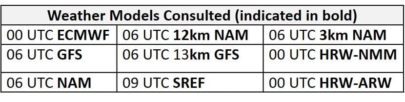
NWP Model Discussion
The weather models remain in close agreement with the evolution of synoptic scale features until Monday. In general, the upper level trough currently over the Mississippi River Valley will slowly weaken throughout the rest of the work week, allowing the strong Bermuda high over the western Atlantic Ocean to build westward, with its center pushing into the Southeastern U.S., into the CONUS by the end of the period. The lingering Mississippi River Valley trough will begin to weaken by 12Z Thursday as much of the embedded shortwave energy has lifted out of the base of the trough and into the northern stream flow across QC. The presence of upper level ridging over the Southwest U.S. and western Atlantic Ocean will allow this upper level trough to remain in place through Friday as it continuously weakens. The westward building of the Bermuda high and eastward building of the southwest U.S. ridge will pinch the Mississippi River Valley trough on Saturday, filling the trough in completely by 00Z Sunday. Once the trough is filled in, the westward push of the Bermuda high and the presence of the Southwest U.S. ridge will promote broad but weak upper level ridging across most of the CONUS by Sunday, with many embedded shortwaves moving over the Mid-Atlantic under the ridge. This upper level ridging will not last long because shortwave perturbations passing over the Rockies in the Northwestern U.S. on Sunday will drop across the Great Plains on Monday and dig out an upper level trough over the Midwest by 00Z Tuesday. The GFS and ECMWF are not in agreement with the progression of this feature on Monday as the GFS is 8-12 hours quicker, pushing a weak front towards the Mid-Atlantic by 00Z Tuesday, while the ECMWF keeps the front across the Ohio River Valley until Tuesday. Currently the WPC is favoring the slower, ECMWF solution. With the upper level trough expected to not quite reach the Mid-Atlantic on Monday, the synoptic pattern will have elements of a classic high ozone pattern for the Mid-Atlantic, with the center of surface high pressure over western NC and a surface (lee) trough along I-95. The weak upper level ridging and more southward center of the mid-level ridge over the Southeastern U.S./Gulf Coast, which will source humid air from the Gulf of Mexico, will keep chances for afternoon precipitation in the forecast, however, introducing uncertainty into how high ozone can climb at the end of the medium range period.
The Dailies
Day 1 (Thursday): Although a few locations in western PA could remain dry, Thursday will soggy throughout most of the Mid-Atlantic. The cold front knocking on the door of the western Mid-Atlantic today will stall along the western edge of the region by Thursday morning. Strong southerly flow aloft and the presence of this stalled frontal boundary will promote widespread, locally heavy precipitation throughout the region. The WPC again has the entire Mid-Atlantic under Marginal risk for excessive rainfall with a strip of Slight risk of excessive rainfall from the Gulf Coast stretching northeastward along the spine of the Appalachians into northeastern PA, and Moderate risk of excessive rainfall throughout western SMA. The air quality models are generally in agreement as they develop widespread Good ozone throughout the majority of the region. The air quality models develop a few patches of Moderate ozone throughout the western NMA/CMA, just west of the stalled front, where widespread precipitation is less likely and some locations may remain dry. Given these conditions, the risk of an ozone exceedance will be Slight Thursday.
Day 2 (Friday): The Bermuda high to the east and weakening trough to the west will keep a northward flowing conveyor belt of moisture moving over the region through Friday, promoting widespread unsettled conditions once again. Similar to Thursday, locations across western PA (PIT metro area) could remain dry as the weak front is stalled to the east. While dry conditions, weak surface winds and a few periods of sun could allow ozone formation to take place, the recent stretch of unsettled conditions and presumably clean air mass should prevent excessive ozone formation. Widespread precipitation along and east of the front will combine with cloudy skies and strong southerly flow aloft to keep ozone in check for another day. The air quality models keep widespread Good ozone throughout most of the region but the various versions of the BAMS and NC models show quite a range in solutions for the western part of the region, varying from Good to Unhealthy. The isolated USG and Unhealthy predictions seem overdone, considering the likely clean air in place. Continued southerly flow and a presumably clean air mass will keep a Slight risk of an ozone exceedance on Friday.
Day 3 (Saturday): Unsettled conditions will dissipate throughout the morning and early afternoon on Saturday as the western edge of the Bermuda high begins to build overhead at mid-levels. A surface trough set up along the I-95 Corridor will keep scattered showers and thunderstorms across the eastern Mid-Atlantic at least through the morning and possibly early afternoon, which along with persistent strong southerly flow aloft for the first half of the day will keep ozone formation in check. Near or slightly above average temperatures, periods of sunshine, light surface winds, and a shift to weak westerly flow aloft will be favorable for gradual ozone formation across locations west of I-81. The primary forecast questions for Saturday will be the coverage of afternoon precipitation, cloud cover, air mass characteristics across the Ohio River Valley (Source region for PIT back trajectories), and how quickly the air mass across the western half of the region will be able to modify. The air quality models are responding to conditions favorable for ozone formation as they develop widespread Moderate across the NMA and CMA. The NC-GFS2 is the most aggressive as it develops a few pockets of USG ozone throughout western PA, while the BAMS models develop upper Moderate throughout PA and isolated USG along the Chesapeake Bay. Given these conditions, the risk of an ozone exceedance will increase to Marginal with a focus on locations west of I-81. The highest ozone is expected to occur around the PIT metro area.
Day 4-5 (Sunday-Monday): Mid-level ridging will encompass most of the Mid-Atlantic on Sunday, but a plume of moisture across the region, sourced from the Gulf of Mexico, will keep scattered unsettled conditions possible. The coverage of scattered showers and associated cloud cover across the NMA and CMA will be a primary forecast question due to many conditions otherwise conducive for ozone formation. A shift to more westerly flow aloft, periods of sunshine, slightly above average temperatures, and light surface winds will allow ozone to rise in locations that remain dry throughout the NMA and CMA. Across the SMA, continued onshore flow and scattered showers will keep ozone formation in check. The air quality models continue to respond to ozone conducive conditions across the NMA and CMA as they develop widespread Moderate ozone with strips of upper Moderate/USG ozone along and east of I-81. A shift to weak westerly surface flow will promote the development of sea/bay breezes throughout the eastern Mid-Atlantic that could help concentrate pollutants along and east of I-95. The risk of an ozone exceedance will remain Marginal due to the uncertainty in the precipitation forecast with a focus on locations across the NMA and CMA. The highest ozone is expected to occur along and east of the I-95 corridor from DC to NYC.
Monday is currently the primary day of interest, but with more than usual uncertainty due to the differences in how the weather models handle the progression of the next upper level trough approaching from the Great Lakes region. Mostly sunny skies and above average temperatures will likely blanket most of the Mid-Atlantic under mid-level ridging. Questions surround the precipitation forecast. The GFS brings some pre-frontal precipitation into the NMA, while the EC has scattered afternoon/evening precipitation due to weak ridging aloft and persistent humidity. Although a surface trough will be in place along I-95, it is more likely to act as a focus for afternoon convection, given the weak upper level ridge that will be in place. Nevertheless, light westerly surface winds, another day of slow westerly flow aloft, and mostly sunny skies will be favorable for further ozone formation to take place in areas that remain dry. Similar to Sunday, westerly surface flow will promote the development of sea/bay breezes throughout the eastern Mid-Atlantic that could help concentrate pollutants along and east of I-95. Throughout the SMA, southwesterly flow should be strong enough to keep ozone in check for one last day. Given the progressive westward push of the mid-level Bermuda High, the risk of an ozone exceedance will rise to Appreciable with exceedances possible throughout the NMA and CMA.
-Enlow/Huff