

Medium Range Air Quality Outlook
Mid-Atlantic Region
Issued: Monday, July 16, 2018
Valid: July 17-21 (Tuesday-Saturday)
![]()

Summary
Finally, after several weeks of non-stop ozone exceedance threats, the medium range looks mostly quiet. A cold front pushing into the region on Tuesday and an atypical upper level trough arriving for the weekend will result in a low risk of an ozone exceedance through most of the period. The main question for the period is the possibility of smoke transport on Wednesday and Thursday from fires burning in western and central ON; localized but high density smoke plumes associated with these fires are present in central ON and eastern QC. A strong cold front pushing into and across most of the Mid-Atlantic on Tuesday will promote widespread unsettled conditions and strong south/southwesterly flow ahead of the front, resulting in a Slight risk of an ozone exceedance. Northerly flow on Wednesday will bring a noticeably less humid and presumably clean air mass into the region. There are currently a few hotspots of surface PM2.5 concentrations in eastern QC, along the ON border, associated with the fires. The risk of smoke transport from the fires is minimal, but should be monitored closely on Wednesday and Thursday, given the source locations for back trajectories are from the fire/smoke locations. The risk for an ozone exceedance will rise to Marginal to account for the potential for smoke transport from upwind. High pressure moving overhead, both aloft and at the surface, may begin to impact air quality on Thursday. Given uncertainty in how quickly the post-frontal air mass will modify under high pressure throughout Wednesday and into Thursday, as well the threat of smoke transport, the risk of an ozone exceedance will remain Marginal with a focus on the I-95 Corridor from DC to NYC and western PA. Friday is a day to watch. Back trajectories will start the day localized but quickly turn south/southeasterly as the weak upper level ridge exits and the Midwest trough begins to build eastward. Weak onshore flow across the eastern NMA and CMA could concentrate pollutants further inland, particularly north/west of I-95. The strength and impacts of surface winds and mid-level flow, in conjunction with air mass characteristics, will be the primary forecast questions for Friday. Last week, for example, a similar pattern led to widespread USG ozone on Monday, but kept ozone limited to the Good to low Moderate range on Friday. The risk of an ozone exceedance will remain Marginal to account for uncertainty. Although the precipitation forecast is unclear for Saturday, a shift to strong onshore flow should keep ozone in check across the region, dropping the risk of an ozone exceedance to Slight.
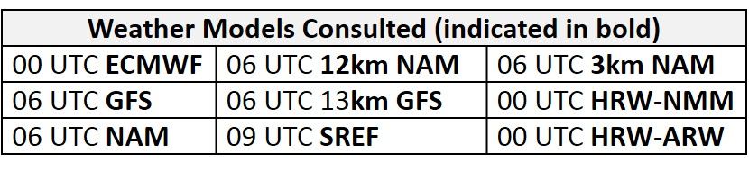
NWP Model Discussion
The weather models remain in close agreement with regards to synoptic scale features impacting the Mid-Atlantic region until late Friday and Saturday where they models begin to disagree somewhat with the development of upper level features. By 12Z Tuesday, an upper level longwave trough moving through eastern Canada will depress the upper and mid-level ridge over the eastern CONUS, placing the entire region under the trough’s influence by 12Z Wednesday. At mid-levels, the trough axis will push into the Mid-Atlantic by 12Z Tuesday, with the upper level trough axis lagging behind by 24 hours. The upper level trough axis will then push to the eastern coast by 12 Thursday, as a weak ridge of high pressure builds in its wake over the Midwest. This feature will also be present at mid-levels, where it will build over the northeastern U.S. by 18Z Thursday. The area of high pressure will slowly drift eastward as the next low pressure system develops over the Upper Midwest, initially as an open wave by 12Z Friday. This feature becomes an atypically strong upper level trough that impacts the Mid-Atlantic over the weekend. The GFS and ECMWF slightly disagree with the evolution of the trough at this time, with the GFS developing the more unseasonably strong system. Specifically, the GFS develops an additional upper level trough that drops southeastward over MB and into ON throughout Friday and eventually phases with the Midwestern trough, forming an amplified longwave trough over the Great Lakes and Ohio River Valley, with a parent closed low over Hudson Bay by 12Z Saturday. The arrival of shortwave perturbations keeps this neutrally oriented amplified trough essentially over the entire eastern CONUS through 00Z Sunday. In contrast, the ECMWF develops a closed upper level low over MN/ON overnight Friday into Saturday, before it opens back up into an open negatively tilted trough over the Midwest and Ohio River Valley by 00Z Sunday. Although the ECMWF and GFS develop similar features, the EC never develops a secondary trough that drops across MB and into ON early Saturday, resulting in a slightly weaker and differently oriented trough over the weekend compared to the GFS. In terms of air quality, both solutions bring strong onshore flow to the region over the weekend, but there are differences in the precipitation forecast.
The Dailies
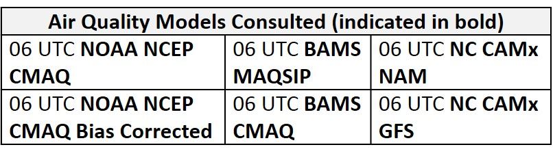
Day 1 (Tuesday): A cold front pushing into and across most of the Mid-Atlantic on Tuesday will promote widespread unsettled conditions. Widespread and locally heavy showers and thunderstorms will form along and ahead of the boundary, beginning in the northwestern NMA around lunch time and pushing southeastward throughout the rest of the day. Although most model guidance suggests that the front and associated precipitation will push to the NMA and CMA Atlantic coast by 00Z Wednesday, it would not be surprising if the eastward progression of the front is slowed throughout the day, with precipitation lingering into the evening. Cloud cover and precipitation associated with the cold front are evident in most of the air quality models as they develop widespread Good and scattered Moderate ozone across the region. The BAMS-MAQSIP is the lone exception with a mix of widespread upper Good/low Moderate ozone across the region despite the frontal passage and unsettled conditions. Due to unsettled conditions throughout the day and strong south/southwesterly flow ahead of the front, there will be a Slight risk of an ozone exceedance on Tuesday.
Day 2 (Wednesday): Pleasant conditions will return to the Mid-Atlantic on Wednesday following Tuesday’s frontal passage. Despite a few overnight showers and thunderstorms possibly lingering into the afternoon along the SMA coast, surface high pressure building into the Great Lakes region will promote mostly sunny skies and the arrival of a noticeably less humid air mass, pushed into the region by northerly flow aloft. Given the arrival of a post-frontal air mass, ozone formation should be limited on Wednesday despite mostly sunny skies, light surface winds, and near/slightly below average temperatures. These conditions are resulting in widespread Good ozone in the air quality models with a few areas of Moderate ozone popping up across the SMA. The NC models are slightly more aggressive in the SMA as they develop more widespread Moderate ozone, possibly in response to weaker northerly flow and near average temperatures. The only risk factor is the fires burning in western and central ON, with associated localized but high density smoke plumes in central ON and eastern QC. Presumably, the passage of the front and its parent low across the region impacted by the fires will minimize any smoke transport, but the fires have been burning for several weeks, and seem unlikely to be contained in the near future. There are currently a few hotspots of surface PM2.5 concentrations in eastern QC, along the ON border, associated with the fires. The risk of smoke transport from the fires is minimal but should be monitored closely on Wednesday and Thursday, given the source locations for back trajectories. Although minimal ozone formation is expected across the Mid-Atlantic on Wednesday, the risk for an ozone exceedance will rise to Marginal to account for the potential for smoke transport from upwind.
Day 3 (Thursday): Although pleasant conditions will continue across the Mid-Atlantic, high pressure moving overhead, both aloft and at the surface, may begin to impact air quality on Thursday. Another day of mostly sunny skies and relatively low atmospheric moisture will allow temperatures to return to near average values across the region. These conditions will combine with light surface winds and weak subsidence to promote ozone conducive conditions, but weak northerly flow aloft, assuming no smoke transport, should prevent excessive ozone formation from occurring. The air quality models are not in agreement with how quickly these conditions will allow ozone to increase, as the BAMS models still keep a mix of Good and Moderate range ozone throughout the region, while the aggressive NC-GFS2 develops more widespread Moderate ozone with a thin strip of USG ozone along the I-95 Corridor and in western PA, likely in response to converging surface winds. The air quality models have become more unreliable over the past week, with almost daily USG ozone predictions from at least one of the models not verifying. Given uncertainty in how quickly the post frontal air mass will modify under high pressure throughout Wednesday and into Thursday, as well as the chance for smoke transport from the ON/QC border, the risk of an ozone exceedance will remain Marginal with a focus on the I-95 Corridor from DC to NYC and western PA.
Day 4-5 (Friday-Saturday): Friday is a day to watch. Surface high pressure will push offshore by 12Z, promoting a shift to southeasterly flow across the region. Back trajectories will start the day localized but quickly turn south/southeasterly as the weak upper level ridge exits and the Midwest trough begins to build eastward. Although weak onshore flow across the eastern NMA and CMA will combine with breezy southerly/southeasterly surface winds to promote Good air quality along the coast, this flow pattern could concentrate pollutants further inland, particularly north/west of I-95. The strength and impacts of surface winds and mid-level flow, in conjunction with air mass characteristics, will be the primary forecast questions for Friday. Last week, for example, a similar pattern led to widespread USG ozone on Monday but kept ozone limited to the Good to low Moderate range on Friday. In the SMA, Tuesday’s cold front will slowly begin to push northward towards the region, but precipitation will likely hold off until overnight or early Saturday morning for the southern parts of NC. Despite mostly sunny skies, onshore flow aloft and sustained easterly surface winds ahead of the front will keep ozone formation in check in the SMA. The air quality models respond to the ozone conducive conditions in the NMA by developing a pocket of upper Moderate/USG ozone across eastern PA, northern NJ, and southern NY, mainly north of the I-95 Corridor. This feature will heavily depend on the air mass characteristics, as well as the impacts of southerly surface winds across the eastern NMA and CMA. Across the rest of the region, the air quality models continue to slowly increase regional ozone in response to mostly sunny skies with widespread Moderate ozone. Given these conditions and associated uncertainty along the eastern NMA and CMA, the risk of an ozone exceedance will remain Marginal.
Although the precipitation forecast is uncertain for Saturday, a shift to strong onshore flow should keep ozone in check across the region. Model guidance begins to diverge at upper levels, impacting the finer details of the forecast. The warm front approaching the SMA on Friday will continue to lift northward throughout the day, but the timing and progression of this feature are a question. In addition to the lifting warm front, a cold front associated with the low pressure system moving through the Great Lakes/ON will approach the western Mid-Atlantic late Saturday. Precipitation associated with these features will move into the Mid-Atlantic from the west and the south, impacting the entire SMA, most of the CMA, and at least the western NMA. There is still some question as to whether the I-95 Corridor in the NMA will remain dry through the evening. Nevertheless, the strong onshore flow aloft will drop the risk of an ozone exceedance to Slight.
-Enlow/Huff