

Medium Range Air Quality Outlook
Mid-Atlantic Region
Issued: Wednesday, June 20, 2018
Valid: June 21-25 (Thursday-Monday)
![]()

Summary
A progressive weather pattern will keep ozone in check across the Mid-Atlantic through most of the medium range period, except for Thursday, when there is uncertainty in the precipitation forecast and air mass characteristics along the I-95 Corridor. A wave of low pressure will move along a frontal boundary across the CMA overnight Thursday, bringing periods of heavy rain to the NMA and CMA. The main forecast question will be how modified the air mass is along I-95, given the heavy overnight rain. This morning, ozone is rising faster than expected at locations across eastern MD and the Delmarva that are south of the frontal boundary, suggesting that this air may indeed remain modified at this time. Weak transport aloft, afternoon sunshine, and converging surface winds increase the risk of an ozone exceedance to Appreciable on Thursday, with a focus of the I-95 Corridor from BAL to TTN. Surface low pressure moving across the Midwest will slowly lift the stalled frontal boundary northward on Friday, resulting in another day with widespread unsettled conditions across much of the region. Below average temperatures, onshore flow aloft and at the surface, and mostly cloudy skies will limit ozone formation, dropping the risk of an exceedance to Slight. The lifting warm front in the morning and an approaching weak cold front in the afternoon on Saturday will result in widespread precipitation and associated cloud cover in the NMA and CMA, with a few scattered afternoon thunderstorms in the SMA. A Slight risk of an ozone exceedance will continue. A weak backdoor cold front will push into the NMA on Sunday, promoting scattered showers and thunderstorms in the afternoon hours. The southward push of this front and associated precipitation will be the primary forecast question for Sunday. At this point, the afternoon looks sunny along the I-95 Corridor. As a result, the risk of an exceedance will increase to Marginal with a focus on the I-95 Corridor from BAL to TTN. A stronger, secondary cold front will move into the region early Monday. A shift to northerly transport behind the front and the arrival of a presumably clean and definitely drier air mass will allow the risk of an exceedance to return to Slight for Monday.
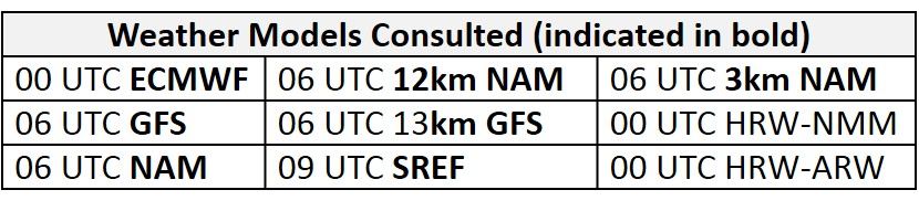
NWP Model Discussion

There continues to be a consensus between the weather models in regards to the evolution of the synoptic pattern throughout the medium range period. By 12Z Thursday, a persistent longwave trough over southeastern Canada will place the northeastern US under the influence of weak troughing, while a weak ridge moves into the CMA, SMA and Ohio River Valley ahead of an upper level closed low over the Midwest. By 18Z Thursday, shortwave energy will eject out ahead of the closed low and into the southern half of the Mid-Atlantic, weakening the mini-ridge as it passes over the Mid-Atlantic by 00Z Friday. The Midwest closed low will continue to push eastward throughout Friday, weakening into an open wave as it reaches the Ohio River Valley around 00Z Saturday. As this feature edges into the western Mid-Atlantic, numerous shortwave perturbations across the central interior US will result in broad troughing across the northern CONUS by 12Z Saturday. The disturbance will continue to push into the Mid-Atlantic throughout Saturday, but the strengthening of the eastern Canadian trough will begin to stretch the Mid-Atlantic disturbance northeastward by 00Z. At mid-levels, this low pressure will compress the westward extent of the Bermuda High over the southeastern US, keeping the SMA under its influence through Sunday. As this occurs, additional shortwave energy over the Great Plains/Midwest will dig out a weak longwave trough over the Midwest by 12Z Sunday that will phase with the eastern Canadian trough, which will be reinforced by embedded shortwaves over the Great Lakes region by 18Z Sunday. The merger of these two features will enhance upper level troughing over the Mid-Atlantic late Sunday. By 12Z Monday, additional shortwaves dropping into the base of the Canadian trough will reinvigorate and strengthen the trough as it drops across ON and over the Northeastern US. This trough will pass over most of the Northeast, with the axis moving off the Atlantic coast by 00Z Tuesday. As this feature departs to the northeast, a ridge of high pressure following in its wake will approach the Mid-Atlantic.
The Dailies
Day 1 (Thursday): A wave of low pressure moving along the stalled frontal boundary overnight will bring unsettled conditions to most of the Mid-Atlantic on Thursday. In the NMA and northern CMA, widespread precipitation overnight, with periods of heavy rain, will dissipate in the morning as the wave of low pressure moves offshore. Overcast skies and cold air advection aloft will keep temperatures near average values. In the SMA and southern CMA, above average temperatures and an abundance of atmospheric moisture will trigger widespread thunderstorms along the frontal boundary. These thunderstorms will push southward across the SMA in the afternoon and evening hours. Mostly cloudy skies, periods of precipitation and breezy surface winds will keep ozone formation minimal in those southern locations. The air quality models are responding to widespread unsettled conditions across most of the region as they show widespread Good ozone. Both the BAMS and NC models highlight the eastern NMA and CMA with Moderate ozone, however, likely due to weak transport aloft, afternoon sunshine, and converging surface winds. As a result, the risk of an ozone exceedance will increase to Appreciable with a focus of the I-95 Corridor from BAL to TTN. Once again the main forecast question will be how modified the air mass will be given overnight and morning precipitation.
Day 2 (Friday): Surface low pressure moving across the Midwest will slowly lift the stalled frontal boundary northward on Friday, resulting in another day with widespread unsettled conditions across the CMA and SMA. Widespread showers and thunderstorms will impact the CMA and SMA throughout the day, dropping temperatures to near average. In the northern half of the Mid-Atlantic, departing high pressure to the northeast and the approaching low pressure system to the west will promote breezy onshore winds and mostly cloudy skies throughout the day. Scattered showers are likely, but will remain along and west of I-81 until the evening hours. Widespread cloud cover, precipitation, and onshore flow are resulting in widespread Good range ozone in the air quality models. The BAMS models and the NC-GFS2 highlight northeastern PA with low Moderate ozone, possibly in response to lighter surface winds and more periods of sunshine. Despite this feature in the air quality models, below average temperatures, onshore flow aloft and at the surface, and mostly cloudy skies will limit ozone formation. The risk of an exceedance will drop to Slight.
Day 3 (Saturday): Unsettled conditions will continue across the NMA and CMA as the surface low pressure system brushes the region to the northwest. The lifting warm front in the morning and an approaching weak cold front in the afternoon will result in widespread precipitation and associated cloud cover in the NMA and CMA. In the SMA, influence from a weak mid-level ridge will allow temperatures to remain above average under partly cloudy skies. Daytime heating and abundant atmospheric moisture will provide the opportunity for a few scattered thunderstorms in the afternoon hours. The air quality models are in agreement that most of the Mid-Atlantic will be under mid/upper Good range ozone. The BAMS models highlight the I-81 corridor through the SMA in response to above average temperatures and periods of sunshine. The BAMS MAQSIP also highlights parts of the NMA with upper Good/Moderate range ozone, however, precipitation and cloud cover will widespread enough to discount this feature in the model. Periods of late June sunshine and temperatures above average will be favorable for some ozone formation across the SMA, but breezy southwesterly surface winds and swift transport of clean air will prevent ozone build-up. The risk of an ozone exceedance will remain Slight.
Day 4-5 (Sunday-Monday): A weak backdoor cold front will push into the NMA on Sunday, promoting scattered showers and thunderstorms in the afternoon hours. The southward push of this front and associated precipitation will be the primary forecast question for Sunday. Periods of sun and clouds and a shift to westerly flow aloft will allow temperatures to rebound. Surface winds front the west/southwest and a westerly transport aloft will be favorable for rising ozone concentrations along the I-95 Corridor if precipitation remains to the north/west. In the SMA, temperatures above average values and partly cloudy skies will be favorable for ozone, but light/breezy surface winds, scattered showers, and fast westerly transport will prevent excessive ozone formation. The air quality models highlight the uncertainty in the south/eastward push of the cold front as they develop Moderate range ozone in the eastern NMA and CMA. As a result, the risk of an exceedance will increase to Marginal with a focus on the I-95 Corridor from BAL to TTN.
A stronger, secondary cold front will move into the region early Monday. A shift to northerly transport behind the front and the arrival of a presumably clean and definitely drier air mass will promote temperatures to fall below average values for most of the NMA and parts of the CMA. With the exception of a few lingering showers, fair weather will return to most of the Mid-Atlantic as high pressure builds to the northwest. Mostly sunny skies and a noticeably less humid air mass will result in pleasant conditions across the NMA. In the SMA, temperatures will likely remain above average but southwesterly onshore flow aloft and periods of sun and clouds will keep ozone formation in check. The risk of an ozone exceedance will return to Slight due to post-frontal conditions across the NMA/CMA and onshore transport aloft in the SMA.
-Enlow/Huff